Grasshopper’s North American 2024-2025 Snow Season Outlook – February Update

Mountainwatch | The Grasshopper
It has been a mixed bag for North American Resorts this season with a current storm system making its way across the west delivering the best conditions at the most elevated resorts. When we last spoke the long-term outlook favoured the areas further to the northwest and through the Canadian Rockies. As we head into spring let’s check out how it is looking for the for the rest of the season – which has a long way to go – also see how we went so far.
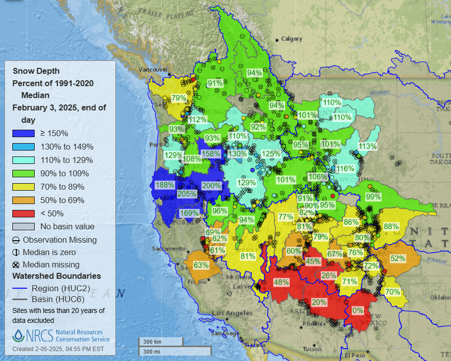
Below is a map showing the snow depth values for stations (dots) and basins (shaded areas) around the western United States as a percentage of the median value from 1991-2020. The further southern basins are showing <50% of the median value for this time of year, while further north things are somewhat neutral (apart from areas of the Pacific Northwest which are showing above 150% of the median). Broadly this picture agrees with our original thoughts on snowfalls across the winter. although it may be said areas most northwest were expected to do slightly better. The southern areas., which typically do not fare overly well in a La Nina pattern, have delivered expected results.
ENSO Update
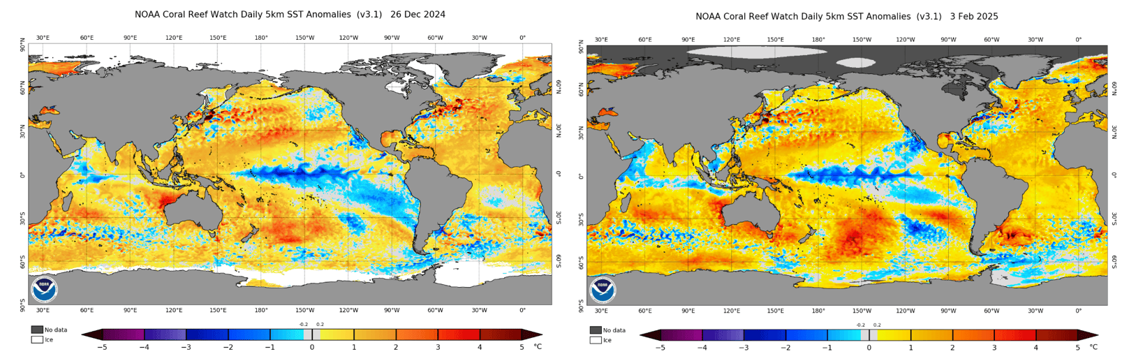
Following on from last month’s update we are currently in an La Nina pattern in the Pacific with waters reaching required thresholds over the last few weeks. Typically, such events peak through the middle of winter so as we moved further into winter the waters in the eastern equatorial Pacific warmed slightly. Forecasts expect a return neutral values sometime through March-May.
Looking below the picture looks very much the same through the equatorial Pacific with perhaps slightly more collection of warmer waters in the west around the maritime continent.
Seasonal Outlooks
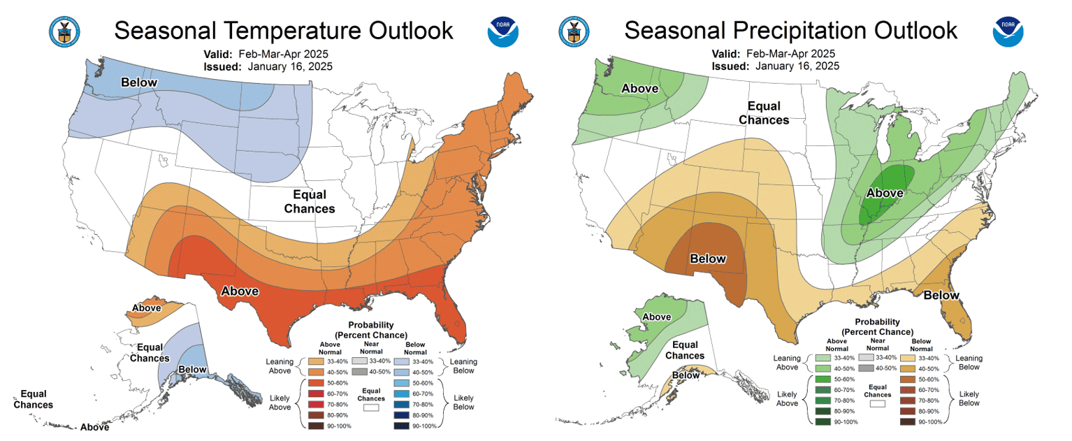
NOAA’s latest seasonal products for temperature and precipitation are shown below. We can see a similar pattern from the last few updates which favours the northwestern USA while areas down south are warmer and drier than average. This is typically an expected La Nina pattern due to its effects on the typical storm track in a neutral year (which we spoke about in our past updates). These products show probabilities for the three-month period February to end of April.
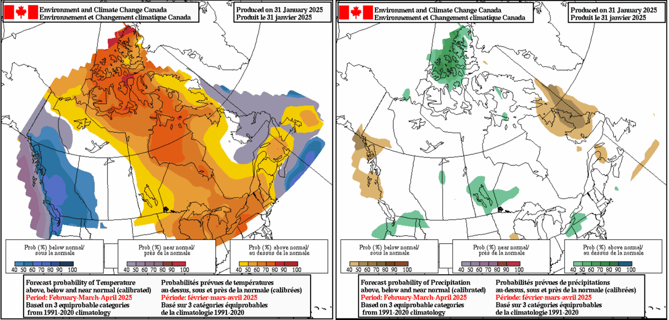
North of the border again it appears similar to past updates with mainly near normal precipitation expected throughout Canada and cooler temperatures confined to the west about British Columbia and areas of the Canadian Rockies. Precipitation is forecasted to be broadly average with some isolated wetter areas about the Pacific Northwest and throughout more central areas.
Spring has Sprung?
Marginal temperatures have spoiled the party this season and forecasts for the next three months show, on average, that higher temperatures are expected heading into spring, possibly meaning higher elevation resorts will become more important. The chart below shows a probabilistic temperature forecast created from a combined output of some of the top global met agencies for the next three months at the 850hPa level, which roughly equates to 1500m or just below 5000ft above sea level. Looking broadly across the southern half of the United States, temperatures are forecasted to be above average with more northern locations appearing to be more neutral, aligning with the NOAA and environment Canada outputs above. This supports the idea that we may see some marginal temperatures with storms throughout the rest of the season.
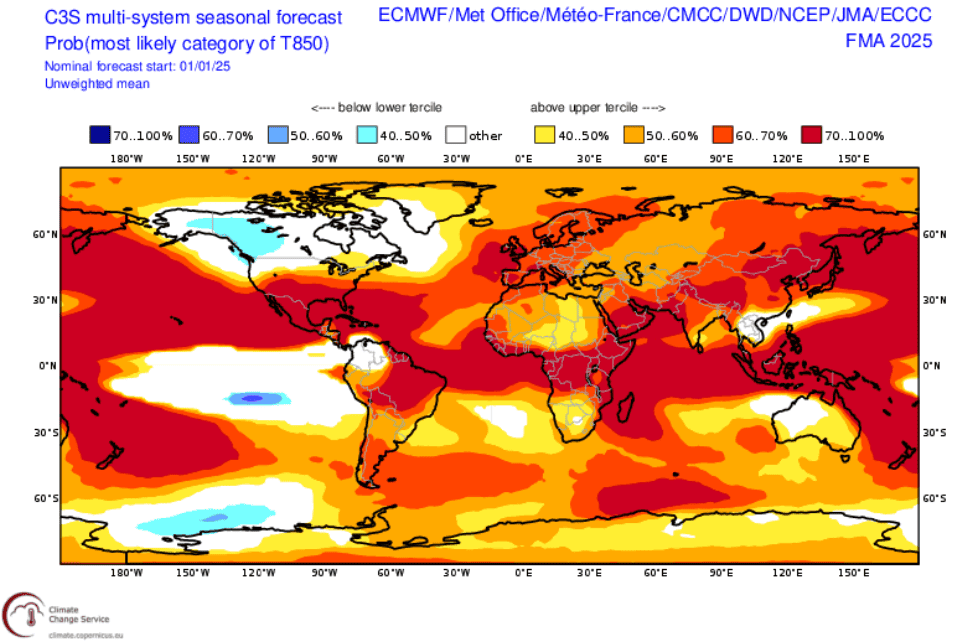
The three-month probabilistic forecast for 850hPa temperature created from a combined output of different met agencies listed in the top right. We can see broadly warm temperatures expected across the southern half of the United States but more neutral to slightly colder over areas further north and heading into Canada. Source: Copernicus Climate Change Service
What’s Left?
A heathy storm system rolls through the west this week with decent totals expected to provide some relief across many resorts after some initially shaking temperatures. Be sure to keep up to date with the weekly forecast here. But looking long term there’s no big surprises heading into the tail end of the season. Our running story of best conditions expected throughout areas of northwestern USA and southwestern Canada remains the same.
As we have seen at times this season, higher precipitation totals haven’t always meant heavy snow. La Nina’s grip on areas further south doesn’t appear to be letting up either, with warmer and drier conditions on average forecasted heading into spring. Importantly, its’ not all doom and gloom, this storm cycle will provide a top up for many areas with plenty of life still left in this season.


