Grasshoppers Weekly Japan Forecast , Feb 1st 2024 – Cold Wave Brings A Nice Top-Up Before A Low Unloads Heavy, Mixed Precip Onto Honshu Monday And Tuesday
Mountainwatch | The Grasshopper
Written Thursday morning 1st February (Japan Standard Time)
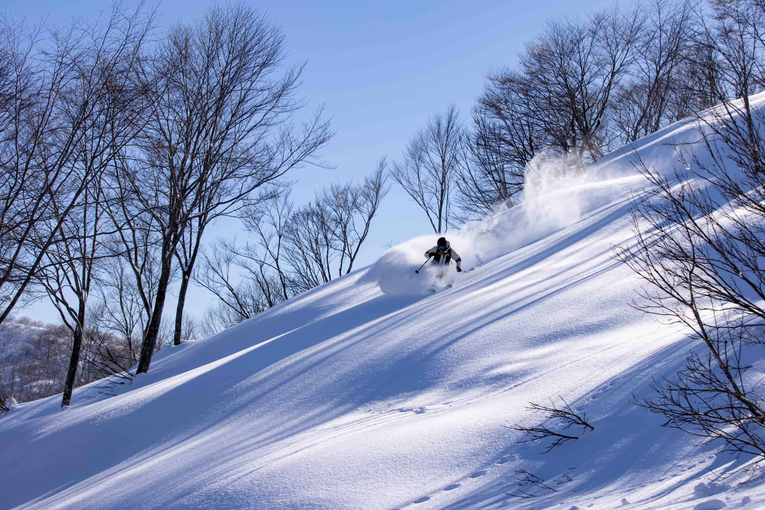
A wave of cold air today will bring much needed fresh snowfall to Japan through into the weekend. Accumulations look to be mostly within a range of 10-30cm for Honshu, and 20-40cm+ for Hokkaido. This should provide some great conditions, especially this weekend when the weather eases up, with sunshine even breaking out over Honshu.
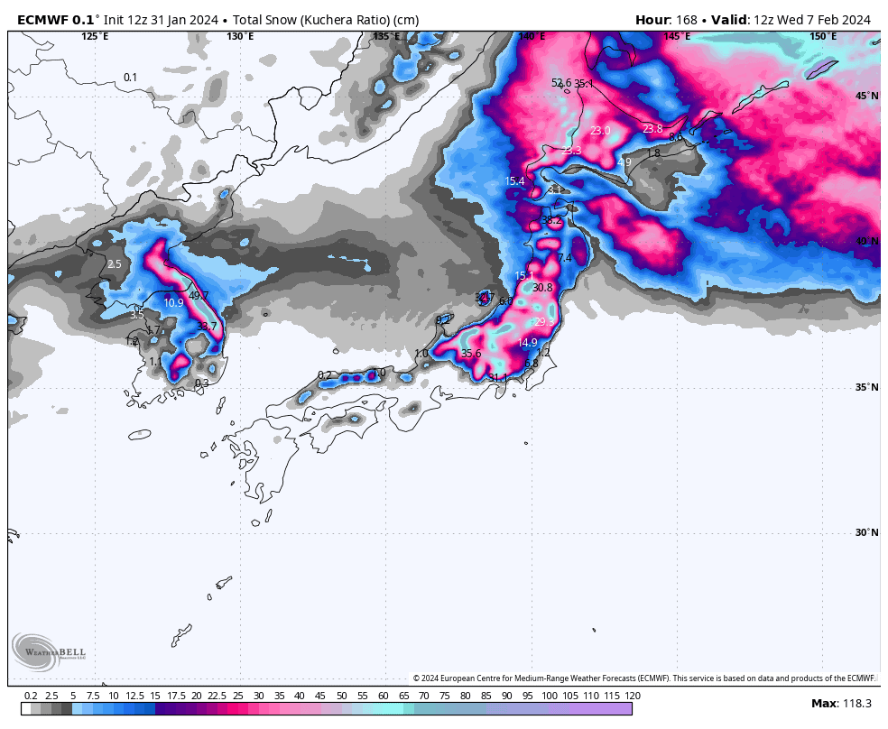
Then on Monday, a low shooting out of the west will spread heavy snowfall up Honshu. Although, it’ll be the denser, lower-quality stuff, snow levels don’t look too disastrous, and it’ll mostly be the lower slopes of central Honshu that’s see’s rain and sleet thrown into the mix.
Cooler N-NW winds will arrive during the latter half of Tuesday, and will provide snow showers to low levels over Central Honshu through Wednesday.
Thursday Feb 1st & Friday Feb 2nd
A cold front passed over Hokkaido overnight, preceded by a wee top-up of denser snow, lower quality snow. Freezing W-NW winds have now arrived, thankfully, and there’ll be consistent light-moderate falls of that high-quality Japow for the rest of today through Friday. Snowfall accumulations look to be up around 20-30cm for this period.
Down on Honshu, the cold front is still making its way southwards over the Island. So, there’ll be moderate falls of mixed rain+snow before colder NW winds sweep in throughout the morning, reaching central Honshu around midday. Light snowfall will then ensue, although some resorts in central Honshu will receive moderate falls, before easing tonight
Light flurries will continue over northern Honshu during Friday and will show up in central parts from Friday afternoon.
Saturday Feb 3rd & Sunday Feb 4th
On Hokkaido, a chilly W-NW will continue to send in light snow showers this weekend, predominantly benefiting resorts in the west, such as those around Sapporo and Niseko. Snow showers will come and go in other parts, such as at Furano, with the cloud cover even breaking apart at times to sneak in a few rays of sunshine.
Snow showers over northern Honshu will continue through Saturday and eventually peter out during Sunday.
Those same snow showers will also be clipping parts of central Honshu east of the Hakuba Valley, but will dry up during the second half of Saturday, leaving partly cloudy skies for the rest of the weekend.
The Hakuba resorts themselves will see a fair amount of sunshine over the weekend, as well as milder temps and light winds. Mint!
Monday Feb 5th to Wednesday Feb7th
Monday, heavy snowfall spreads up Honshu as one of those lows shoot out of the west, bringing strong, mild and moist winds from the south and east. The snow will be of the dense, lower-quality type, but temperatures don’t look too bad, especially for northern Honshu where snow levels should remain at base levels. Resorts in central Honshu will see rain and sleet mixed in base levels and lower slopes, and possibly even mid-level slopes for a time at some resorts.
Tuesday, the low heads off into the Pacific and precip over Honshu gradually backs off to lighter snowfall, even clearing in the north, as cooler winds from the north start to arrive. Snow showers should continue over Honshu during Wednesday as winds from the N-NW persist.
While all that’s happening, Hokkaido will sit idly by, with just a few light flurries mostly during Monday and Wednesday in western parts. Other than that, there’ll be copious amounts of that rare and glorious winter sunshine.
Extended Outlook
Light snow showers are likely to continue across Japan next Thursday and Friday before high pressure clears things up Saturday.
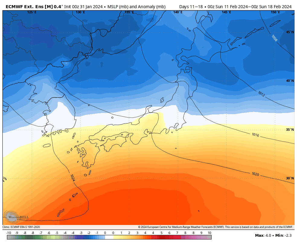
From next Sunday 11th Feb, the pattern looks to favour cold northwesterlies with low-pressure systems popping off the north Chinese mainland, as opposed to those coming out of the west. This should hopefully bring proper winter conditions with proper Japow, without the warm spells that we’ve seen all too much of this season.
That’s all from me today. Have a great week, see you next Thursday.
Grasshopper


