Grasshopper’s Weekly Japan Forecast, Thursday, Jan 11th – Japan Continues to Light Up with Two More Big Storms on The Way
Mountainwatch | The Grasshopper
Written Thursday morning 11th January (Japan Standard Time)
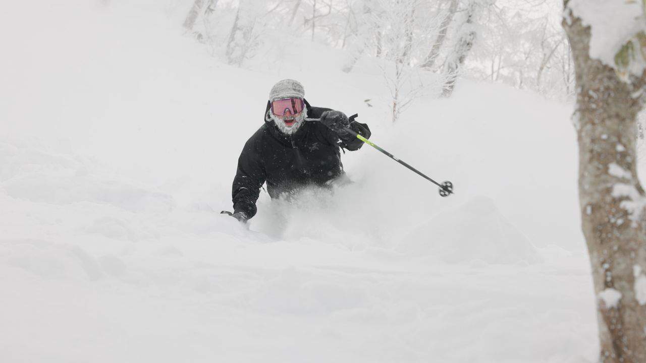
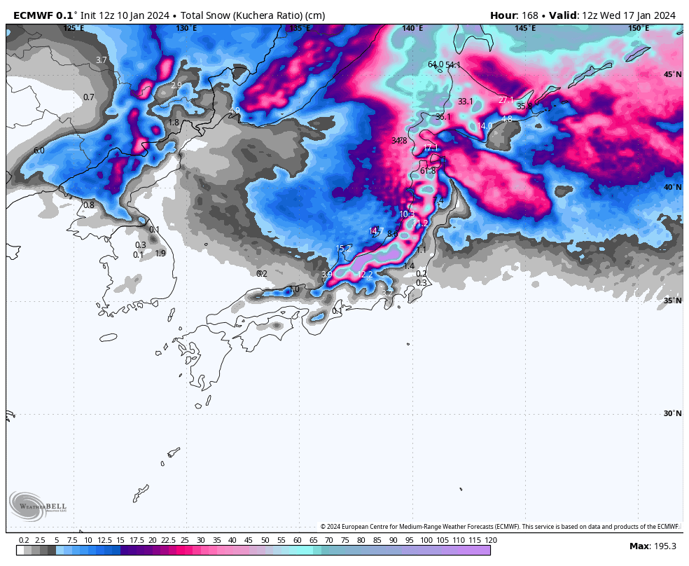
After a massive week, things really look to have turned on here in Japan. One of the biggest storms of the season to date hit on Sunday, producing totals of up to 70-80cm in both central Honshu and Hokkaido during a 24hr period. Hokkaido also saw good, consistent snowfall throughout the last seven days, as did the north of northern Honshu.
Two big storm cycles will continue to light up Japan over the coming seven-day period; the first, Friday into Sunday, and the second, Monday into Wednesday (hence why I’ve broken down the forecast that way). Both will produce some hefty totals, but the second will be the bigger and colder of the two, with strong winds and blizzard conditions.
For those of you with a softer exoskeleton like mine, my picks of the week would be today, Sunday and Wednesday, which will be the deepest, most settled days of the forecast period.
Thursday Jan 11th
Great conditions today as a ridge of high pressure brings about some calmness to Japan. Remaining cloud will clear most areas, but will come and go in the west and south of Hokkaido.
Friday Jan 12th to Sunday Jan 14th
Friday, a low passes just north of Japan, kicking off the first big snowstorm of this forecast period. The cold front extending south crosses Hokkaido and northern Honshu during the first half of the day, then reaches central Honshu during the afternoon.
There’ll be a period of heavy snowfall with the front, backing off to light-moderate falls as snowlines gradually drop, then an extra round of heavy, high-quality snowfall over central Honshu during the latter half of Saturday as another wave of cold air hits.
The storm exits Sunday, with skies clearing Central Honshu early in the day and snowfalls further north eventually petering out, although they’ll return at night as the next snowstorm approaches.
Monday Jan 15h to Wednesday 17th
Monday will see storm number two getting underway. This storm also features a low passing to the north, however this one looks to be much deeper than the first, and the cold front, which hits both Hokkaido and Honshu during the first half of the day, is even gruntier and colder.
So, we should see heavy-very heavy snowfall with the front on Monday, with winds becoming very strong along with blizzard conditions, then heavy-moderate falls starting to back off during Tuesday, before clearing early Wednesday as winds abate and sunshine returns once again.
Extended Outlook
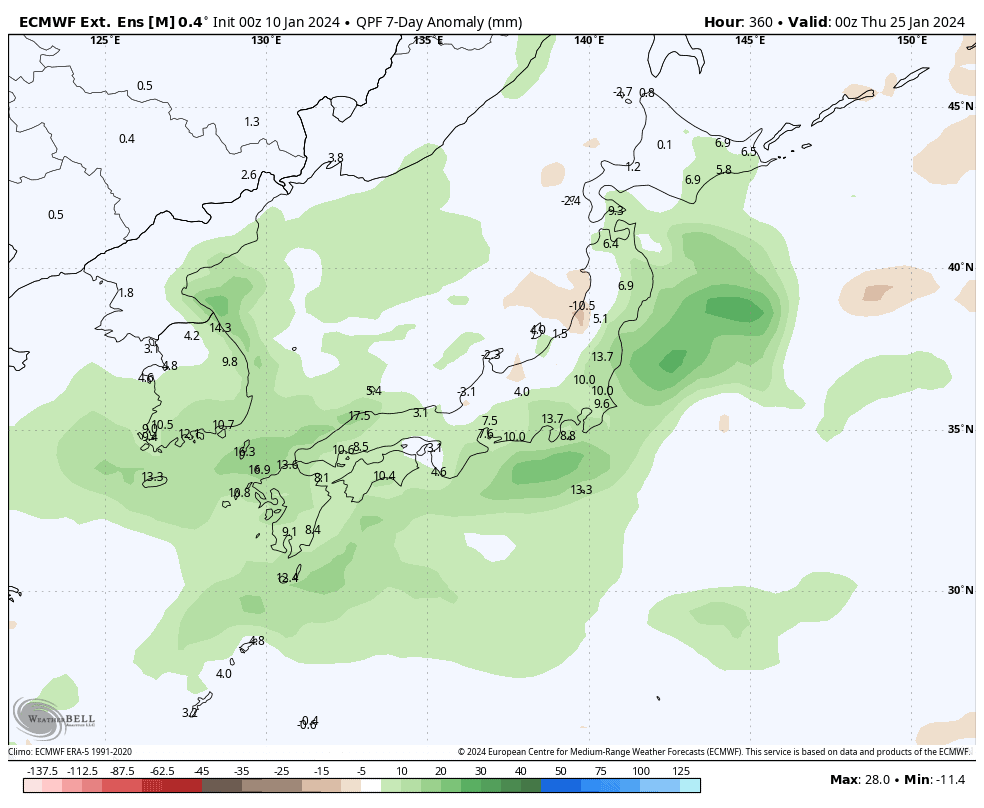
A weaker round of snowfall looks likely next Thursday and Friday (18th-19th Jan).
Then, low pressure migrating out of the west may bring a few or more days of easterly winds starting next weekend, along with mild temps, dense snowfall and low-level rain, particularly along eastern Japan as highlighted in the image above.
As the low continues to migrate northeastwards later that week, we should see a good period of colder northwesterlies and better-quality snowfall.
That’s all from me today. Have a great week, see you next Thursday.
Grasshopper


