Grasshopper’s Weekly Japan Forecast, Jan 4th – Persistent Falls for Hokkaido, And a Big Dump for Central Honshu Sunday Into Monday
Mountainwatch | The Grasshopper
Written Thursday morning 4th January (Japan Standard Time)
After a bit of a mixed bag last week, which saw fairly good, consistent falls on Hokkaido, but only one or two decent snowfalls on Honshu along with some low-level rain, we’ve got a somewhat more promising seven-day period ahead.
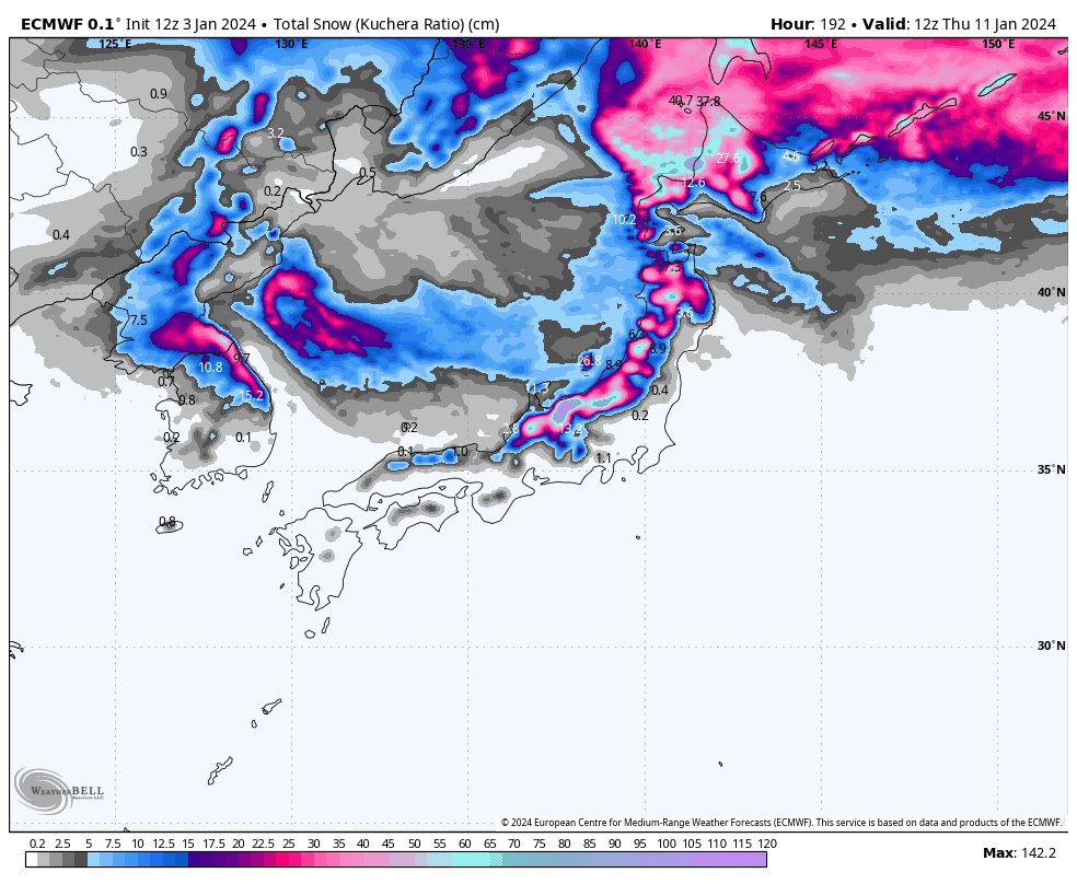
With fresh snow over Central Honshu today, the next big snowfall events will come late Sunday/early Monday and again Wednesday next week. There’ll be the usual low-level rain ahead of the snow, but accumulations will more than make up for it.
Northern Honshu and Hokkaido will drum to a slightly different beat, with persistent snowfalls peaking in volume and quality after the passing of each cold front on Friday, Monday, Tuesday and Wednesday. It should be a good week for Hokkaido but Northern Honshu won’t see the same quantity of snow.
Thursday Jan 4th
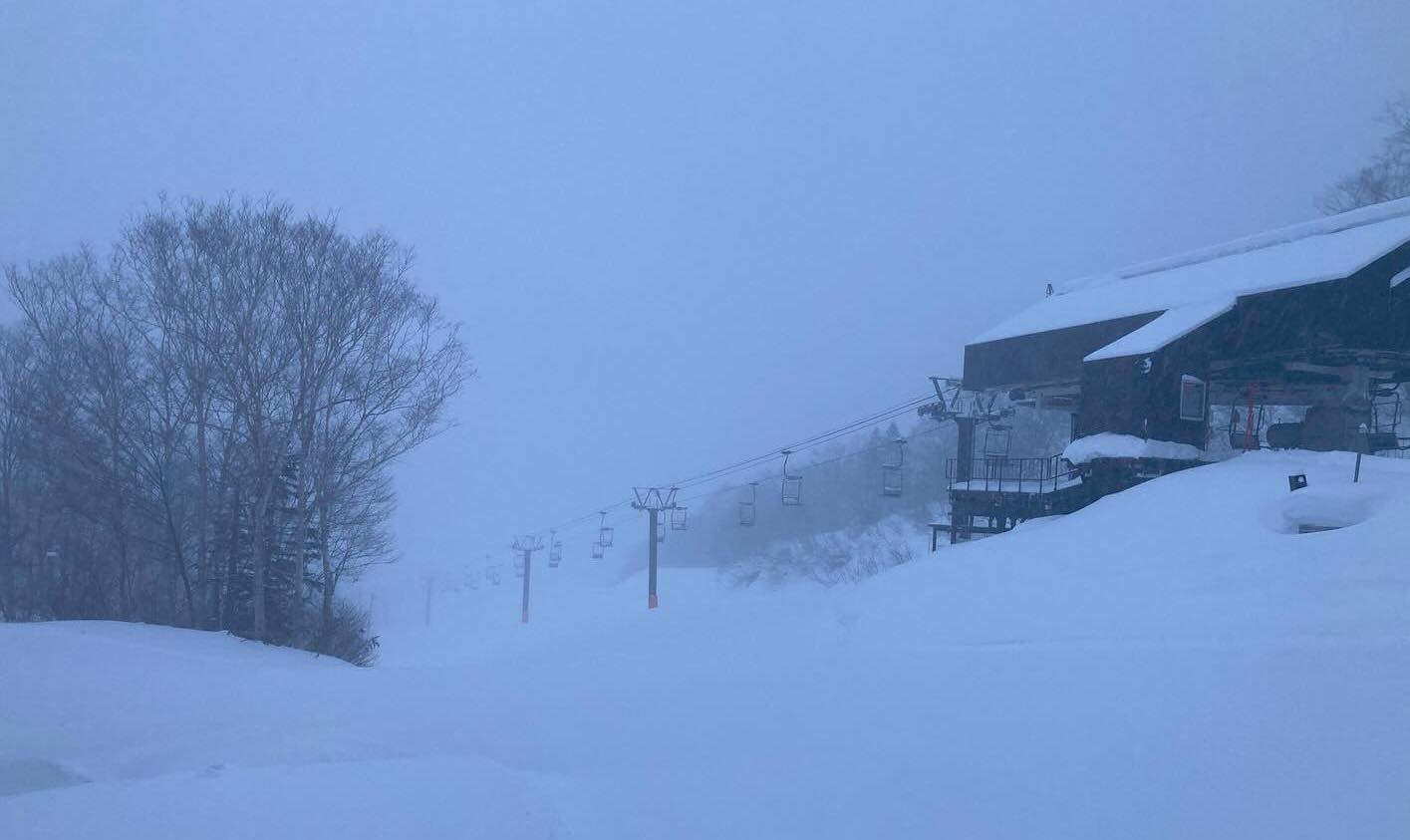
Late yesterday and last night, a low passed over Honshu, and as I type, the cold front is making landfall. So currently, we’ve got mod-heavy falls over central Honshu, but light-mod falls in the north as wind are hitting from the north and we aren’t seeing the usual uplift we get from NW winds.
For the remainder of today, snow levels will gradually drop to low levels, although not quite to rock-bottom, while the snowfall gradually peters out. Hokkaido, meanwhile, will bathe in sunshine and light winds.
Friday Jan 5th & Saturday Jan 6th
This period will see a low drifting off the continent and just over the north of Hokkaido. First, mod-heavy precip will spread over northern Honshu and Hokkaido during Friday, although initially this will be coming out of a relatively warm SW flow, so low-level rain is expected before colder westerlies hit late in the day (Hokkaido) or overnight (northern Honshu). Snow will continue to fall through Saturday, mostly light snow showers for northern Honshu, but heavier and more persistent falls for Hokkaido.
Central Honshu, meanwhile, will be clear and calm Friday, but come Saturday the cold front will have stalled just shy of the area and resorts here will mostly pick up off-cuts of snow on mid-high slopes and low-level rain, some of course getting more than others as the flow remains mild from the W-SW.
Sunday Jan 7th & Monday Jan 8th
This period will be one of, if not the, highlights of the week. Sunday, cold air will bank up in the Sea of Japan as low-pressure systems surrounding the country deepen. Light snowfalls across Japan will start to get heavier late in the day and overnight, especially over central Honshu, as this cold air finally starts to arrive with winds hitting from the NW.
Monday, snowfall will eventually clear Central Honshu (from the south first then the north later), but it’ll continue over northern Honshu and Hokkaido as cold winds from the W-NW persist.
Tuesday Jan 9th & Wednesday Jan 4th
Tuesday, snow will continue to fall over northern Honshu and Hokkaido, with a wee wobble in the isobars providing some bonus heavier falls late in the day.
The wobble will be part of a greater low-pressure system, which will come out of the west Wednesday and provide another period of heavy snowfall across the country after it crosses late in the day, before things back off during Thursday.
Extended Outlook
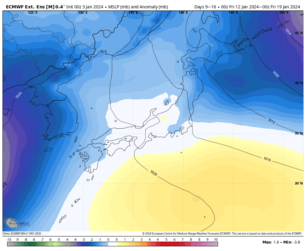
After potentially another big snow storm next weekend, models expect things will calm down to more “normal” levels, as low pressure anomalies ease and even become positive for a time after the storm. Overall, it could be an average week in terms of snowfall, which here in Japan is a good thing!
That’s all from me today. Have a great week, see you next Thursday.
Grasshopper


