Grasshopper’s Weekly Japan Forecast, Thursday, Feb 8th – Excellent Conditions and A Fresh Dump This Weekend, Before A Meltdown Next Week
Mountainwatch | The Grasshopper
Written Thursday morning 8th February (Japan Standard Time)
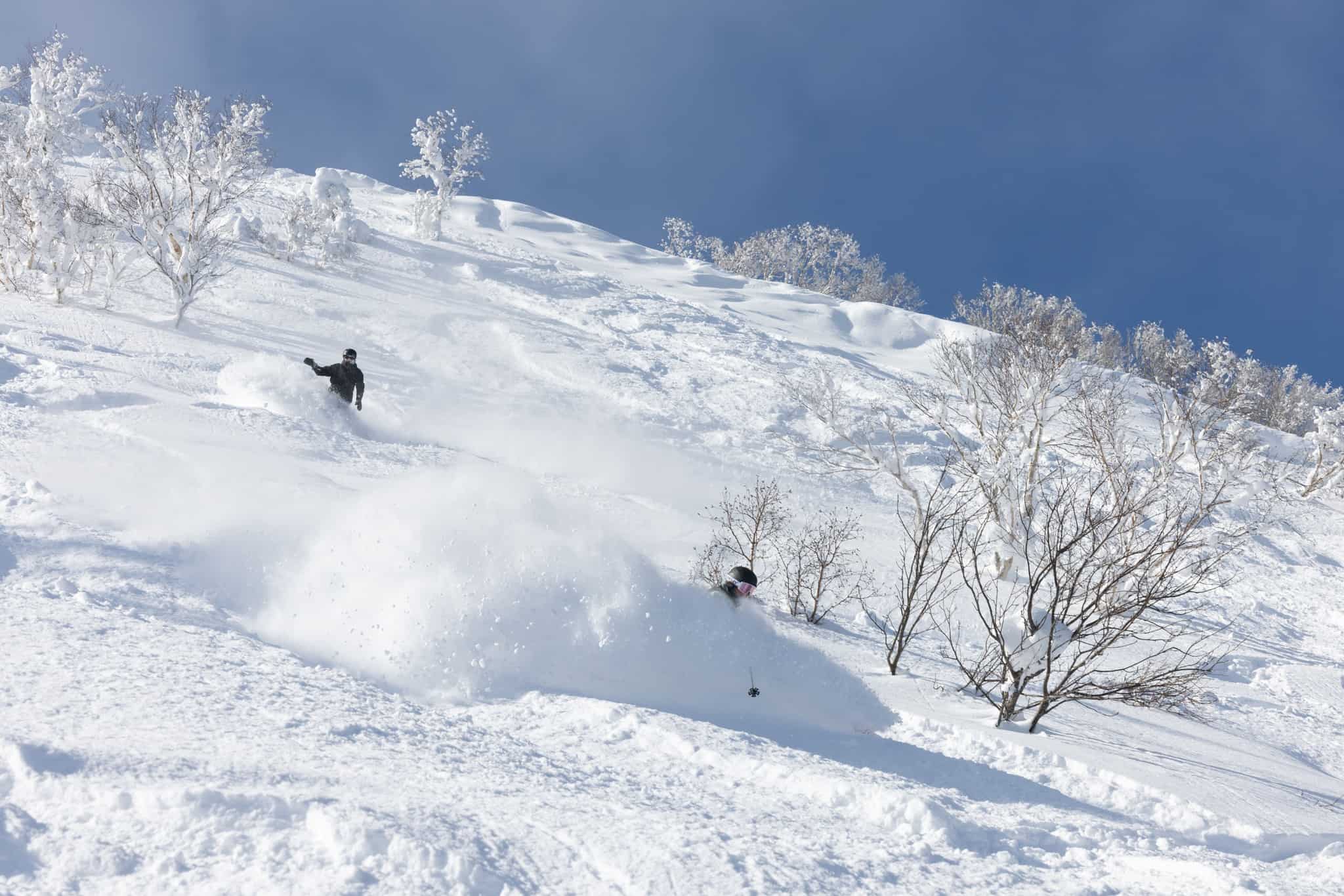
The storm that hit on Monday delivered the goods, with 20-40cm of fresh powder being dumped onto resorts in central Honshu down to base levels. Hokkaido has also been consistent and cold with a lot of snow falling last Thursday through to Monday, with 80cm+ being reported in Niseko.
Conditions will remain excellent as temps remain nice and cold, with light snow showers across Japan drying up Friday.
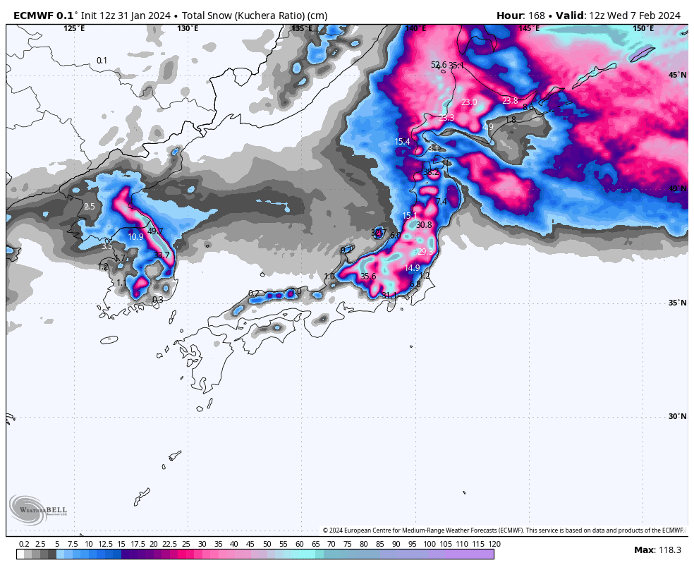
This weekend, a low out of the NW will bring another dump of about 10-30cm across Honshu from the latter half of Saturday into Sunday. You’ll want to make the most of it, because Monday to next Thursday, Japan will undergo a serious meltdown as a warm SW flow develops. The plus side of it, however, is that the sun will be shining and you may even want to ditch the Jacket for some spring-like runs.
Thursday Feb 8th & Friday Feb 9th
A cold, but gentle westerly flow blows over Japan, providing fuel for mostly light snow showers or flurries throughout the Sea of Japan side today (Thursday).
However, resorts in the western part of central Honshu (those outside of the Echigo Range, such as Hakuba, Myoko and Nozawa) will see little or none until this afternoon when winds tilt more to the NW (although still maybe not at Hakuba), with fine spells breaking out before then.
Friday, a ridge of high-pressure drifts over Honshu, killing what remains of the NW breeze and drying up any lingering snow showers there during the morning. Light snow showers will also become a little sparser on Hokkaido.
Saturday Feb 10th & Sunday Feb 11th
Saturday will start off mostly sunny on Honshu as a low approaches from the NW. The low will hit during the afternoon, bringing a fresh wave of cold W-NW winds as well as fresh snowfall of up to moderate intensity through into early Sunday. Snowfalls will gradually peter out over Honshu during Sunday as high-pressure once again returns.
Up on Hokkaido, light snow showers will mostly hit the NW corner of the Island during Saturday, with snippets of fine spells creeping through elsewhere. A fresh wave of cold NW winds will also arrive here Saturday night, bringing more widespread snow showers to the Island during Sunday.
Monday Feb 12th to Wednesday Feb 14th
Monday, light snow showers over Hokkaido, and a few a few clipping central Honshu, will clear during the morning to fine as a warm SW flow spreads up the country.
Tuesday and Wednesday, Japan will have a significant meltdown as warm W-SW winds continue to blow – strongly over northern Honshu and Hokkaido, but lightly over central Honshu. Skies will also be mostly sunny over central Honshu and Hokkaido, while rain showers build over northern Honshu.
Extended Outlook
At this point, models expect we’ll see a short, sharp and heavy dump of powder across Japan next Friday 16th Feb, before another meltdown over the following weekend as warm SW winds return.
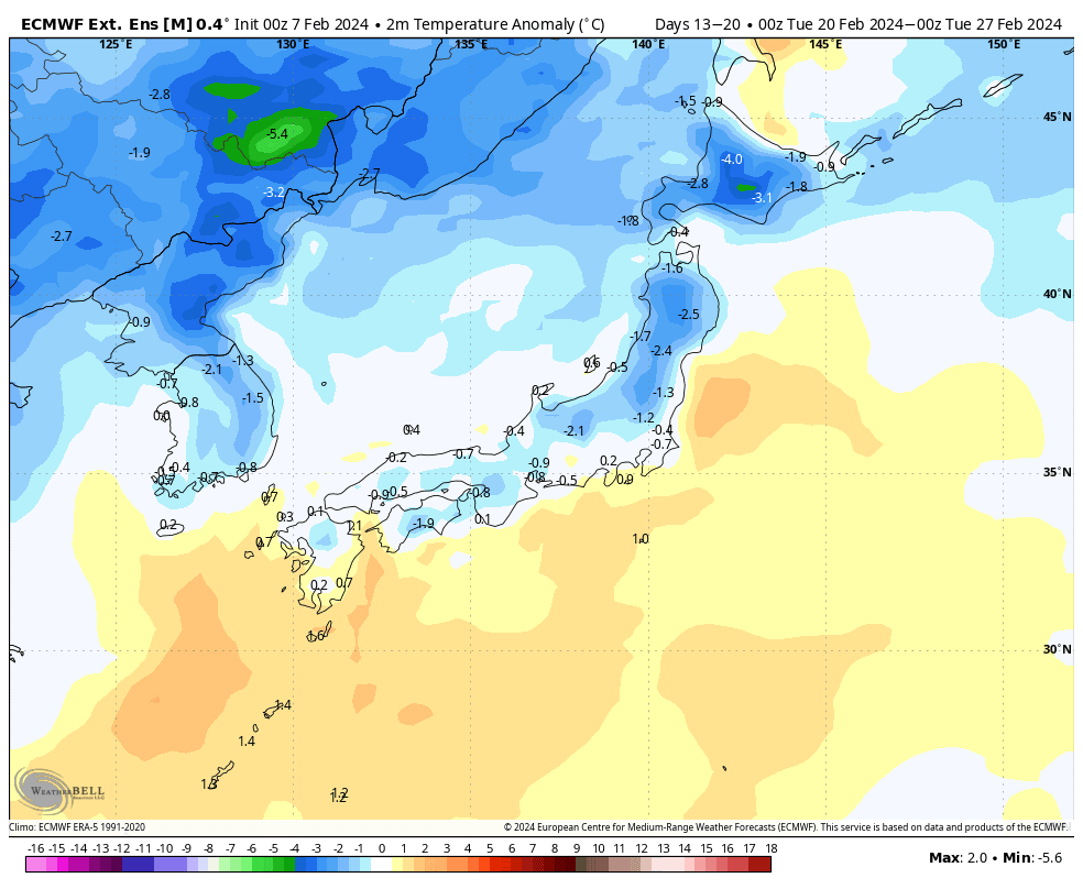
Early the following the week (starting Monday 19th Feb), we should see a return of winter and its cold winds from the NW, likely providing fresh powder and a much-needed reset.
That’s all from me today. Have a great week, see you next Thursday.
Grasshopper


