Japan Weekly Forecast, February 17 – A Snowy Week Ahead For Central Honshu
Mountainwatch | The Grasshopper
Valid February 16 – February 23
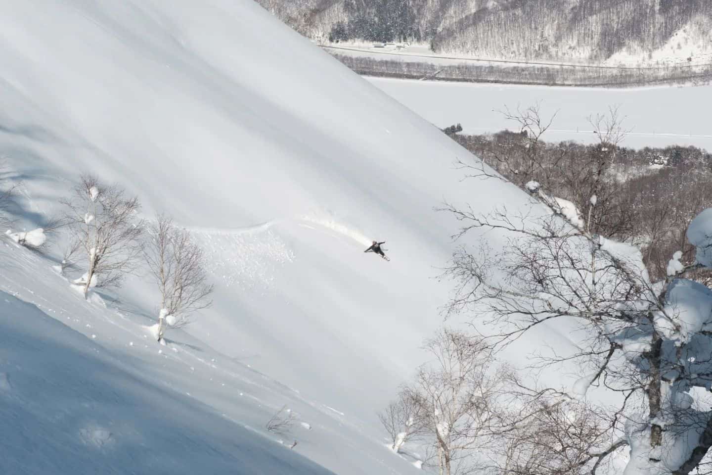
Quite a subdued week around the resorts this week after we saw monster numbers a fortnight ago. In the past week Niseko did better than initially expected to record 34cm thanks to a 15cm day on Monday. Further south Hakuba recorded 25cm itself and Myoko 27cm. More relaxed numbers which was to be expected, but still some fresh snow in there to enjoy for those who can. But don’t despair, there looks to be plenty more of the goods on the way around the country over the coming week shown in the map below.
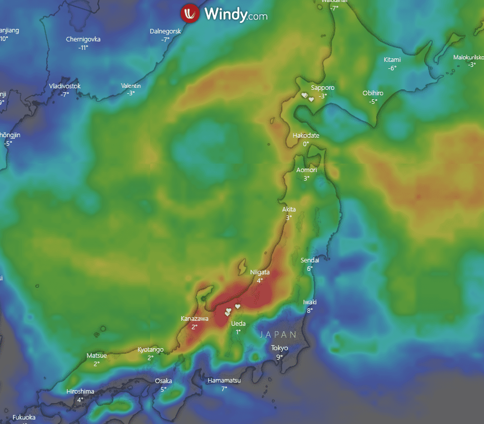
We can immediately see some deep reds through central Honshu, an image that once again has become the story of these updates. The reddest regions through central Honshu look to be around 1.5+ metres which is based on accumulations for the next 10 days, so slightly longer than the next week. In the near future it’s set to snow into the weekend giving us some good quality conditions around the country, which we’ll go into further below.
Forecast
Thursday Feb, 17 – Friday, Feb 18
After some overnight snow around Honshu it doesn’t stop through the day with mainly westerly winds getting gusty increasing through the evening alongside heavy snow in parts. Totals look big in parts around 25-55+cm setting up a big Friday. Quite relaxed with cloud in Hokkaido, not expecting much snow. Possibility for some light falls overnight shouldn’t amount to much. Totals 2-9cm.
Snow continues through Honshu on Friday morning but tapers off through the day with winds winding down and some partly cloudy flurries. After a productive 36-48 hours prior, conditions should be firing for those lucky enough to be out. Totals around 10-25cm, mostly falling early. For Hokkaido the light falls overnight continue into the morning and hang around for most of the day. Winds northwesterly reasonably light. Totals 3-10cm.
Saturday, Feb 19 – Sunday, Feb 20
A quiet morning around Honshu with initially southerly winds turning westerly and bringing snow through the evening. Totals 7-18cm. Up north it’s more of the same for Hokkaido with light snowfalls through the morning and day getting a little heavier through the evening. Winds once again low to moderate initially westerly turning southwesterly. Totals 4-12cm.
Snow continues through Honshu om Sunday with overnight snow from Saturday setting up another nice day around resorts. Falls get heavier again through the day and into the evening with a similar look to Thursday. Northwesterly winds increase alongside the snow with good totals of 20-40+cm. Around Hokkaido some light flurries early shouldn’t amount to much before winds turn northwesterly and pick up strength in the evening. Overnight totals look quite hit and miss, around 5-15cm.
Monday, Feb 21 – Wednesday, Feb 23
The show rolls on around Honshu but not quite to the extent of Thursday or Sunday. Consistent westerlies shouldn’t be too strong with totals of 5-20cm, dependent on location. Up north in Hokkaido strong west northwesterly winds and snow continue from Sunday. Falls don’t look to heavy, but temps will be cold with snow totals of 5-15cm.
You guessed it, Honshu is expecting more snow on Tuesday with westerly winds really kicking up through the middle of the day. Totals of 10-30+cm. The strong winds hang around in Hokkaido but should ease a little through the day and evening. Light snow is also expected through the day but shouldn’t amount to much with totals of 2-7cm.
We finish off on Wednesday with more snow for Honshu but not as heavy as Tuesday. Winds are quite swirly but not as strong as what is forecast for Tuesday. Totals 4-12cm. Similar story to Tuesday for Hokkaido with westerly winds hanging around and getting stronger in the evening. Totals again look small, around 2-7cm.
Extended Outlook
So, it is a bit of a mixed bag around resorts for the next week. Honshu is set to do well over a couple of days with some deep low-pressure systems dominating the pattern over the next seven days and helping produce snow-bearing north-westerlies for many of the resorts. The picks of the week look to be Thursday/Friday and Sunday/Monday in Honshu. Sunday sees strong primary and secondary lows sitting off the east coast of Japan in the northern Pacific. The winds then wrap around and hit central Honshu from the northwest and the strength and proximity of these lows sees wind strength pick up for areas of both Honshu and Hokkaido.
Looking further ahead, it looks like things will calm down around Honshu giving those lucky enough to be there a chance to enjoy what should be a big week. These relatively relaxed conditions should continue through to the start of the next weekend. For Hokkaido after a week with some strong winds it does look to calm down as well after Thursday heading into the start of the weekend. I’ll bring you more on what to expect over the next fortnight in the next update.
Take care,
Grasshopper.


