New Zealand Forecast – A Bit Of This And A Bit Of That After The Icy Blast Left A Trail Of White Smoke
Mountainwatch | The Grasshopper
Written early Friday 11thAugust, valid to Sunday 13thAugust
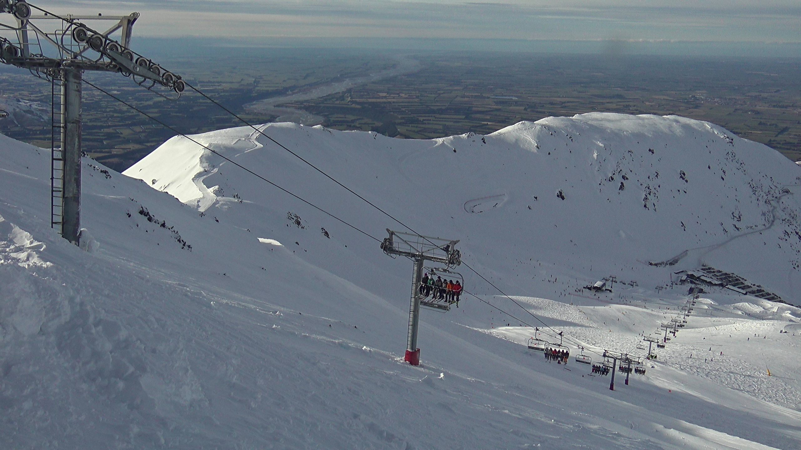
New Zealand is on the back end of an icy blast that gave the Southern Lakes a nice dusting of snow, and a dump of 15-20cm over Canterbury. Ruapehu received 10-15cm and counting.
Although accumulations weren’t exactly up to your neck, it’s has all been about the quality of the snow, one report describing it as white smoke, thanks to the freezing temperatures that brought snow down to super low levels, affecting many towns and roads throughout the country. And with blue skies over the South Island yesterday, it was perhaps the best day of the season thus far.
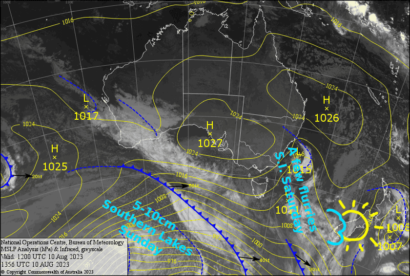
Today, Friday, a low and it’s cold southerlies will pull away to the east, while a ridge of high pressure moves up the South Island. The ridge will quickly move across the North Island this weekend, allowing W-NW winds to blow over the North Island where plenty of cloud and light precip will push into Ruapehu.
Meanwhile, down on the South Island, there’s nothing in the weather to halt the shred-fest during Saturday as a weak front passes over. Then on Sunday another, more vigorous cold front passes over to give the Southern Lakes another 5-10cm and the upper slopes of Canterbury a dusting.
Friday 11th
It’ll be an icy cold morning for the South Island, and a bit of mid-high level cloud will mean it’ll be slow to warm up. However, it should be mostly sunny skies during the afternoon. A light SW breeze over the Southern Lakes dies away, while a light southerly will kick in over Canterbury later in the afternoon.
Cloud and light snowfalls continue on Ruapehu, but it’ll start to clear up during the afternoon as strong, icy southerlies abate.
Saturday 12th
NW winds kick in over the South Island, not too strong mind you, and will blow in plenty of cloud over the Southern Lakes, and possibly a snow furry or two. Canterbury will be fine with just some high cloud.
Cloud will build over Ruapehu during the morning before a few light flurries during the afternoon. Chilly westerly winds.
Sunday 13th
Snow will start falling over the Southern Lakes during the morning, with a period of heavy-ish falls before pinning back to light snow showers during the afternoon as NW winds ease. Treble Cone may pick up around 10cm for the day, while the others should see 5cm or less.
Cloud will build over Canterbury while NW winds rise to gale. Snow will fall over the club fields during the afternoon into the evening, with a few light snow showers reaching Mt Hutt and Porters Pass, although it’ll likely be wet on the lower and possibly mid slopes.
Ruapehu will remain in the clouds as slightly milder NW winds pick up, with mostly light snowfall throughout the day likely falling as drizzle about the lower slopes.
Extended Forecast
From Monday through into Thursday, a cold wintry low pressure system passing over NZ should see the South Island topped up with some more white smoke, while Ruapehu potentially cops the mother lode, depending on whether a particular juicy dollop of tropical moisture is added to the mix or not (we hope it is, but in a good way).
After a couple of ridge days, and some amazing conditions, some more atmospheric action next weekend is likely to bring more snow to what has become a powder paradise.
That’s all from me today, folks. See you again Monday.


