New Zealand Forecast, June 10th – A Couple of Top-Ups Today & Tonight, Then a Mix of Rain & Snow through Opening Weekend
Mountainwatch | The Grasshopper
Published early Monday 10th June 2024
Good morning folks! This coming weekend is Opening Weekend in Aotearoa, New Zealand, so I thought I’d get the ball rolling with the first NZ forecast 2024. Mt Hutt is scheduled to open this Friday, while Coronet Peak, The Remarkables and Cardrona are scheduled for Saturday. Treble Cone and all other resorts are planning to open from late June.
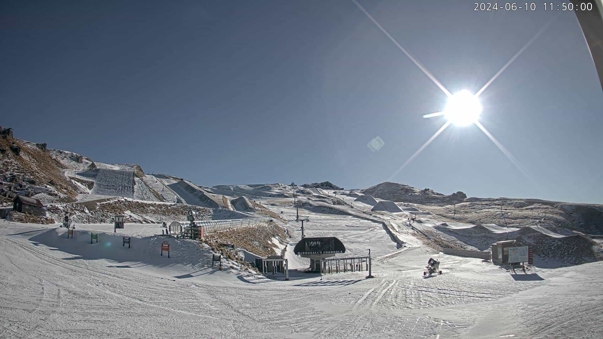
Despite a cold May and an early pre-season dump of snow, recent conditions haven’t been great preparation for Opening Weekend. Several strong northwesters and a week of warm, sunny weather has left resorts rather thin and bony on the ground.
However, a couple of quick cold changes today and tonight/early Tuesday will bring small top-ups of about 5cm each to South Island resorts and the chance to make a tonne of snow.
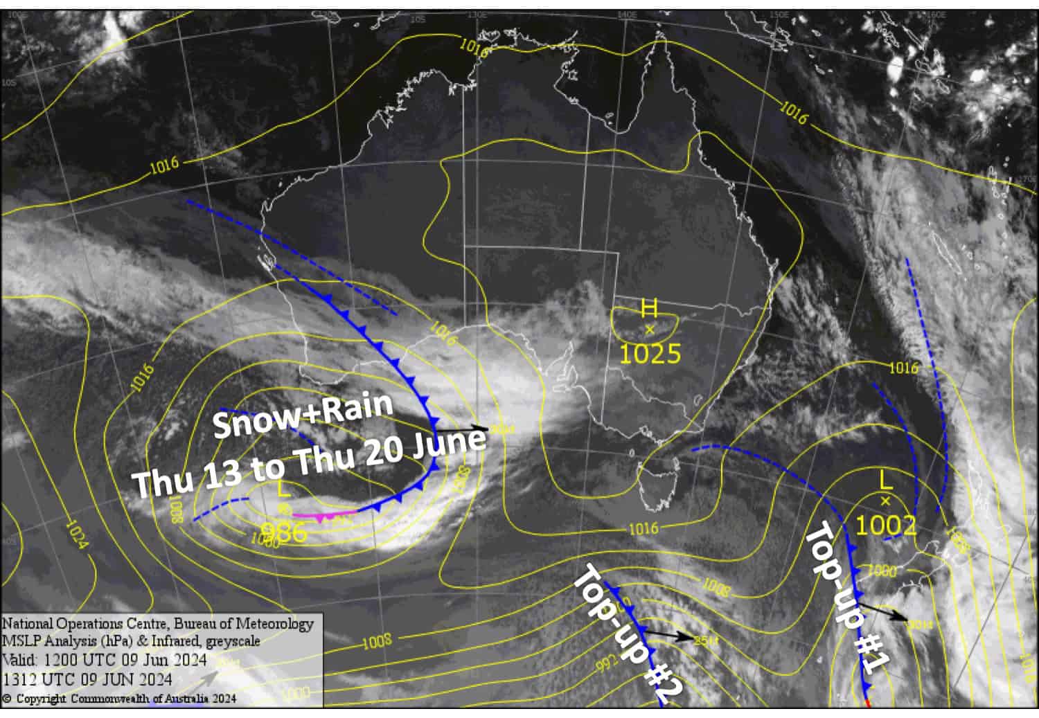
Clouds will then start to gather before a slow-moving low-pressure system in the Tasman Sea nails the country over about a seven-day period starting this Thursday. There are big question marks over what exactly will happen, but conditions will likely get a little hairy at times with periods of heavy rain and snow.
Monday June 10th
A cold SW change is going through the Southern Lakes early this morning and will work its way up Canterbury throughout the morning, putting an end to the rainy/showery strong NW winds currently there at the time of writing.
The cold change will bring a short period of snowfall to near base levels of the resorts. Skies then clear over the Southern Lakes in the afternoon and over Canterbury from late afternoon. Around 5cm or less is expected.
Tuesday June 11th
Another cold front passes over the South Island Monday night into the early hours of Tuesday. The Southern Lakes will pick up another 5cm or so, while Canterbury will just see a light dusting spill over the Main Divide as winds continue from a westerly direction – Mt Hutt and the Craigieburn Range club fields may only see a brief flurry.
The remainder of the day will be mostly fine and chilly with light winds and the potential for the snow guns to fire up.
Wednesday June 12th
Mid and high-level cloud build over the South Island as NW winds pick up a little.
Thursday June 13th
Northerly winds blow over the country as a low approaches from the west. Cloud and showers will build over South Island resorts, first over the Southern Lakes from morning then Canterbury from evening, falling as snow about the tops.
Extended Forecast
The outlook is looking wild folks. A slow-moving low-pressure system (the one that approaches on Thursday) is expected to affect the country from Friday 14th all the way through into Wednesday 19th or even Thursday 20th of June. Opening Weekend will likely be a mixed bag of rain and snow.
At this stage, there are big question marks around the movement of the low and the subsequent weather and temperatures it will bring to NZ resorts. At least the first half of this stormy period is likely to bring winds from the N-NE along with milder temperatures and high-level snow, which could be heavy at times.
During the latter stages of this period, winds may swing around to a colder SE quarter over the South Island and hopefully dump snow there. At this stage, Ruapehu will stay on the north side of the low, so mainly rain and high-level snow is expected there too.
In the days following the departure of this low, from about Friday June 21st, a cold change may sweep up the country, bringing fresh snowfall to all. But this is a long way off, so we won’t count on it just yet.
That’s all from me today folks. I’m sending out these forecasts every Monday, Wednesday and Friday, so I’ll see you again soon.
Grasshopper


