New Zealand Forecast, October 2nd – Rain Turns to Snow as Cold Southerly Sneaks in to Save the Day, Warm Again Tomorrow

Mountainwatch | The Grasshopper
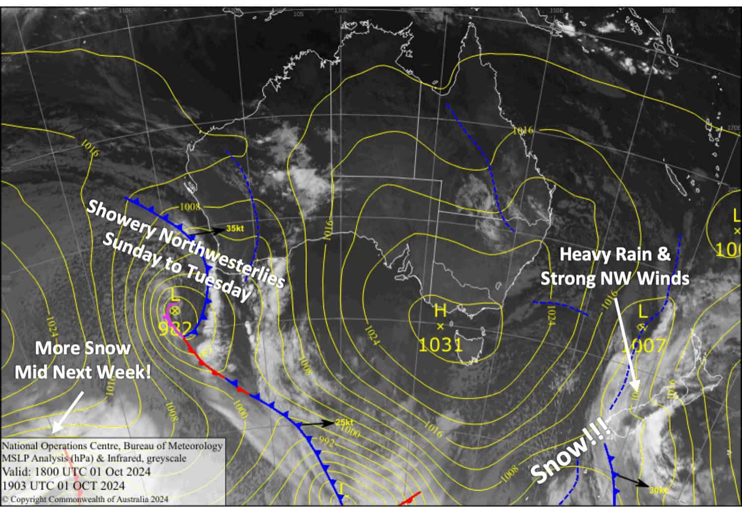
An active low-pressure system will nail New Zealand today (Wednesday) and Thursday, bringing heavy rain and strong north-northwest winds. However, a cold southerly wind will sneak up over the lower South Island during the latter half of today, turning it all to snow.
Earlier forecasts had the cold air stopping just shy of the Southern Lakes, but things have changed in our favour, and it’s now expected to reach as far north as central Canterbury… but only just! Therefore, snowfall has been tentatively forecasted for Mt Hutt and the Craigieburn Range tonight, but it’s on a knife edge.
The snow will gradually turn back to rain on Thursday as warmer air pushes back in. Overall, we could be looking at 15-30+ cm for the Southern Lakes and the Mackenzie Basin, and 5-15 cm for Mt Hutt and the Craigieburn Range. However, confidence in these numbers is fairly low.
The low will continue to affect the country on Friday and Saturday while it weakens in the Tasman Sea, but conditions will be less severe.

Wednesday October 2nd
Rain with heavy falls spreads up the South Island during the morning with strong northwesterlies reaching severe gale in exposed areas of Mt Hutt and the Craigieburn Range. A lighter but colder southerly change will reach the Southern Lakes around the middle of the day, then move up Canterbury in the evening and at night, bringing snow down to low levels.
A cloudy day for Mt Ruapehu, with drizzle developing in the afternoon before turning to rain in the evening. Whakapapa will be worse off, with clagged-in, foggy conditions due to northerly winds, which will become strong.
Thursday October 3rd
Snow falling over South Island resorts will gradually turn to rain as warmer air arrives. Southeasterlies become strong over the Southern Lakes and MacKenzie Basin.
Heavy rain and severe-gale northerlies on Mt Ruapehu will back off significantly around opening time and will continue to ease throughout the day.
Friday October 4th
Rain at times for South Island resorts, falling as snow on mid and/or upper slopes, will gradually clear during the latter half of the day. Visibility will be low with clagged-in conditions at a lot of resorts, particularly those in the Southern Lakes and Mackenzie Basin where easterly winds will be a bit stronger.
A nice sunny day for Mt Ruapehu with a northerly breeze.
Saturday October 5th
A fairly cloudy day for South Island resorts, with scattered showers in Canterbury falling as snow about the upper slopes. North to northeast winds will be stronger in Canterbury.
On Mt Ruapehu, rain develops in the morning, with snow falling up high. Whakapapa will be worse off again, with clagged-in, low-vis conditions due to brisk, northerly winds.
Extended Forecast
A strong, unsettled northwest flow will bring periods of rain and high-level snow to the country from Sunday to Tuesday. Another cold southerly is expected to bring more snow to the country on Wednesday, the 9th of October, and possibly Thursday, the 10th.
That’s all from me today, folks. The next forecast will be out Friday, see you then and have a great couple of days.
Grasshopper


