New Zealand Forecast, September 2nd – A Rough Start to the Week Leaves a Little Snow and Fine Weather for Wed & Thurs

Mountainwatch | The Grasshopper
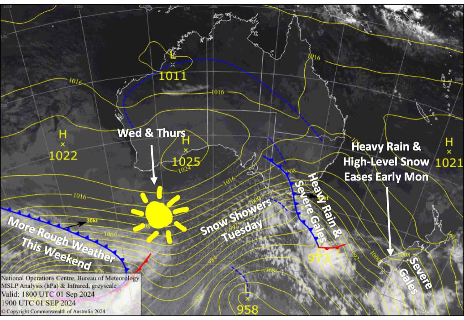
The forecast starts with extremely rough conditions for the South Island, with many resorts likely to be closed today, Monday. This is due to a front lying over the lower South Island, which will leave behind around 10-20cm of snow on the upper slopes of the Southern Lakes and MacKenzie Basin before it weakens this morning.
Another active front will move up the South Island tonight and reach Mt Ruapehu Tuesday afternoon. This front will bring another bout of heavy rain and severe gales, but a cool change chasing its tail will bring a little snow before the weather settles and clears up on Wednesday and Thursday as we see a break in this active pattern. Snow totals could get up to the 5-10cm mark.

Monday September 2nd
A rough day for the South Island, with northwesterlies reaching gale to severe gale in exposed places. Heavy rain, thunderstorms and high-level snow over the Southern Lakes and southern Canterbury clear in the morning, leaving mainly sunny skies. Rain and thunderstorms spread north again after dark with heavy falls.
A sunny day for Mt Ruapehu with northwest winds.
Tuesday September 3rd
Rain turns to snow early in the morning for the Southern Lakes as a front brings cooler west-to-southwest winds. The snow eases to the odd light flurry and sunny spells later in the morning.
In Canterbury, there’ll be rain and severe gale northwesterlies. But the same front will cross the region in the afternoon, bringing snow and lighter southerly winds.
A clear morning on Mt Ruapehu, but northwest winds will be blowing a gale. Heavy rain develops in the afternoon, then eases to showers in the evening while gradually turning to snow.
Wednesday September 4th
Snow clears Canterbury early in the morning, bringing a fine day for South Island resorts. However, the Southern Lakes will see some cloud later in the afternoon. South-to-southwest breezes turn westerly.
Mt Ruapehu will be mostly cloudy with afternoon snow showers, which will likely be wet about the lower slopes. Southwest breezes turn southeast in the morning.
Thursday September 5th
A nice day for South Island resorts with some high clouds. Northwest winds for the Southern Lakes and lighter southwesterlies in Canterbury.
Clear skies and brisk southerly winds for Mt Ruapehu.
Extended Forecast
The weather will become rough again this weekend and next week as this strong, active westerly spring pattern returns after a short break. Numerous passing fronts are expected to bring more bouts of heavy rain and severe gales, followed by brief cold changes and small top-ups of snow. It’s four-seasons-in-one-day kind of weather, and snow conditions will fluctuate accordingly. It’s best to keep your eyes on the short-term forecast and be flexible and prepared for disruptions.
That’s all from me today, folks. The next forecast is Wednesday. See you then, and have a great couple of days.
Grasshopper


