New Zealand Forecast, Wednesday, September 25th – Heavy Rain & Strong Winds Thursday into Friday, Followed by a Light Dusting & Icy Temps

Mountainwatch | The Grasshopper
The Southern Lakes received a couple more small top-ups on Monday and Tuesday, although Tuesday’s snow came with intense winds and was heavy and dense. High snowfall and fluctuating temperatures have also created considerable avalanche risks for the Southern Lakes, and over a dozen have been reported in the area in the last week. So take care if venturing backcountry; if you’re unsure, play it safe by sticking to the ski resorts where avalanche risk is actively managed.
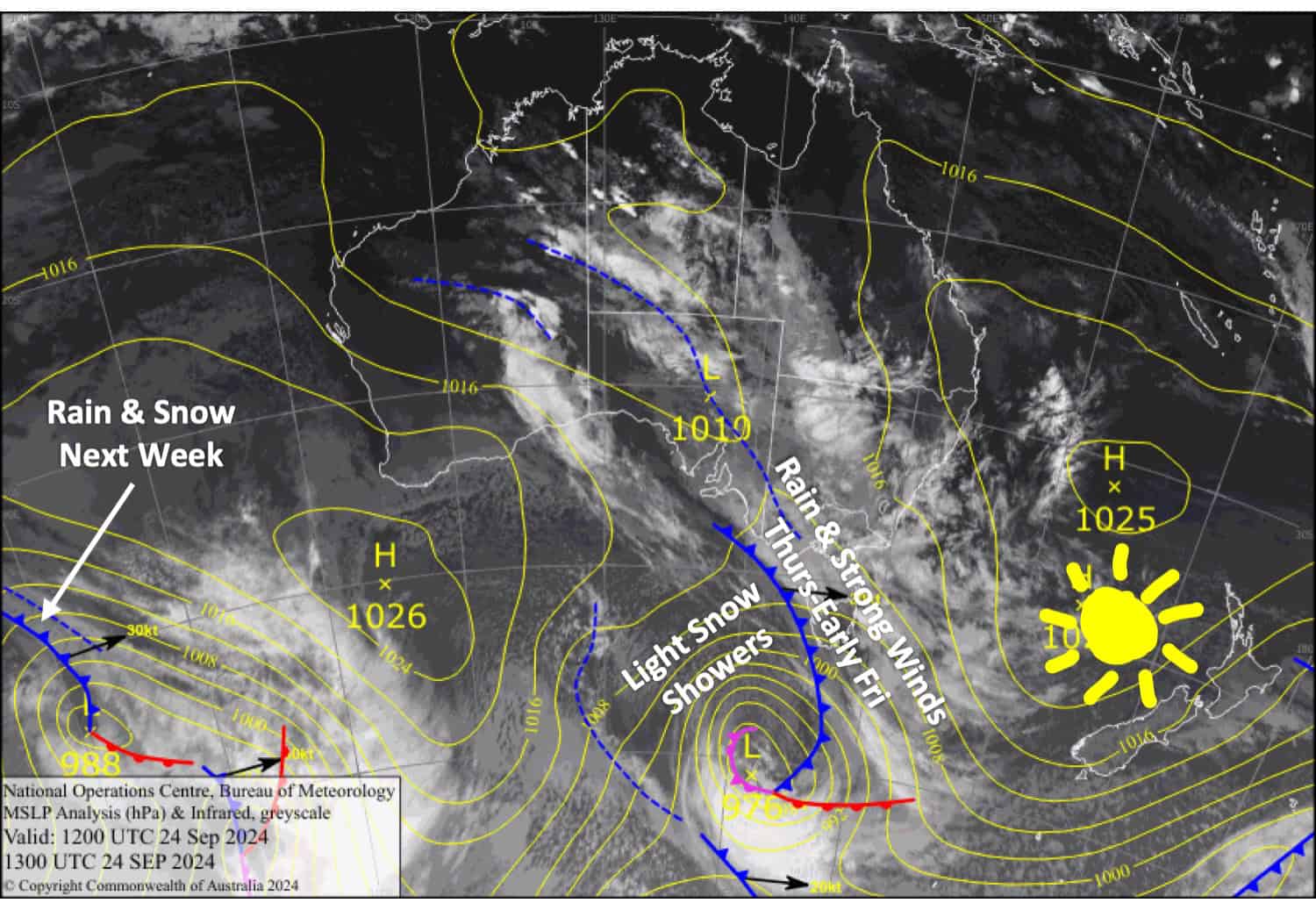
Today, Wednesday, will be mostly fine throughout New Zealand, but a front moving up the country will bring heavy rain and gale to severe gale winds to the South Island on Thursday and the North Island during the early hours of Friday. Following the front, icy cold winds from the southwest will sweep up the country, bringing just a dusting or skiff of snow to Kiwi resorts.
West to southwesterly winds will continue through the weekend, bringing partly cloudy skies as high-pressure approaches from the west and temperatures start to rebound.

Wednesday September 25th
A fine morning for South Island resorts, but clouds will build in the afternoon, especially over the Southern Lakes, where there’ll be heavy rain overnight. Northwest winds gradually pick up.
A nice, sunny day for Mt Ruapehu. Southerly winds gradually ease while turning to the west.
Thursday September 26th
A rough day for the South Island with gale-severe gale northwest winds and heavy rain spreading northwards. However, a colder, lighter westerly change will reach the Southern Lakes early afternoon and then Canterbury in the evening, bringing a light dusting of snow before clearing at night. Disruptions and closures are likely, especially in Canterbury.
Clouds gradually build over Mt Ruapehu before rain sets in during the evening. Southwest winds clock northwest while strengthening.
Friday September 27th
Icy cold west to southwest winds over the South Island will push in clouds over the Southern Lakes with light afternoon snow showers. Canterbury will be clear and sunny.
A cold southwest change on Mt Ruapehu will see heavy rain ease to light snowfall briefly around opening time, leaving a skiff of snow and mostly cloudy skies for the rest of the day.
Saturday September 28th
A fairly cloudy day for the Southern Lakes and a nice sunny one for Canterbury as cold southwesterlies turn westerly and start to warm.
A nice sunny day for Mt Ruapehu as light, chilly, southerly winds turn westerly.
Extended Forecast
West to southwest winds continue to blow over the country on Sunday, bringing partly cloudy skies to the South Island and early light snow showers to Mt Ruapehu. Temperatures will still be on the rebound and will warm up significantly on Monday as winds turn northwest while high pressure moves over the top of the country.
As we head into October, the next weather system will pass over the country from late Tuesday onwards. Models are still unsure of the details, but we’ll likely see a period of rain and strong northwest winds before a cold southerly change brings a top-up or possibly a larger dump of snow.
That’s all from me today, folks. The next forecast is Friday. See you then, and have a great couple of days.
Grasshopper


