New Zealand Weekend Forecast, Friday July 31st – Fresh Powder, Icy Temps Make, & a Cracker of a Weekend
Mountainwatch | The Grasshopper
Published early Friday, 31st July 2026
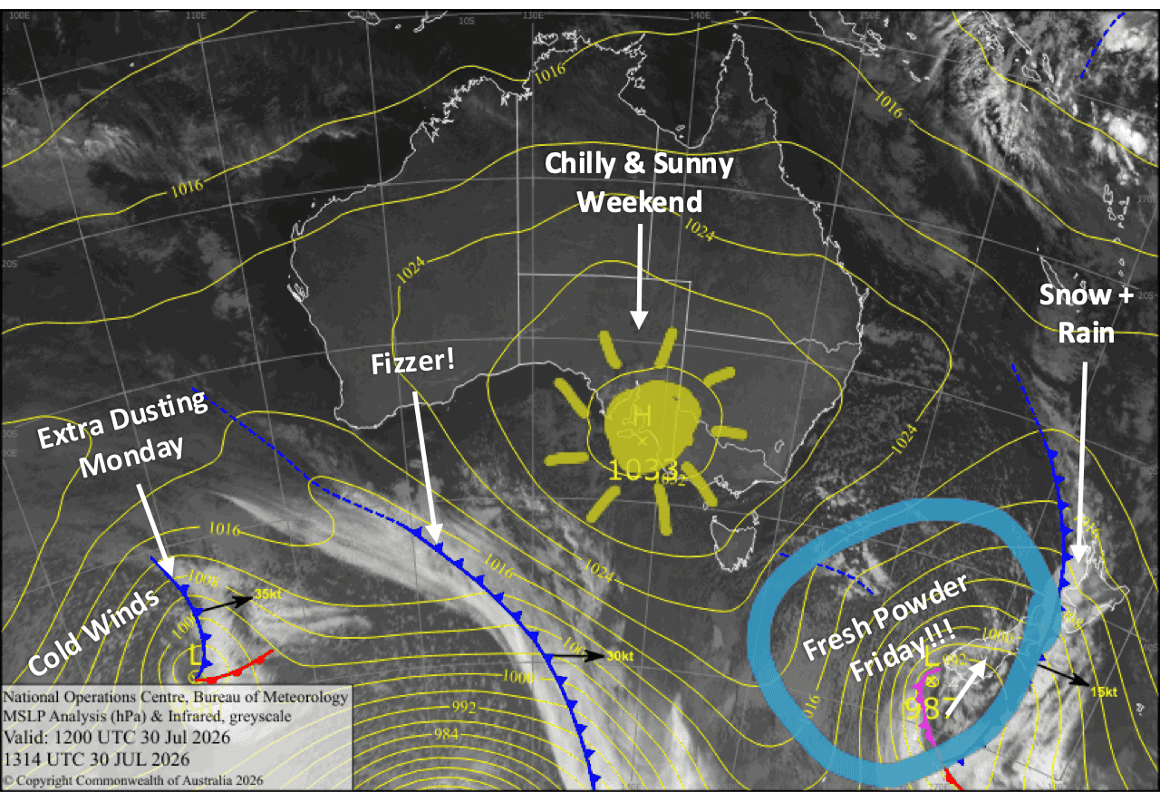
Winds really ramped up yesterday, Thursday, forcing early lift closures across the country, while most ski fields in Canterbury remained shut for the day. The culprit was a strong northwesterly frontal rainband that swept through the Southern Lakes during the afternoon before reaching Canterbury in the evening. As I write in the early hours of Friday morning, it’s still crossing Mt Ruapehu.
We were expecting the front to deliver a dump of snow on mid and upper slopes, but snow levels looked marginal for the lower slopes. Fortunately, snow came in nice and low in the Southern Lakes. We’ll have to wait for the morning reports to see just how much fell there, and how Canterbury and Mt Ruapehu fared.
Behind the front, much colder air surges in. Westerlies will keep snow falling on Mt Ruapehu through Friday, with another 10-35+cm on the cards, while an icy southerly races up the South Island later in the day, delivering a further 5-10cm to most ski fields and as much as 15-20cm for The Remarkables.
The weekend then shapes up beautifully for powder hunting, with sunshine returning, although cold winds hang around. A weak cold front brushing the South Island on Monday should bring a light top-up to the Southern Lakes and a sprinkling for Canterbury later on, while Mt Ruapehu also picks up a few more centimetres. Cold conditions continue into Tuesday, making for another excellent day on the slopes.
Friday 31st July
After fresh snowfall overnight, skies will mostly clear over the South Island by breaky time, although strong west-to-northwest winds will continue to blow, and snow will continue on the Main Divide, where Temple Basin will benefit from even more powder after a heavy dump overnight.
Then, an icy-cold southerly change whips over the Southern Lakes late morning/midday and up Canterbury during the afternoon, bringing high-quality snow to very low levels which will affect some roads. Most ski fields should receive a 5-10cm top-up before the snow clears at night, but the Remarkables will be in the firing line and could receive 15-20cm.
After a load of snow on mid-upper slopes overnight, snow also continues on Mt Ruapehu, lowering to base levels early in the morning as strong northwesterly winds shift to a colder westerly. Snow clears in the evening, leaving a solid 10-35+cm coat of fresh powder.
Saturday 1st August
Any leftover snowfall and clouds clear the South Island during the morning for a mostly fine, sunny day, but wrap up warm because there’ll be icy-cold winds from the south turning southwest.
Icy-cold southerlies also arrive at Mt Ruapehu early morning, bringing brief light snowfall, then clouds clear for a mostly fine, powder-filled day.
Sunday 2nd August
A fairly cloudy day for the Southern Lakes and a clear, sunny one for Canterbury as chilly southwesterlies turn west-to-northwest.
A great day for Mt Ruapehu with clear, sunny skies as cold southerlies gradually die out.
Monday 3rd August
Fine and cloudy spells for South Island ski fields. Strong west-to-northwest winds turn southwest as a weak cold front brushes past, bringing a period of light snowfall to the Southern Lakes during the day and to Canterbury at night.
Snow showers develop on Mt Ruapehu during the morning, but it could be a little wet and sleety at base levels for a time. Strong southwest winds.
Tuesday 4th August
Another partly cloudy day for the South Island as cold south-to-southwest winds gradually ease.
Light snow showers and cloud clear Mt Ruapehu during the morning as strong southwesterlies turn to a colder, drier southerly.=
Extended Forecast
High pressure is picked to bring cold, settled winter weather through mid-next week. The storm window opens up again from about Friday or Saturday, the 7th and 8th of August onwards, as a series of low-pressure systems move in from the Tasman Sea. Canterbury is in a great position to maximise any potential snow, while the Southern Lakes may only see light falls on the edges. Mt Ruapehu could also see good snowfall initially before temperatures become too warm there.
That’s all from me today, folks. I’m sending out NZ forecasts every Monday, Wednesday and Friday throughout the season. Have a great weekend, and I’ll see you back here on Monday.
Grasshopper