New Zealand Weekend Forecast, Friday, September 6fh – Get Your Turns In Today Before Things Get Nasty From Saturday Onwards

Mountainwatch | The Grasshopper
Today, Friday will be the pick of the bunch. Weather conditions will be nasty over the next several days, with strong winds likely causing major disruptions and closures at many resorts.
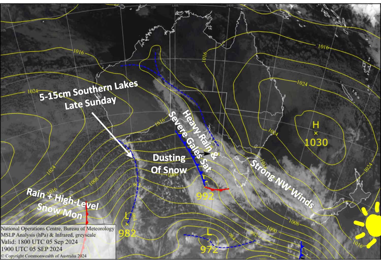
Saturday will be particularly rough as a strong front moves northwards up the country, bringing heavy rain and severe gales. Cooler westerlies behind the front will leave a dusting of snow, and a weaker front caught up in the flow will bring more snow late Sunday, benefiting Treble Cone the most with 10-15cm, while 5-10cm should fall elsewhere in the Southern Lakes. Canterbury will pick up a dusting mostly about the upper slopes.
The snowfall will eventually turn wet on mid- and lower slopes Sunday night, and more frontal activity from the west, coupled with strong westerlies, will force more rain and high-level snow to spill over the Main Divide through Monday.

Friday September 6th
Partially cloudy skies for the South Island with one or two light showers over the Southern Lakes and MacKenzie Basin. Northwesterly winds will be strong in exposed areas, and rain will spread northwards at night.
A clear morning for Mt Ruapehu resorts above a deck of cloud. The Cloud will lift to resort height in the afternoon with a little drizzle as southwesterlies pick up.
Saturday September 7th
It’ll be a very rough day for the South Island as a front brings a period of heavy rain to the Southern Lakes in the morning and to Canterbury in the afternoon. Severe gale northwesterly winds preceding the front will turn a cooler westerly behind it, turning rain to snow showers for the Southern Lakes in the afternoon and providing just a skiff of snow in Canterbury in the evening.
A grey, drizzly day for Mt Ruapehu as strong westerly winds gradually rise to severe gale in exposed areas by day’s end. Drizzle turns to rain in the evening.
Sunday September 8th
A clear morning for the South Island with strong and gusty westerlies. Another front spreads snow showers over the Southern Lakes in the afternoon and Canterbury in the evening while winds turn northwest and strengthen even more, reaching severe gale in exposed areas. The snow will eventually turn wet about the lower slopes, and those furthest south and closest to the Main Divide will receive more of it – Treble Cone will do well while Mt Hutt and Porter’s Pass will see little, if any.
Mt Ruapehu will be partially cloudy with a light snow flurry or two. Strong southwest winds back off a tad in the morning.
Monday September 9th
Rain and high-level snow throughout much of the day for the South Island, with potentially heavy falls. Strong northwesterlies will persist, reaching gale in exposed areas of the Southern Lakes and severe gale in Canterbury.
Clouds build over Mt Ruapehu before showers kick in during the afternoon, while westerly winds gradually turn northwest and strengthen.
Extended Forecast
Next week, strong westerlies persist over the country on Tuesday and bring further showers of rain and snow to the resorts. The showers clear for Wednesday ahead of a weak southerly change on Thursday, bringing a top-up of snow, which will likely benefit Canterbury the most.
That’s all from me today, folks. The next forecast is Monday. See you then, and have a great Weekend.
Grasshopper


