New Zealand Weekend Forecast, July 28th – Chasing Clouds Amongst A Heap Of Sunshine And Powder
Mountainwatch | The Grasshopper
Written early Friday 28thJuly, valid to Sunday 30thJuly
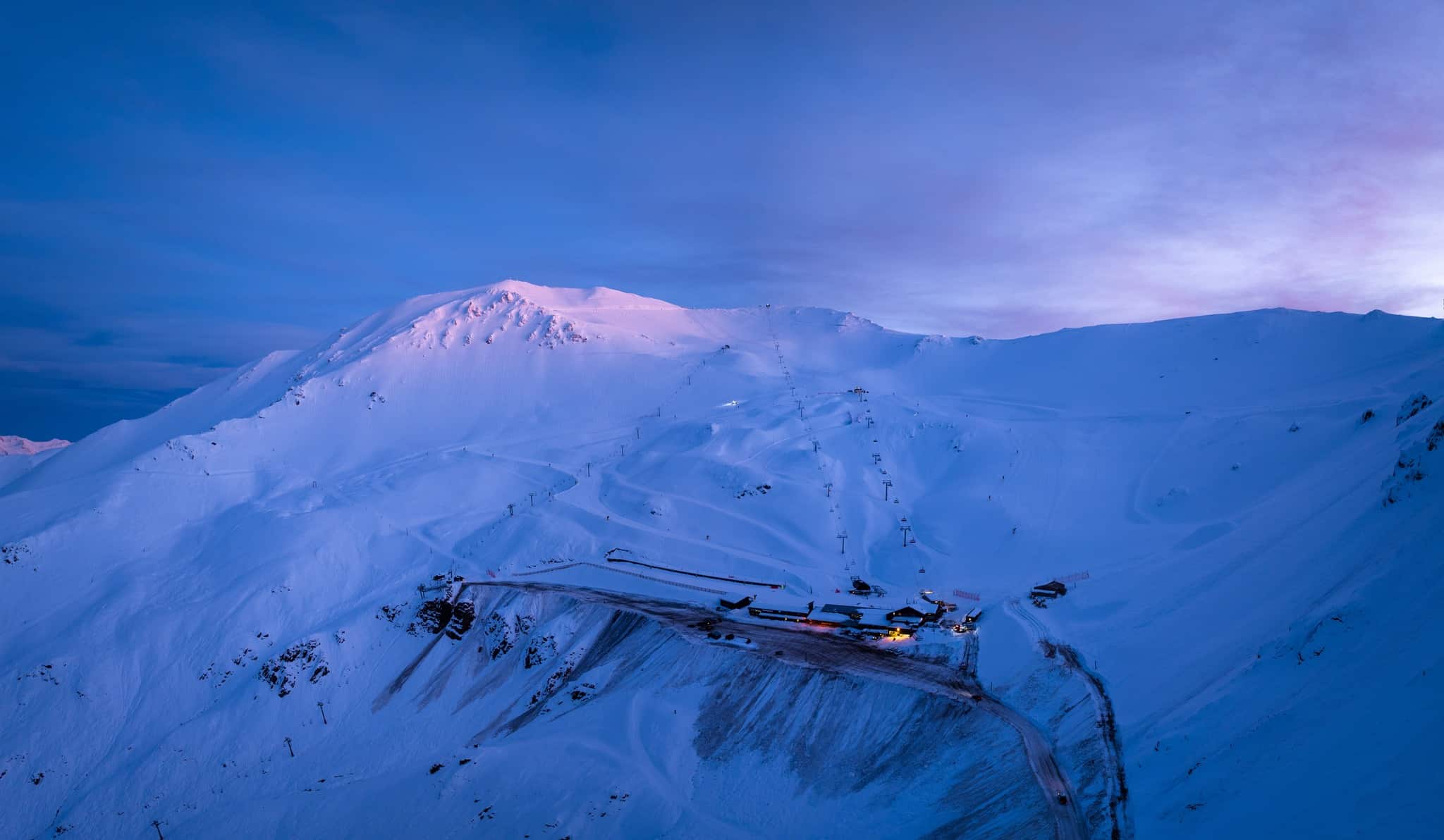
It’s been one heck of a week east of the ditch, where all manner of weather thrown at NZ resorts has ended in powder – the Southern Lakes picking up about 10-20cm, and Ruapehu 15cm down low and 25-35cm up high. After reporting 70cm over the weekend, Mt Hutt has since picked up another 22cm. It has been a much needed boost to the NZ scene at a time the snow cover was getting rather threadbare.
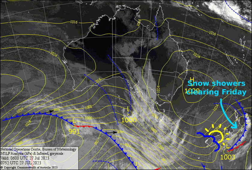
Mt Ruapehu will see out the last snowflakes this morning as the strong, cold southerly flow eases, while a ridge of high-pressure over the South Island drifts northwards. With the ridge pausing over the North Island, this weekend’s forecast simply had me chasing cloud amongst a lot of sunshine, along with NW winds over the South Island Sunday.
Friday 28th
Plenty of sunshine for the Southern Lakes, with just a bit of cloud about at times and a W-SW breeze.
Cloud over Canterbury will gradually clear this morning while southerly winds drop off, leaving a fine, calm afternoon.
Snowfall on Ruapehu will gradually clear this afternoon with sunny spells developing. Meanwhile, gale southerlies will gradually abate and turn a little to the southeast.
Saturday 29th
The Southern Lakes day will start out fairly cloudy, but will get sunnier as the day progresses. Super light W-NW breezes. Canterbury will also be mostly fine with a light southerly breeze. There’ll be scraps of high cloud overhead and some lower level cloud about the club fields.
Ruapehu will start out fine, but SW breezes will push in a bit of afternoon cloud and there could be a light snow shower or two.
Sunday 30th
NW winds will pick up over the South Island with a fair bit of mid-level cloud sitting over the Southern Lakes, while Canterbury will be clear and sunny.
A rare fine day for Ruapehu, with just a little bit of low level cloud at times about the lower slopes and a super light SW breeze.
Extended Forecast
Monday will see a front fade away as it passes over the South Island, bringing a top-up for the Southern Lakes and just a few showers to Canterbury, although temps aren’t ideal, so it’ll be wet on the lower slopes.
A more active cold front crosses the South Island during Tuesday, then the North Island on Wednesday. This one is looking like a doozie, the South Island resorts possibly picking up something like 10-20cm, while Ruapehu could see 15-30cm+. A ridge of high pressure following close behind the snowstorm should bring a couple of fine, dreamy powder days, although the wind could still be up over the South Island. More active weather and snow looks likely at some point next weekend.


