Northern Hemisphere Winter Reflection – Our LA NINA Forecasts Came True
Whistler in March. The British Columbia resort barely seemed to see sunshine this season with fresh tracks almost every day. Image:: Coastphoto/Whistler
Season Wrap up | Tess Cook, with The Grasshopper
Season 2010-2011 began auspiciously in tandem with the rise of a significant La Nina weather pattern. Back in November 2010 we predicted North America would experience a heavy winter thanks to this helpful weather pattern.
Now, as Easter – generally the marker of the seasonal turning point – passes without much sign of the spring rebirth it is traditionally associated with we can look back to see how the La Nina winter went.
North America
So what effect did La Nina have this winter? The key signature of La Nina is colder than normal water in the eastern equatorial Pacific Ocean near Ecuador. This cold pool of water can affect weather patterns around the globe, shifting the normal mix of high and low pressures. Around the Western United States and Western Canada, La Nina shifts the position of the westerly jet stream, an area of really fast wind high in the atmosphere. This jet-stream is pushed further north during La Nina, delivering more storms to the Pacific North-west and British Columbia. From this northerly position the jet stream flows towards the south-east, clipping northern Utah and northwest Colorado along the way, and enhancing snowfall as it goes.
You can see the average effect of this shift on snowfall in the image on the bottom right of figure 1 below, for moderate to strong La Nina events. The Pacific North-west generally gets a bunch of extra snow during La Nina, as do north-eastern California (around Mammoth/Heavenly), northern Utah and north-west Colorado. On the other hand southern Colorado tends to get a bit less snow-fall, because the jet stream has moved further north.
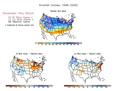
Based on these averages (and they are just averages), back in November Mountainwatch predicted above-average snowfalls for most of the places named above, but we warned that southern Colorado could be a bit below average, and advised you to stay north to be safe.
Here’s what happened:
Whistler, British Columbia, averages 1022cm a year. We said it would be an above average year. It received over 1500cm.
Verdict: Forecast successful!
Lake Louise, Alberta, averages 454cm a year. We said it would be an above average year. It received over 530cm.
Verdict: Forecast successful!
Mammoth, California averages 1016cm a year. We said it would be an above average year. It received over 1600cm.
Verdict: Forecast successful!
Breckenridge, Colorado averages 750cm a year. We said it would be an above average year. It received over 1200cm.
Verdict: Forecast successful!
Snowbird, Utah, averages 1250cm a year. We said it would be an above average year. It received over 1650cm.
Verdict: Forecast successful!
And we said watch out for Wolf Creek, Colorado – nothing to panic about but it could be a little lower than normal… It averages 1180cm per year. It received about 980cm.
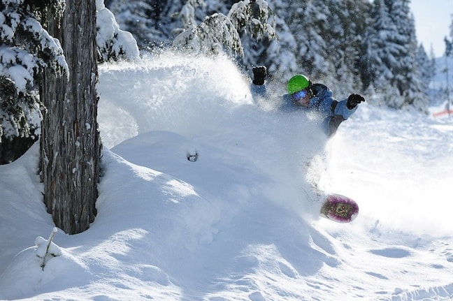
Mammoth on 27 February when endless powder and bouts of sunshine made it a snow-paradise. Image:: Mammoth
“Overall, this La Nina episode behaved like a typical strong La Nina event, ” meteorologist Aaron Cook said. “The most exciting storms this winter arose from large low pressure systems that originated around the Gulf of Alaska and moved slowly south, pushing strong on-shore winds onto the coast from British Columbia down to northern California. These winds were packed with moisture and as it was pushed up against mountain ranges large amounts of snow were inevitable.”
Nowhere was the La Nina effect more evident than in Mammoth Mountain, California. In December the resort experienced the first of many multi-metre snowfalls; five metres in under five days made it snowiest place in the world. Winter in Mammoth and across most of California oscillated between weeks of endless bluebird and days of intense snowfall. It’s a winter that doesn’t seem to have given up yet. On 24 April, a post on Mammoth’s facebook page read:
“2”-4″ overnight! 4″-8″ in the last 48 hrs + 10″-18″ over the last four days! 53 FEET (536″) this season!”
That’s 1361cm for the season and a steady 45cm in the previous four days, with May coming up fast. Mammoth will stay open until June or even July and with a 635cm snow base it seems likely summer will never arrive.
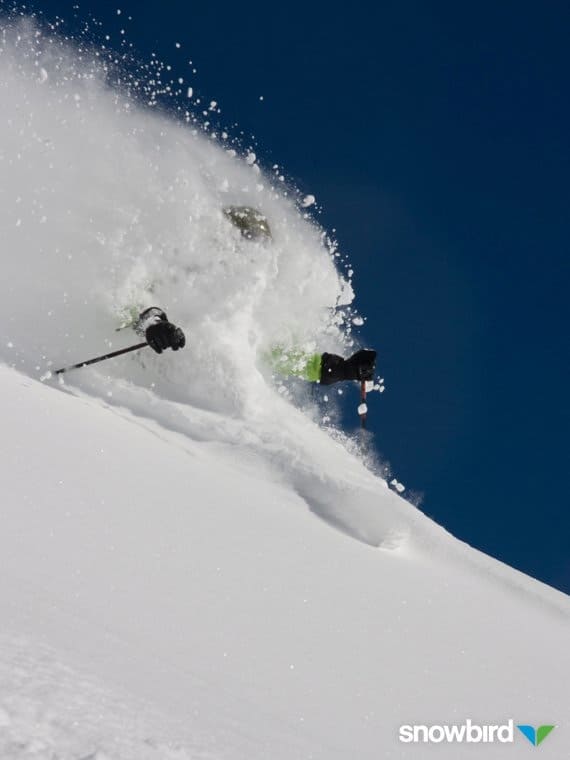
Snowbird, Utah in February. Image:: Snowbird
Europe
Across the pond however, winter wrote a rather different story in Europe where intermittent snowfall and rather too much warm weather prevented the season from ever really taking hold.
Spending most of the winter in Europe, Chris Booth reflected that the best snowfall he saw was in London over Christmas, when Britain was brought to a standstill by unexpected snowstorms. Even these however failed to make a mark on the European Alps.
“The relationship between La Nina and snowfall in Europe is actually quite weak, which is not surprising given how much further away Europe is from the origins of La Nina in the Pacific,” Cook said.
“There is evidence that La Ninas can lead to a higher frequency of colder, drier winds from the north-west over western Europe. The first consequence of this is that winter often arrives early, as we saw with the snow that shut down large parts of the UK, France and Germany.
“This can also mean slightly less snow on average, as we have observed this time around. But there are other more local factors that can play a bigger role in any one season’s weather, so we have to be careful not to blame everything on La Nina, or to fool ourselves that there’s a perfect correlation.”
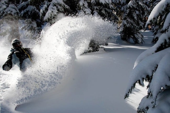
Faceshots at Breck with Ben Comber from Ben Comber on Vimeo.
Powder days in Breckenridge in late January
The future
“The La Nina is now in its death throes and we’re heading back to neutral conditions in the Pacific. It’s too early to tell yet what next winter will bring, but some of the models are starting to hint at the possibility of a weak El Nino event. If an El Nino was to occur, then we’d see conditions similar to 2009/10, when the best snow moved south, and we were worried we wouldn’t get enough snow for the winter olympics in Vancouver.”
Cook added: “But it’s still more likely that we’ll just see neutral conditions and most resorts in the western United States and British Columbia can look forward to an average year.”
For now, it’s time to look to the southern winter and how La Nina might affect the season in Australia and New Zealand.


