NZ Weekly Weather Blog – Freshies at last.
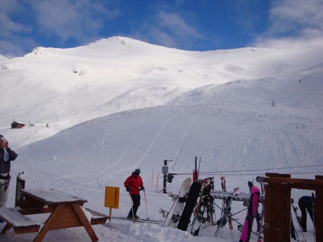
Broken River looking good with a dusting of snow Image:: Broken River
Snow Journal | Matt White
Kia Ora Everyone!
Finally I have something exciting to report on! Yes mother nature has been oh so kind to us and coated the mountains with some snow! In some places like Mt Dobson (1.3M!) it was a sight for sore eyes, before this storm they were closed due to lack of snow! Its funny what a little bit of powder can do for the soul, especially when it seems like you’ve been waiting an eternity for it!
Hopefully this is only the beginning and by the look of the forecast for the upcoming week there may be more snow on the horizon!!!
Heres how the weather is looking for this week:
North Island
Whakapapa/Turoa/Tukino– A chance of snow showers tomorrow and cloudy patches on Sunday, then snow forecast to 1700m through to Tuesday evening with the freezing level rising by wednesday with the chance of showers through until Thursday.
Maunganui– Some scattered snowfall tomorrow, clearing for Sunday but come Monday the rain should settle in for a few days with a freezing level of over 2000m
South Island
North Canterbury
Rainbow– Snow showers for tomorrow and then what looks to be a mixed bag for the rest of the week, rain for Sunday, cloudy for Monday, snow for Tuesday and then some more rain into Thursday.
Hamner Springs/Mt Lyford– Snow to 1500m tomorrow, rain for Sunday, clearing Monday and then more snow forecast from Tuesday onwards. Fingers crossed for that!
Canterbury
Temple Basin, Broken River, Cragieburn, Cheeseman, Mt Hutt, Porter Heights, Mt Olympus– Chance of snow showers tomorrow and then rain for Sunday. A foggy start to Today and then it may sock back in Tuesday with snow showers/rain for the rest of the week.
South Cantebury
Fox Peak, Mt Dobson Round Hill, Ohau– Snowing tomorrow, freezing level may rise overnight and bring showers for Sunday. A foggy Monday will lead into more Snow/rain on Tuesday-Wednesday.
Southern Lakes
Treble Cone, Cardrona, Snow Park/Snow Farm, Remarkables, Coronet Peak– Snow to 1500m tomorrow afternoon through until Sunday evening. Monday looks foggy until mid-day and then it looks as though we will see more snow/rain on Tuesday/Wednesday
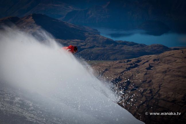
Treble Cone Instructor getting some fresh turns in Image:: Treble Cone
Here’s how the resorts are shaping up snow-wise
Snow Bases across the country (cm)
Whakapapa 63
Turoa 82
Tukino 40
Manganui 25
Rainbow 40
Hamner Springs 45
Mt Lyford 100
Mt Hutt 90
Porters 70
Mt Cheeseman 65
Mt Olympus 75
Cragieburn 55
Temple Basin 54
Broken River 55
Fox Peak On Hold
Mt Dobson 110
Roundhill 50
Ohau 95
Treble Cone 79
Cardrona 72
Snow Park 35
Snow Farm 20
Coronet Peak 60
Remarkables 70
Queenstown Snowcats opening 5 August
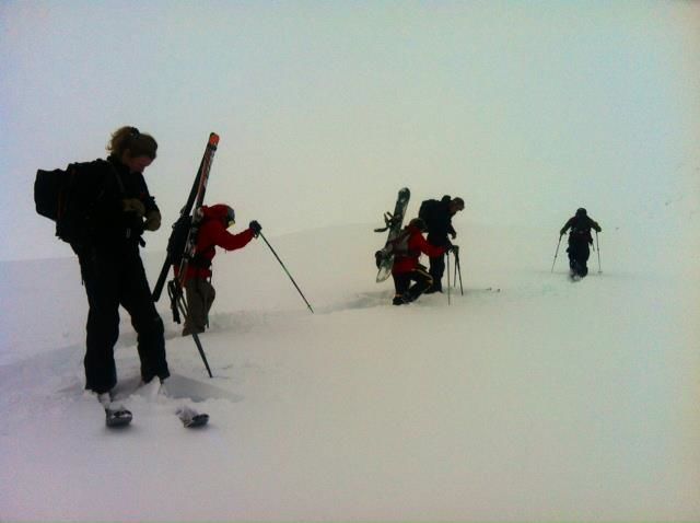
Turns getting earned at Roundhill Image:: Roundhill
Local Knowledge…
Theres still fresh tracks out there to be had, but youve gotta work for them, the backcountry is relatively stable at the moment and has finally filled up enough to enable you to get out there… the usual safety precautions always apply, ride with a buddy and carry the appropriate equipment, just make sure you dont poach my lines ok?!?! This weekend is the annual Billabong Slopestyle at Snowpark, if you want to see some of the most progressive freestyle snowboarding then get up there and check this out!! Think its finally all about to happen people so get those August powder trips booked and ready to go.. Let it snow!
The Remarkables forecasts,
snow reports and
live snow cams.
Treble Cone forecasts,
snow reports and
live snow cams.
Snow Park forecasts,
snow reports and
live snow cams.
Cardrona forecasts,
snow reports and
live snow cams.
Turoa forecasts,
snow reports and
live snow cams.
Coronet Peak forecasts,
snow reports and
live snow cams.
Whakapapa forecasts,
snow reports and
live snow cams.
Mount Hutt forecasts,
snow reports and
live snow cams.


