NZ Weekly Weather Blog – The Snow is upon us!
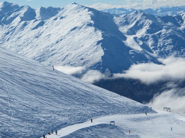
Fresh lines at TC Image: Courtesy of Treble Cone
Snow Journal | Matt White
Kia Ora Everyone! Its been a good week for powder hounds over here in NZ, a good dusting of fresh snow has definitely eased the woes of a so far average season. Just like last week, the snowfalls have allowed fields such as Temple basin to re-open and has allowed for Fox Peak to finally open for the season! On top of that we have had volcanic eruptions on Mt Tongariro so it has been quite a eventful week in the Mountains!
Let’s take a look at the weather for this week
Its looking good across the country for a bit more snowfall, August is usually the month of snow and this is proving true so far, I wouldn’t say to pack your powder snorkel yet but there should definitely be some good powder to be had over the next coming days…
North Island
Whakapapa/Turoa/Tukino– A snowy/rainy week ahead, Freezing level starting out at 2000m with moderate N winds, this will slowly lower to 1400m through to Wednesday with a clear and sunny day predicted for Thursday
Maunganui– Snow above 2000m today and tomorrow, clearing by Monday with the rest of the week looking clear and sunny.
South Island
North Canterbury
Rainbow– Snow to 1300m with a initially strong NW wind but easing by Monday, Snow will continue to fall through to Wednesday night and then looking to clear up for a sunny end to the week
Hamner Springs/Mt Lyford– Snow falling to 1000m through to Wednesday, a chance of rain for Thursday but otherwise fine through to the weekend
Canterbury
Temple Basin, Broken River, Cragieburn, Cheeseman, Mt Hutt, Porter Heights, Mt Olympus– Snow to 1000m with SE winds through to Wednesday, N winds developing Wednesday afternoon, a chance of rain for Thursday and fine for Friday
South Cantebury
Fox Peak, Mt Dobson Round Hill, Ohau– More snow! Falling to 1000m through to Wednesday with a N shift in the afternoon bringing a few showers and sunshine for Friday
Southern Lakes
Treble Cone, Cardrona, Snow Park/Snow Farm, Remarkables, Coronet Peak– Snow to 1000m with SE winds, clearing up by Tuesday evening, a chance of showers on Wednesday with N winds developing, Fine and sunny for Thursday onwards.
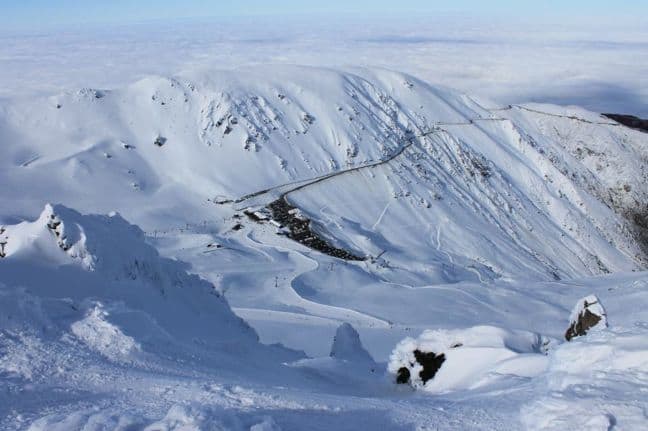
Mt Hutts looking good Image: Mt Hutt
Here’s how the resorts are shaping up snow-wise
Snow Bases across the country (cm)
Whakapapa 95
Turoa 114
Tukino 80
Manganui Closed
Rainbow 60
Hamner Springs 50
Mt Lyford 135
Mt Hutt 125
Porters 85
Mt Cheeseman 80
Mt Olympus 120
Cragieburn 70
Temple Basin 65
Broken River 75
Fox Peak 80
Mt Dobson 180
Roundhill 70
Ohau 115
Treble Cone 101
Cardrona 75
Snow Park 35
Snow Farm 20
Coronet Peak 62
Remarkables 76
Queenstown Snowcats Opening soon..
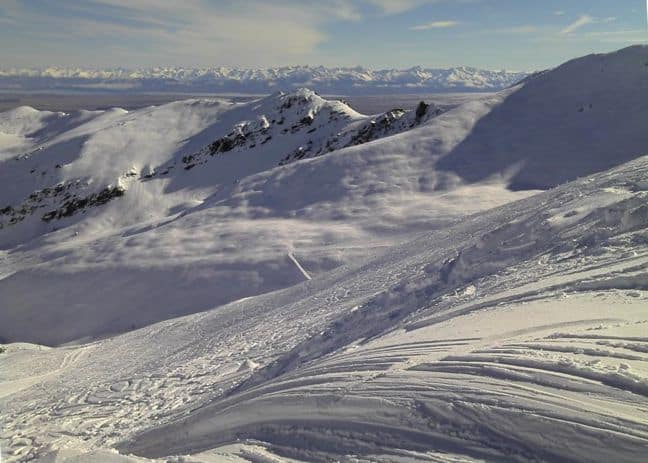
Mt Dobson is COVERED!! Image: Mt Dobson
Local Knowledge
It may not be the best snow season so far but there are still places out there doing well, Mt Dobson has by far the most snow, they keep getting hit much harder than everyone else.. well worth checking it out, i grew up skiing and boarding there, it has good terrain and a very laid back atmosphere. Coming up this week there will be the Burton High Fives Invitational, a chance to see the worlds best slopestyle and halfpipe riders battle it out up at Snowpark.
Anyways, enough from me, theres still powder to be had out there… Get out there and get some for yourself!
Let it snow!
The Remarkables forecasts,
snow reports and
live snow cams.
Treble Cone forecasts,
snow reports and
live snow cams.
Snow Park forecasts,
snow reports and
live snow cams.
Cardrona forecasts,
snow reports and
live snow cams.
Turoa forecasts,
snow reports and
live snow cams.
Coronet Peak forecasts,
snow reports and
live snow cams.
Whakapapa forecasts,
snow reports and
live snow cams.
Mount Hutt forecasts,
snow reports and
live snow cams.


