The Grasshopper’s 2026-2027 Japan Snow Season Outlook – November Update
Mountainwatch | The Grasshopper
Recent early snowfalls in Japan have reminded us that the season is right around the corner. With another month down in our seasonal outlook series, let’s unpack whether much has changed since our last deep dive as we hope for some of Japan’s finest snow over the coming season.
Current Conditions
With some recent falls – Niseko received 25-30cms earlier this week – you would be forgiven for thinking winter is already here. It’s always a nice sign to see some early snowfalls so is there anymore on the way? After some flurries and low accumulations for Hokkaido and northern Honshu this weekend a stronger system is on the way next week.
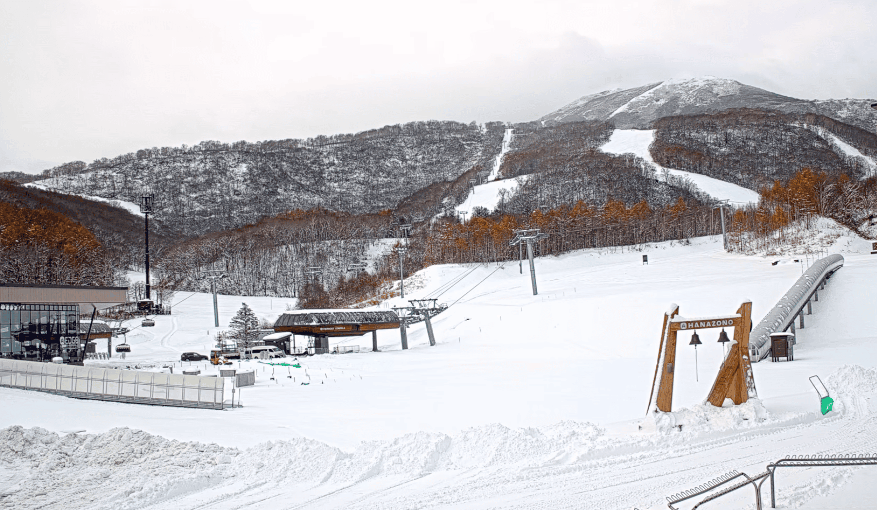
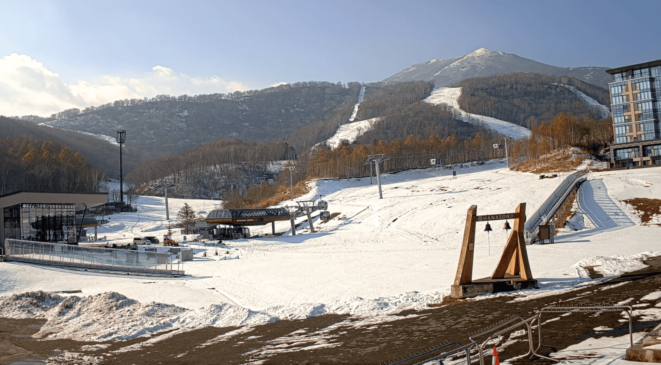
Precipitation will initially fall as rain in many areas from Wednesday, Nov 18th, but it should turn to snow with potential for some heavy snowfalls into the weekend. Hokkaido will see less rain and has a better chance of snow, but the system looks like it will bring more precipitation to areas on Honshu.
However marginal temps will lead to fluctuating snow levels, the best-case scenario seeing accumulations in the 50-80cm range at higher elevations, dependent on the amount of rain at the beginning of the system before temps drop. It is still a little way out, so be prepared for that number to change, but at this stage as it will be highly dependent on the temperature.
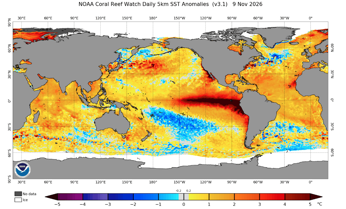
While we are on the topic of current conditions let’s quickly look at the state of the oceans. The current Super El Nino event is still present in the Pacific, dominating the scene with anomalies reaching the top end of the scale, accompanied by warmer waters in the northwestern Pacific around Japan.
El Niño Update
Straight to the elephant in the room: has there been any major change in the (Super/Godzilla/insert any word synonymous with large) El Niño since last month? The short answer is not really, but let’s unpack it further.
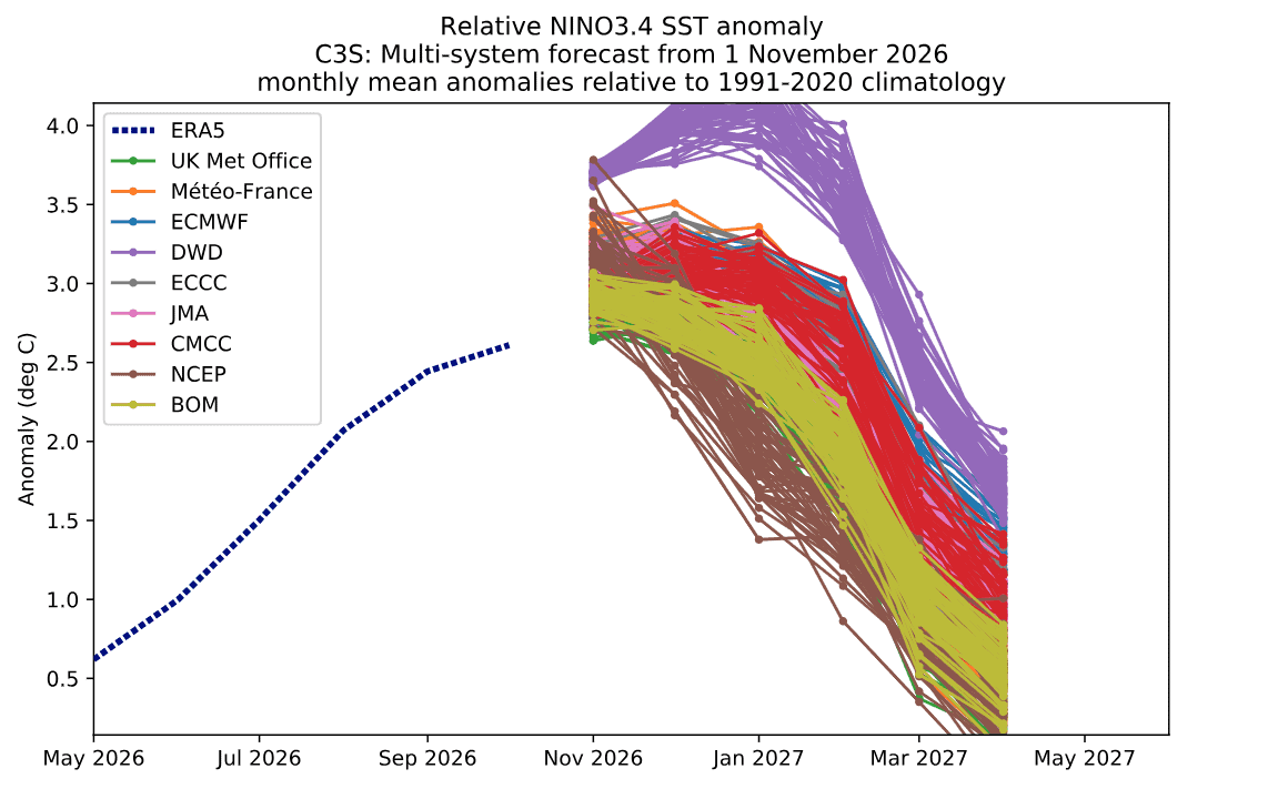
To put a number on it, NOAA is forecasting an 83% or greater chance of El Niño conditions continuing through January–March. Updating our previous outlook, we now have the forecast evolution from several of the major meteorological agencies. We can see that the peak is broadly expected to occur in December, but because of the unusually strong anomalies, El Niño conditions are expected to continue well beyond the peak. This explains the forecast for El Niño conditions to remain in place through to March.
So, just to confirm what we outlined in our previous update, El Niño conditions are highly likely to persist throughout the coming season, which comes as little surprise.
Seasonal Products
The big question for this season is what impact El Niño will have. Being such an unusually strong event, there are all sorts of wacky ideas being thrown around, but let’s focus on the most likely outcomes.
Briefly recapping our initial update, El Niño events generally don’t produce the greatest snow seasons in Japan. The usual mechanism behind this is El Niño’s impact on weakening the East Asian Winter Monsoon (EAWM), which is the primary driver of the big storms Japan experiences throughout the snow season.
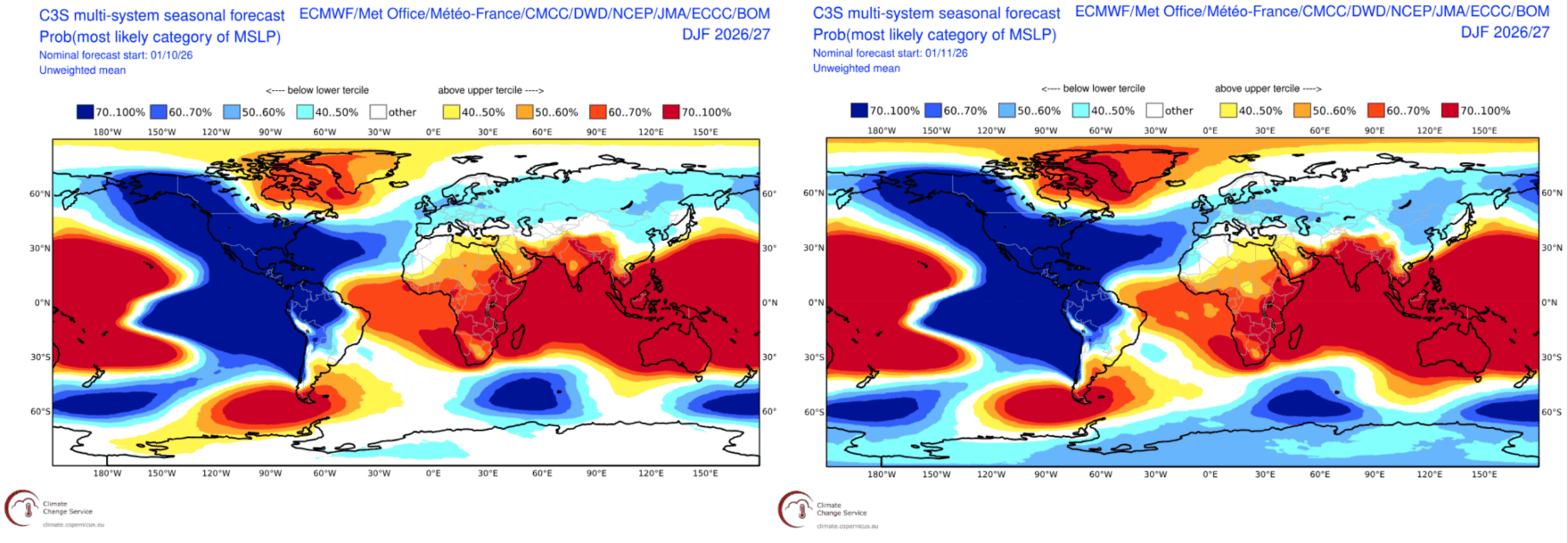
In our last update, we discussed the Siberian High’s role in this process. Simply put, the Siberian High is a region of higher pressure that helps drive the EAWM winds from the northwest across the Sea of Japan. El Niño years typically weaken the Siberian High, consequently dampening the EAWM. As we mentioned in our previous update, there were already signs of this developing.
Below are two mean sea-level pressure (MSLP) maps for the upcoming winter. The map on the left shows last month’s forecast run, while the one on the right shows the latest run. The differences are subtle, but we can see that the broad area of below-average pressure across northeastern China and Siberia is more pronounced in the latest forecast.
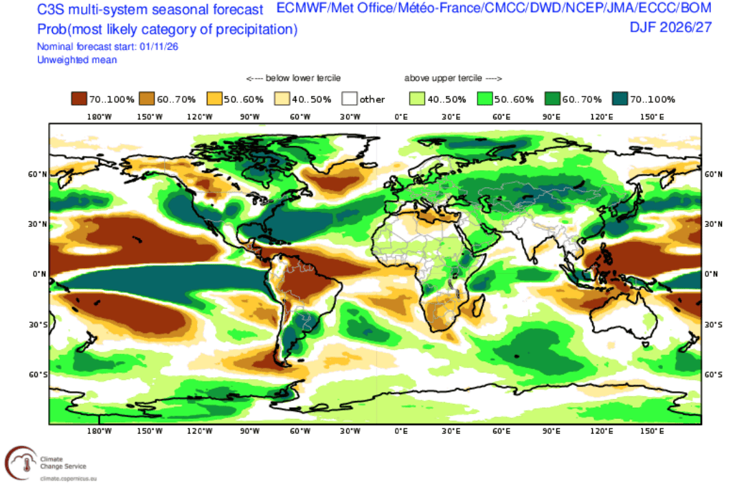
Next, looking at precipitation, our initial investigation last month pointed towards average to above-average precipitation over winter. This might initially sound like a good thing, until you factor in the higher-than-normal temperatures. That combination lends itself to every skier and snowboarders least favourite weather type: rain.
During milder spells, lower-elevation resorts in Japan can be particularly susceptible to rain, especially in Honshu, which is generally a little warmer than Hokkaido and the more northerly regions.
We also touched on this in our last update, but El Niño increases the likelihood of storms developing on the eastern, Pacific-facing side of Japan due to its influence on traditional pressure patterns and global circulation. Due to the southeast airflow, these storms are generally warmer and wetter.
Conclusion
Overall, there have been no major deviations from our initial investigations last month. As we move into the season, it remains to be seen how much of an impact the forecast higher-than-normal temperatures will have on resorts’ ability to build an early snow base and, importantly, hold onto it into spring.
There will undoubtedly still be some of the deep storms that Japan is synonymous with, but we might just have to wait a little longer than usual between drinks. Areas further north, along with higher-elevation resorts, will be better placed to mitigate warmer temperatures and potential rain events.
Stay tuned for next month’s update, with further forecasts from the JMA expected at the start of winter.