Weekly Japan Forecast, Thursday January 29th – Several More Days of Deep Powder for Honshu
Mountainwatch | The Grasshopper
Written late Wednesday, 28th January (Japan Standard Time)
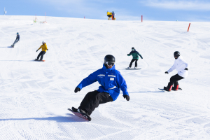
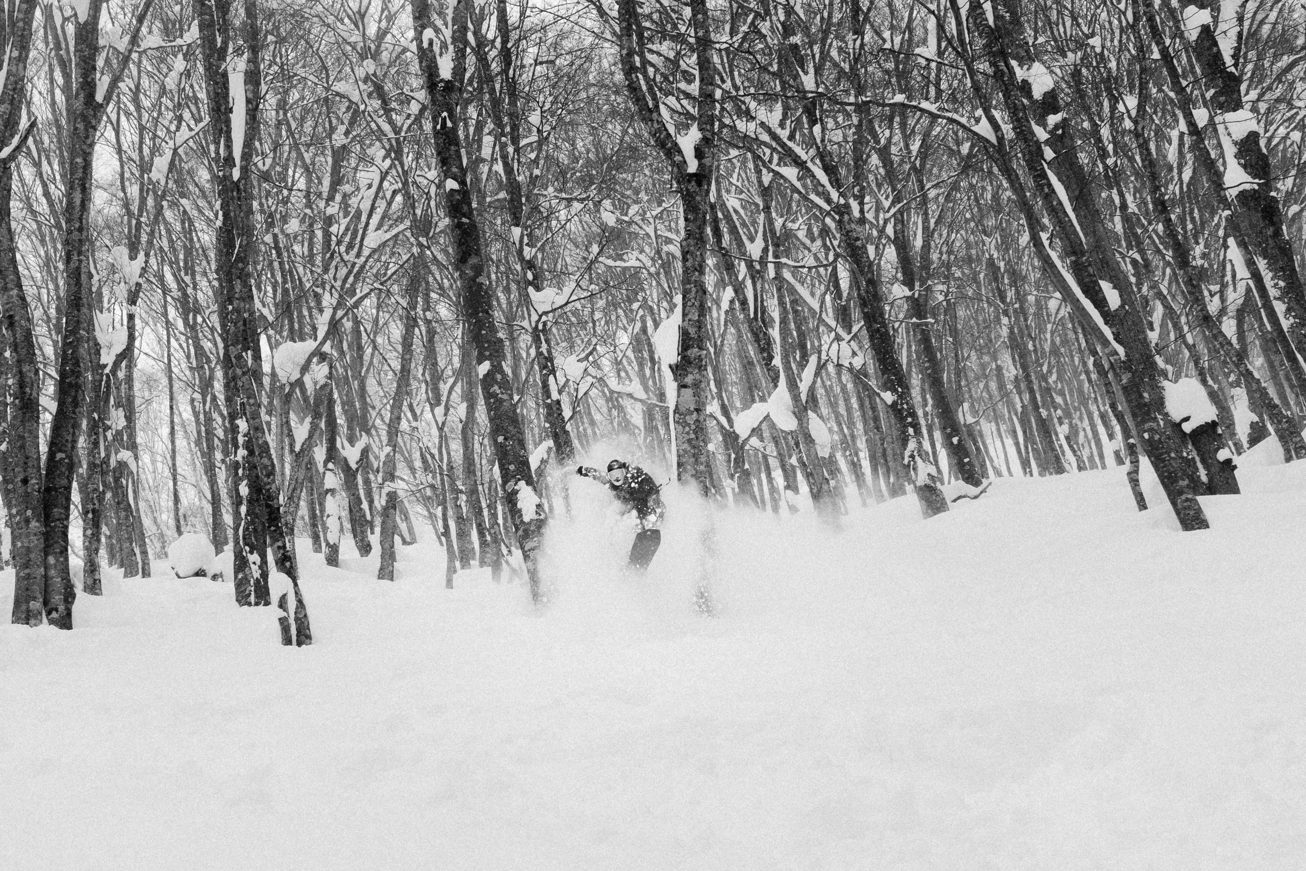
It was a deep, deep weekend for resorts in central Honshu, where up to 1-1.5 metres fell over the two-day period. That’s about belly to neck deep of cold, high-quality fluff! The storm cycle took a break on Monday and Tuesday, but returned Tuesday night, with another 10-30cm reported by Wednesday Morning, and will continue for the next several days. There’ll be a heap more powder added to the tally before the next break starts on Tuesday, this time lasting for a few days.
Just like the previous week, snowfall has been steadier in the north with around 15 to 40 cm reported at Niseko consecutively over the last seven days. Things will be quieter on Hokkaido during Thursday and much of Friday, but that steady snowfall will return this weekend onwards.
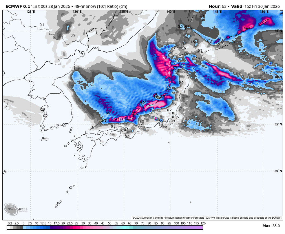
Thursday January 29th & Friday January 30th
The storm that kicked off Tuesday night will continue across Honshu through Thursday and Friday, with most resorts picking up another 15-40cm over 48 hours, although favoured spots in central and southern Niigata could receive up to 80+ cm. Freezing winds off the continent will bring consistent, high-quality snowfall to sea level, with heavy falls at times.
Hokkaido will be much quieter, with snowfall on the northern edge of the storm clipping southern parts of the island. A fresh surge of northwest winds will also see light-to-moderate snowfall sink down over the northern two-thirds of the island on Friday. All up, resorts should pick up between 5 and 15cm.
Saturday January 31st January & Sunday February 1st
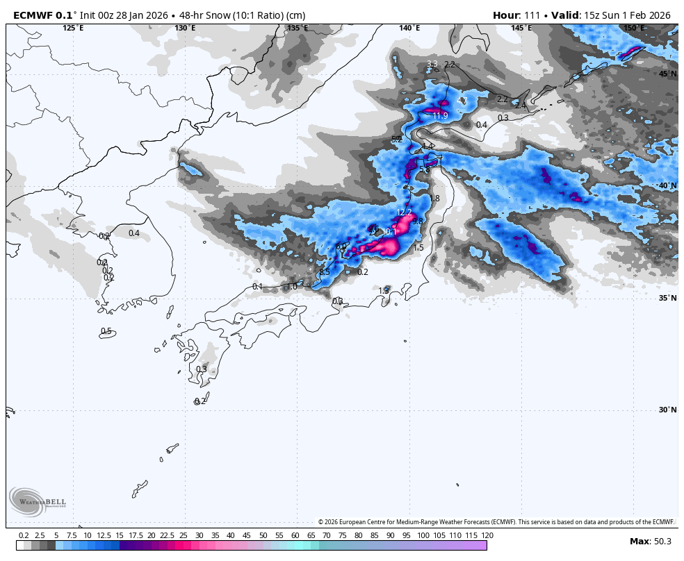
Freezing west-to-northwest winds will keep the powder tap open over northern Honshu and Hokkaido throughout the weekend, with snowfall rates mostly in the light to moderate range. Most resorts should score around 10-30cm.
A wobble in the isobars will turn winds to the southwest over central Honshu on Saturday, causing snowfall to ease and even partly clear for a time, especially in Nagano and southern Niigata. However, the winds and snow may surge back in later on Sunday. Weekend accumulations will peak in the central Niigata area at around 40-80cm, with 10-30cm elsewhere.
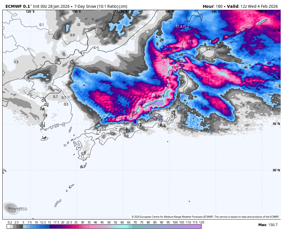
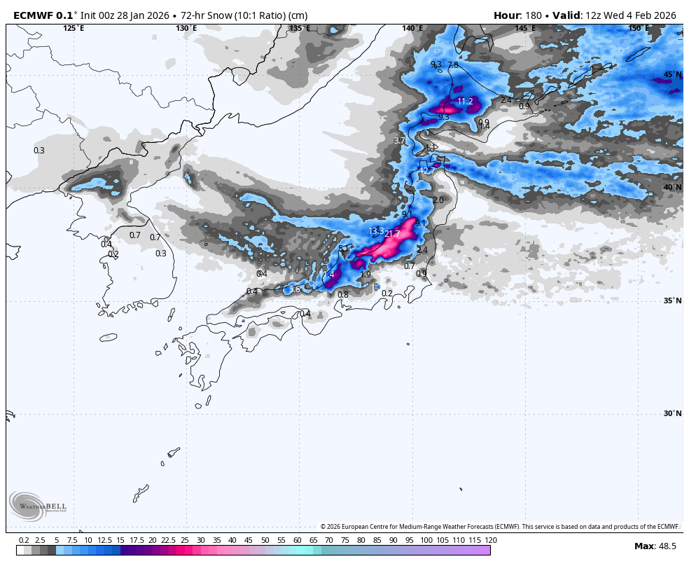
Monday February 2nd to Wednesday February 4th
Powder will continue to pile up over Honshu on Monday, with central regions once again favoured for the heaviest falls. Things will then ease up for Tuesday and Wednesday as a weak ridge of high pressure passes over, bringing a milder southwesterly flow. Snow clears central parts on Tuesday while becoming few and far between in the north.
On Hokkaido, mostly light snowfall will persist over these three days, with heavier falls likely Tuesday night as a fresh surge of icy winds arrive. A solid 20-40+ cm should quietly build up in many areas of the western half of the island.
That’s all from me today, folks. Have a great week, and I’ll see you here next Thursday for another weekly rundown of Japan’s highlights and snowlights.
Grasshopper