World Snow Wrap, February 2nd ,2024 – Dry Spell About to Break in North America, Off and On in Japan, Spring-like in Europe
Mountainwatch | Reggae Elliss
Not a lot of action over the past two weeks with just a couple of storms in Japan, a dry spell in the US and Europe and a mix of rain and mild weather in Canada.
Japan
The on-again, off-again season continues in Japan with a few good storms over the past two weeks although there has been some mild weather and rain at times in between. Unlike most seasons in Japan, there hasn’t been a long run of consistently cold and snowy weather and the base at resorts in both Hokkaido and Honshu are below average for the start of Feb. However, there is still a deep enough base for most off-piste areas and when the storms have come through there has been some nice powder turns on offer.
Last week is a good example when a two-day storm hit Central Honshu resorts last Wednesday/Thursday dropping 55cms at Hakuba, 63cms at Myoko and 61cms at Nozawa Onsen. That storm was followed by a couple of mild and sunny days, rain on Wednesday ahead of snow in the past 24 hours. Myoko picked up 20cm, Nozawa 15cms but there was just a 5cms dusting in Hakuba – I arrived here in Tuesday – where the base had frozen making for classic “dust on crust’ conditions. A classic case of you should have been here last week!
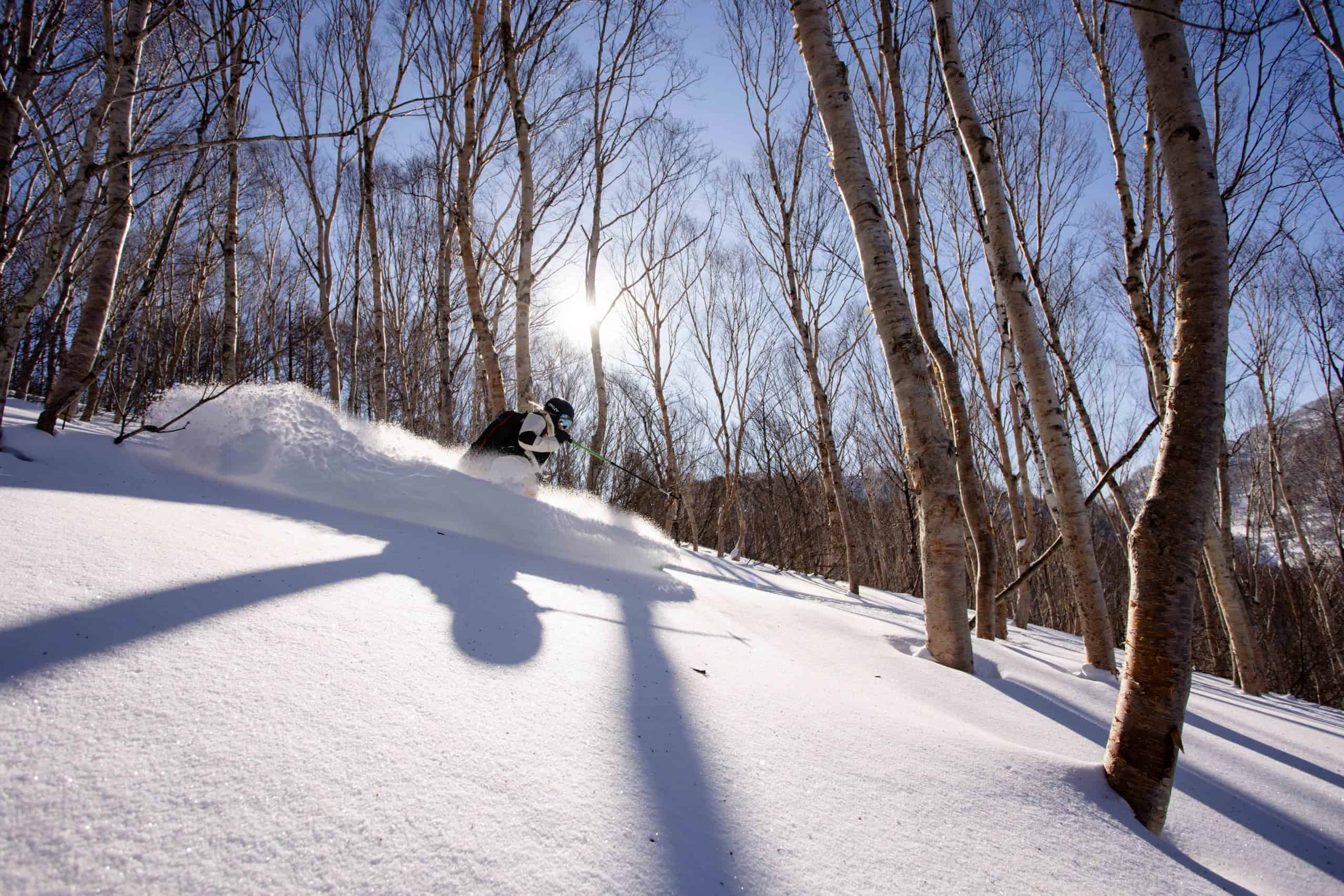
In Hokkaido, Niseko and Rusutsu received 27cms last weekend and after a couple of mild days early in the week, another small storm moved in on Wednesday night, with another 27cms falling over the past 48 hours. Furano also enjoyed a few good powder days last week, thanks to 42cms on Jan 23rd folowed by anther 38cms over the following three days. Light snow falls will continue in Hokkaido this weekend with 10-15cms by Sunday night before the snow clears with just a few lingering snow showers next week.
Another storm is due for Honshu on Monday, but in this week’s forecast the Grasshopper said temps will not be super cold so we may see rain/sleet at times at the base in resorts in Central Honshu. However upper elevations should see some good totals of heavier snow with 40-50cms forecast for Hakuba, Myoko and Nozawa.
USA
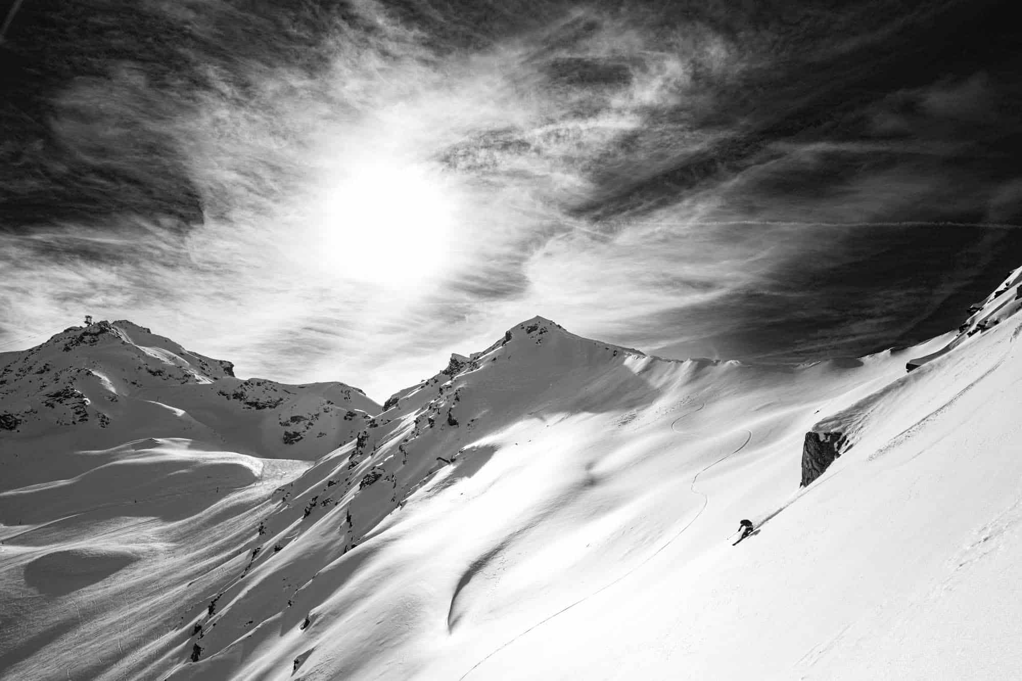
After a slow couple of weeks in the western US, things are ramping up with the first of two solid storms hammering the Sierras for the past 12 hours while in the Rockies the snow kicks into gear tonight.
The monthly snow totals in the Sierras were close to average for January average, 246cms for Palisade Tahoe and 190cms for mammoth Mountain. In the Rockies the past two weeks have been mainly dry and despite the dry end to January, snowfall totals for the month still look pretty good, Jackson Hole with 208cms, Steamboat 245cms while further south Aspen received 107cms.
The Pacific North west has seen a fair amount of precipitation over the past week, but mild temps and freezing levels above 2000m saw heavy rain at al elevations and damage to the snow pack. Unfortunately, the two storms due this week are too far south and while temps will be much colder, resorts like Mt baker and Crystal may see just a few centimetres.
However, in the Sierras and Rockies, the expected snow totals are impressive, the Grasshopper writing in his weekly north American forecast today that in the Sierras “the Snowfall accumulations will be huge, it’s hard to put numbers to it, but current models have them ranging from 75-150cm around the Tahoe region, to upwards of 150-250cm further south of there,” – i.e. Mammoth.
While totals in the Rockies won’t be at that scale, they will still be very healthy, Aspen, Jackson Hole 50-60cms while in Utah resorts could see around 100cms in the next 7 days.
Canada
It’s fair to say it has been a disappointing season in Canada, with below average snowfalls, fluctuating temps and rain at base elevations. In the Coast Mountains, the resorts outside Vancouver are struggling while Whistler Blackcomb suffered another bout of rain to the top last weekend. The mild temps over the past week extended inland, Kicking Horse climbing to +5 degrees earlier in the week, the melt/freeze cycle leading to an unstable snow pack and some wet slides, and the resort was closed for avalanche mitigation on Tuesday. The past two days have been rock solid after a big freeze. In Revelstoke high freezing levels lead to rain mid-mountain to the base and it was a similar story in Fernie.
A storm has crossed into BC in the past 24 hours with snow at upper elevations in Whistler Blackcomb and the snow line is expected to remain at mid-mountain into weekend with 15-20cm likely over the next two days. The temps will be colder and freezing levels lower for Interior BC resorts and snow is forecast through to Monday/Tuesday, Big White and Fernie in line for 20cms, Kicking Horse 16cms and Revelstoke 26cms.
In Alberta it has been dry and unseasonable warm over the past few weeks with just a dusting snow for Lake Louise and the Banff resorts. That made for some pleasant days on the hill for some cruisey on-piste turns but a good snowfall is long overdue. While there is no major storm in the forecast the weather pattern will change this weekend with snow on the way with a potential 15-25cmsnor Castle Mountain and Nakiska while Lake Louise should see 12cms over the weekend.
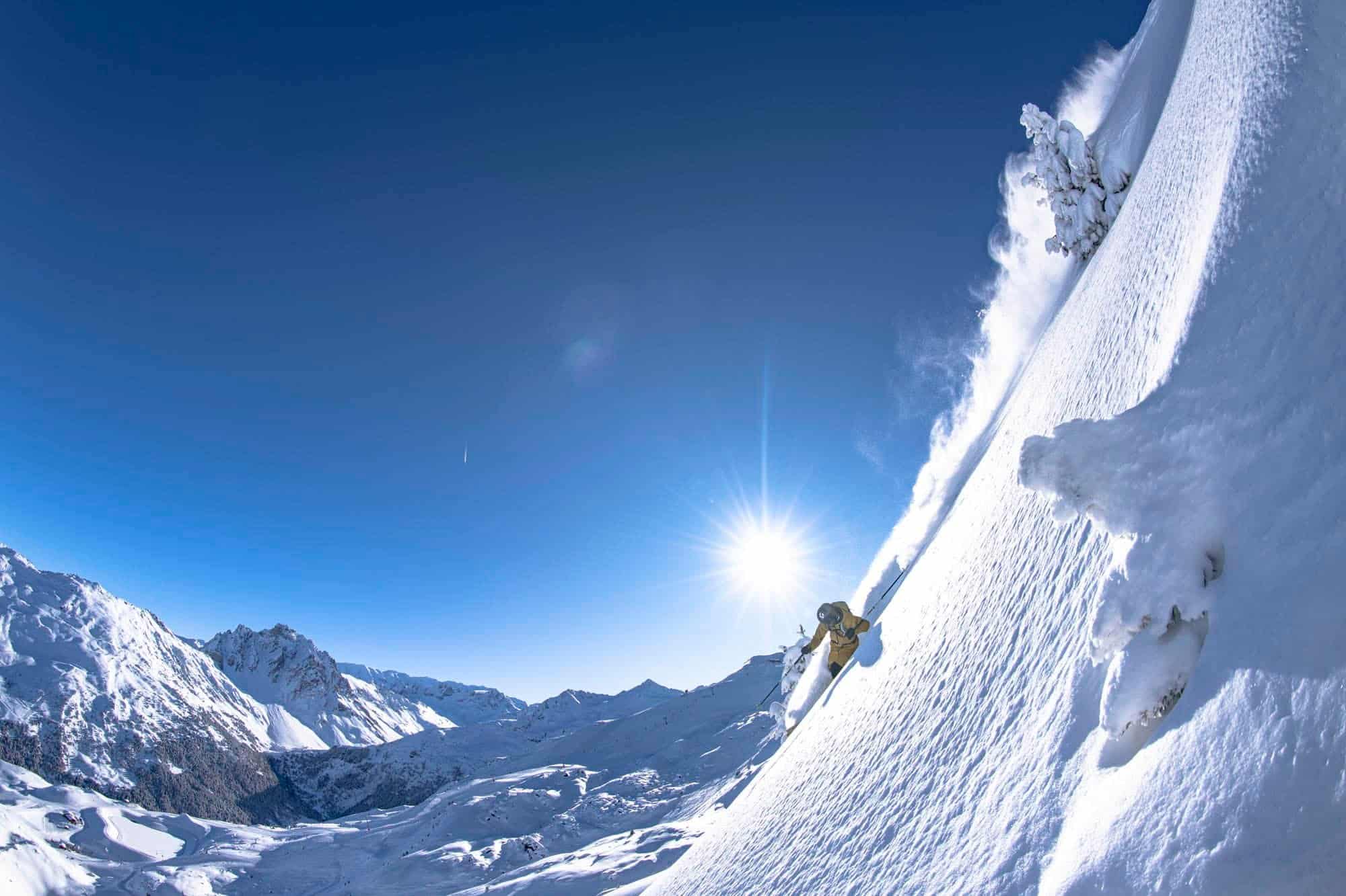
Europe
After some snow two weeks ago, the past 10 days have been mostly dry across the Alps, although a quick front dropped 5cms across the Austria’ Arlberg yesterday. Other than that, is has been like spring with temps at lower resorts climbing into double digits and a melt-freeze cycle in place at higher resorts.
Fortunately, the big snow falls in December set up a good base and the major resorts in France, Switzerland and Austria are all in good shape. Australian photographer Tony Harrington has been in Les Trois Vallees in France, and said the past few days have been about waiting for the snow to soften and enjoying some nice corn snow in the afternoon.
It has been dry in the Pyrenees and while the on-piste cover is pretty good, it is well below-average and very bony off piste which lead to the FWT cancelling this week’s comp scheduled for Ordino Acarlis this weekend.
The fine weather is set to continue over the next few days with daytime temps above zero ahead of a change next weekend that should deliver some snow.
Where We’d Like to Be This Week
Mammoth Mountain. With 150cms and cold temps on the way, a good base already and some of the best terrain in North America, Mammoth is going to be the place to be.


