World Snow Wrap Up Vol. 10, 3 January – Bluebird at Last
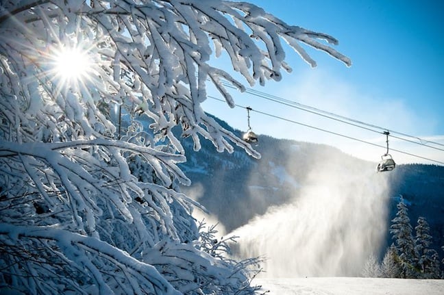
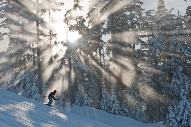
Whistler 30 December. Image:: Logan Swayze, Coastphoto.com
Stormwatch:
The snowfall heros
Finally some sunshine! Most of North America and Europe bathed in some New Years bluebird on the weekend so the snowfalls are not as impressive has they have been. Still, that’s going by this season’s standards, really, conditions are incredible.
- Heavenly – with 88cm for New Years
- Vail – a nice 50cm thanks very much
- Shiga Kogen – 90cm over the weekend for the Main Island Japanese resort makes it Ja-powed up right now
The snow forecast heros:
Again, sunshine is the order of the week with Colorado looking at daily blue skies and Europe expecting bluebird until Friday.
- 65cm for Whistler, after a rather dry 19cm last week…
- Niseko is going to be snowed under with 105cm
- Switzerland, with 30cm-ish
Last week’s highlights:
White Christmases of course!
Highlights this week:
- * 2 – 8 January 2011 O’NEILL EVOLUTION, Davos, Switzerland. slopestyle and halfpipe. TTR World Tour 6Star
- * 4 – 6 January 2011 ALPINE SKIING WORLD CUP, Zagreb, Croatia. Men’s and women’s slalom
- * 6 – 9 January 2011 ALPINE SKIING WORLD CUP, Alternmarkt-Zauchensee, Austria. Women’s downhill and super G
- * 7 January 2011 FREESTYLE WORLD CUP – skier X. St Johann (Tirol), Austria
- * 8 – 9 January 2011 ALPINE SKIING WORLD CUP, Adelboden, Switzerland. Men’s slalom and GS
- * 8 – 15 January 2011 BURTON EUROPEAN OPEN, Laax, Switerland. TTR World Tour 6Star
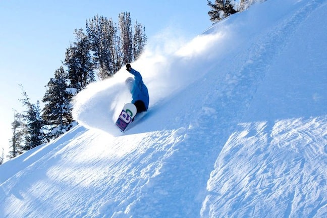
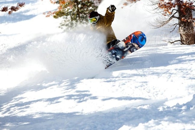
Jared Dawoud in Mammoth 30 December. Image:: Mammoth
If we could pick anywhere this week, we’d be: Davos for the O’Neill Evolution and the 30cm of fresh that’s on the way…
Colorado
OPEN
Recent Snowfalls: 20.32cm at Aspen Mountain in the last 7 days and 35.56cm at Aspen Highlands
7 Day forecast: about 2cm forecast in the next 7 days for Aspen Mountain – plenty of sunshine though!
Current snow depth: 93.96cm at Aspen Mountain, 139.70cm at Snowmass
Current conditions: packed powder
Is that the sun we see creeping out from behind those clouds? Well don’t waste the opportunity, get to the top of Highlands Bowl asap, finally you’ll be able to see the pow.
OPEN
Recent Snowfalls: 25.4cm in the past 7 days
7 Day forecast: about 1cm for the coming week
Current snow depth: 139.7cm
Current Conditions: packed powder
Blue skies for Breck at last – so conditions are pretty much perfect for trying out the 22ft Dew Tour superpipe, now open to the masses… go on, you know you want to…
OPEN
Recent Snowfalls: 2.5cm in the last 48 hours
7 Day forecast: about 1cm forecast in the next 7 days
Current snow depth: 147.37cm at mid mountain
Current conditions: packed powder
Hello sunshine, hello seriously sweet bowls, hello 2011 at Steamboat – get amongst it.
OPEN
Recent Snowfalls: 50.8cm in the last 7 days
7 Day forecast: about 1cm and plenty of sun
Current snow depth: 111.75cm
Current conditions: packed powder and powder
Vail has cracked the 1m snow base again, that 50cm last week was a nice way to bring in the new year and the sunshine this week will be a nice way to enjoy it.
And Colorado generally…
Snow last week, sun this week… could we script it better? Wolf Creek and Crested Butte had a lovely snow-filled weekend, as did the San Juans – Silverton would be epic right now. This coming week though is all about bluebird, the clouds should clear tomorrow for a few days of sparkling sunshine. Happy New Year indeed.
Park City looking pretty. Image:: Park City
Utah
OPEN
Recent Snowfalls: 2.5 in the past 3 days
7 Day forecast: no snow
Current snow depth: 213.36cm
Current conditions: powder and packed powder
BLUEBIRD. Six little sun icons all in a row is telling us there will be plenty of clear skies at PC this week. The sunshine will be deceptive though, right now it’s about minus 20 degrees Celcius and it’s not going to get much warmer. Can anyone say frostbite?
OPEN
Recent Snowfalls: nothing
7 Day forecast: no snow this week
Current snow depth: 261cm at mid mountain
Current conditions: packed powder
Bluebird at Snowbird, with some pretty chilly temperatures to keep all that snow lovely and dry. Forget the new years bubbly, the only champagne we want right now is the white fluffy kind you’ll find at Snowbird.
And Utah generally…
Powder Mountain received a very handy 73cm of fresh over the weekend but in general Utah is basking in some sunshine, not of the warming kind however with temperatures down below minus 10 degrees celcius for most of the state for most of the week.
Snowbird face shots December 30. Image:: Snowbird
California
OPEN
Recent Snowfalls: 88.9cm in the last week
7 Day forecast: 12cm forecast for the week
Current snow depth: 198cm
Current conditions: powder, packed powder, man made and machine groomed
A not too shabby 90cm or there abouts last week, thanks Mother Nature. Next week is more about sunshine though with clear skies in the middle of the week.
OPEN
Recent Snowfalls: 50cm on the weekend
7 Day forecast: 20cm forecast
Current snow depth: 548cm at the summit
Current conditions: fresh powder, packed powder and machine groomed
Mammoth welcomed in the new year with a new 50cm of snow and unlike the rest of the west coast there’s not much sunshine on the forecast. There’s really not much left to say about Mammoth except go there, now.
And California/Tahoe generally…
Anywhere from 20cm to 50cm at the California resorts this past week, making it the state with the best snowfalls for the last week of 2010. It looks set to be the state with the most snow next week as well with some moderate snowfalls across Tahoe and a decent topping at Mammoth (again).
Eric Jackson in Mammoth 30 December. Image:: Mammoth
And the rest of the USA…
The snow spread itself all across the USA last week with everywhere from Wisconsin to Arizona getting a fresh topping. Alaska saw some nice snowfalls, Alyska is reporting about 50cm over the weekend, which will get the heli skiing going nicely. All in all the coming week will be less snow filled, with some blue skies around about.
Japan
OPEN
Recent Snowfalls: about 10cm since the new year
7 Day forecast: 105cm
Current snow depth: 125cm at the Niseko Village summit
Current conditions: japan powder!
Niskeo is topping the forecast snowfall list for the coming week, a couple of avalanches have been reported so everyone should be on the best behaviour when sampling the nice New Years fresh.
OPEN
Recent Snowfalls: 25cm over the weekend
7 Day forecast: about 28cm for the week
Current snow depth: 185cm at the summit
Current conditions: early season powder
Thanks to stable temperatures and steady snowfall, the snowpack at Hakuba is nice and stable right now, with a lovely topping of fresh pow. More snow should come in the week.
And Japan generally…
It was a good start to the New Year on the Main Island, Monday is being called the best day of the year at Nozawa and Shiga Kogen received a tasty 90cm on Sunday. It’s pretty chilly on the Main Island, which is making for dry dry pow.
British Columbia
OPEN
Recent Snowfalls: 27cm this week
7 Day forecast: about 16cm in the next 7 days
Current snow depth: 131cm
Current conditions: packed powder and machine groomed
Grey skies and serious cold is what Mother Nature is sending Big White for the New Year, which will make for some pretty danm good skiing in the back bowls.
OPEN
Recent Snowfalls: 21cm in the last 7 days
7 Day forecast: 21cm for the week
Current snow depth: 131cm
Current conditions: powder and packed powder
Fernie how we love your steeps, your deeps and your bowls filled with powder. So we’re very glad you’ll be getting a nice top up this week.
OPEN
Recent Snowfalls: 11cm last week
7 Day forecast: about 10cm for the week
Current snow depth: 140cm
Current conditions: fresh powder and machine groomed
Steady snowfalls coming through from last week into the week coming makes Silver Star a pretty snow town. We love riding Silver Star but come sundown we’re always going to be found at the ice skating rink and tube town…
OPEN
Recent Snowfalls: 11cm last week
7 Day forecast: about 5cm for the week
Current snow depth: 101cm
Current conditions: packed powder
Snow flurries all week – so we don’t mind the name Sun Peaks will be a little misleading, especially as there’s some beautiful dry pow about, thanks to some seriously cold temperatures. Don’t forget the extra thermal layer!
Mason Mashon Getting a Facial…or 6 from Callum Jelley on Vimeo.
OPEN
Recent Snowfalls: 19cm in the last week
7 Day forecast: 65cm coming up
Current snow depth: 213cm
Current conditions: Powder and packed powder
The snow blower took a week off last week, 19cm in seven days is a more than reasonable snow total. But things will gear up again in Whistler this coming week with moderate snowfalls beginning Thursday.
And BC Generally…
It was a blue sky week for BC, even Whistler had some sunshine. There were a few flurries around on the last days of December, to the tune of about 10cm at Revelstoke, but nothing more than a nice dusting. The coming week will see some steady snowfalls however.
Sunshine for Whistler, unusual! Image:: Logan Swayze, Coastphoto.com
Alberta
OPEN
Recent Snowfalls: 16cm in the last 7 days
7 Day forecast: about 11cm for the coming week
Current snow depth: 85cm
Lake Louise is still under the radar, with consistent low level snowfalls keeping the resort kicking along nicely without the flashy snow totals of some of its neighbours (ehum… Whistler…). Next week will me much the same, with some really cold – we’re talking -20 degrees Celsius – days to keep that snow dry as dry.
Going Global
France
Recent snowfalls:There’s nothing exciting to say about new snowfalls in France this past week, it was sunshine all round.
Forecast snow: Morzine should have a nice 25cm later in the week, Val d’Isere 28cm and Courchevel 23cm.
Snow conditions: Packed powder
Top pick: Courchevel, in order to enjoy the sunshine with a little bit of luxury
Switzerland
Recent snowfalls: Again, no snow last week in the Swiss Alps
Forecast snowfalls: Verbier is expecting about 27cm, beginning Thursday, about 30cm for Zermatt and 31cm for Saas-Fee
Snow conditions: packed powder
Top pick: Saas-Fee, a 215cm base and a nice 31cm of fresh coming for the weekend
Austria
Recent snowfalls: Unlike its western neighbours, Austria was snow blessed last week. Schladming had 20cm and Seefeld 25cm, though the Alberg stayed resolutely clear of snow clouds.
Forecast snowfalls: A light dusting of about 11cm in the Alberg at the end of the week and a few centimetres for Kitzbuhel on the weekend but nothing much to write home about in Austria this coming week
Snow conditions: powder and packed powder
Top pick: Kitzbuhel, it’s just so much fun!
Italy
Recent snowfalls: Again, nothing to report snow-wise for Italy this week
Forecast snowfalls:A nice 18cm for Livingo beginning Thursday and the clouds will move east to the Dolomites with snowfalls of about 21cm beginning in Cortina on Saturday
Snow conditions: packed powder
Top pick: Bormio, plenty of nightlife and a heathly 210cm snowbase
Hakuba forecasts,
snow reports and
live snow cams.
Lake Louise forecasts,
snow reports and
live snow cams.
Heavenly forecasts,
snow reports and
live snow cams.
Big White forecasts,
snow reports and
live snow cams.
Whistler forecasts,
snow reports and
live snow cams.
Vail forecasts,
snow reports and
live snow cams.
Steamboat forecasts,
snow reports and
live snow cams.
Fernie forecasts,
snow reports and
live snow cams.
Snowbird forecasts,
snow reports and
live snow cams.
Niseko forecasts,
snow reports and
live snow cams.
Aspen Mountain forecasts,
snow reports and
live snow cams.
Sun Peaks forecasts,
snow reports and
live snow cams.
Park City forecasts,
snow reports and
live snow cams.
Breckenridge forecasts,
snow reports and
live snow cams.
Silver Star forecasts,
snow reports and
live snow cams.
Mammoth forecasts,
snow reports and
live snow cams.


