2019-2020 North American Snow Season Outlook – February Update
Mountainwatch | The Grasshopper
The Status Quo Continues, But Spring May Breathe Life Into the Sierras
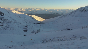
The powder parade has continued in the Pacific Northwest and Rockies this past month, and there are no signs of it stopping this spring. While the Sierras have missed out on all the fanfare, recording close to zilch this month, there are some signs that some of that powder may find its way further south.
Checking in with the latest SNOTEL chart and reports from various resorts, we quickly see who the greatest movers and shakers have been this past month. The Coast Mountains of Canada have had to bear the brunt of storms rolling out of the Gulf of Alaska, so it’s not surprising that Whistler Blackcomb has already received close to 160% more snow than they usually get during February. And there’s still a more to come.
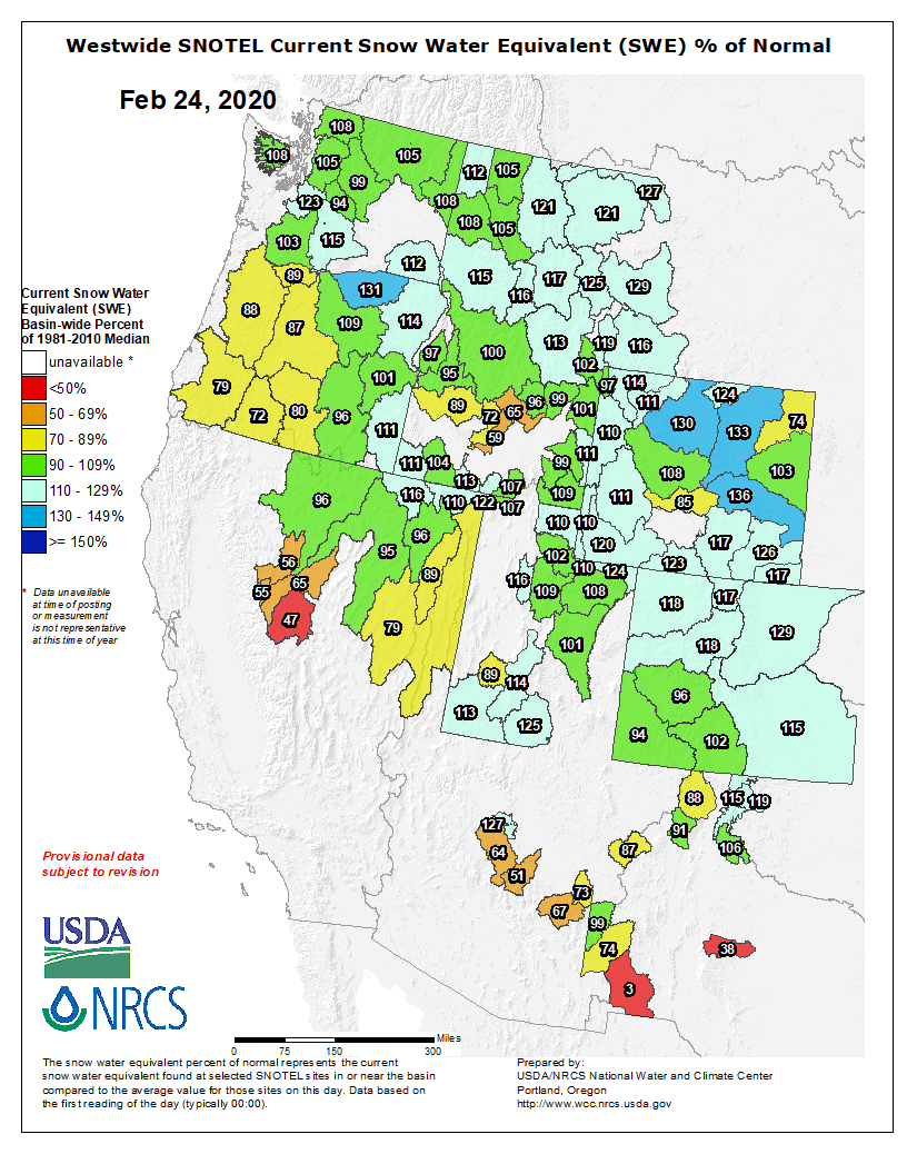
The northern Cascades and most resorts throughout the expansive Rockies have also been on the receiving end, and snowfalls are generally sitting a little higher above average than when we last checked in. Reggae’s latest World Snow Wraphighlights just how good the powder has been.
And then there are the Sierras… the poor ol’ Sierras… talk about contrast! Apart from copious amounts of solar radiation, the only thing to fall from the sky was a measly 5-10cm of snow in the north at the start of the month. Compare that to 5-8 metres last February! Snowpacks are about half full compared to average, which isn’t too bad considering.
Spring may breathe new life into the Sierras
Spring will arrive in the Sierras in the form of cold air from the north and 10-20cm of fresh powder. Most of it will fall late Saturday into early Sunday, followed by another dusting on Tuesday.
But that’s not all. Some ensemble models, which attempt to forecast out a month or more, suggest that the anomalous low pressure that we’ve seen over the Pacific Northwest and Rockies should continue through much of March, and is likely to extend down over the Sierras too.
It’s akin to a negative phase of the Pacific-North American pattern (PNA) that I’ve talked about previously, which tends to bring snow to western North America. The PNA has been hovering around neutral values this past month, but is in fact tipped to dive into negative values just in time for spring.
As always, I attach the caveat to these long-range ensemble models that they’re a bit of a stab in the dark. Additionally, running counter to the Sierras springing to life is that the strongly positive Arctic Oscillation is expected to continue at least through March. A positive Arctic Oscillation usually benefits resorts in Canada and the northern states, while leaving the Sierras and central-southern Rockies warm and dry.
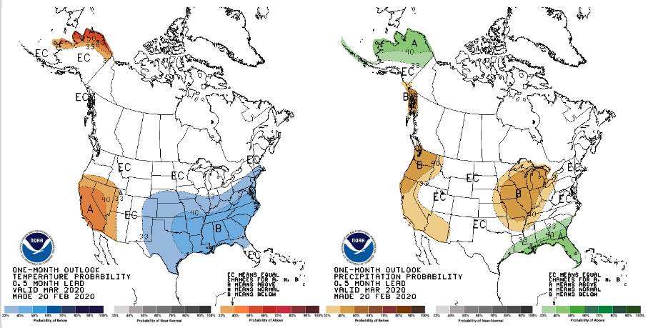
NOAA’s outlook for March casts even more doubt that the Sierras will spring to life, with warm & dry conditions expected to continue. Source: NOAA
Climate models continue the status quo
Overall, the past month has seen little change in the climate since the previous outlook, and climate models looking at the next three months of spring expect that to continue. This comes as good news to resorts in the Pacific Northwest and Rockies who have had a good run.
As we head further into spring, the winter regime gradually breaks down; storms rolling off the North Pacific become less frequent as pressure rises, leaving snowfall to quietly taper off.
Set atop of this backdrop we can still expect above average snowfall in the Coastal Mountains of Canada and over the Rockies as far south as Wyoming. Utah and Colorado should also maintain excellent conditions with average or above spring snowfall.
The northern Cascades are sitting on the fence and could go either way, while the Sierras along with the southern Cascades and New Mexico are likely to be average or below. I stress the “average” because it’s a real possibility for the Sierras, and I expect March at least to be much better than the last couple of months.
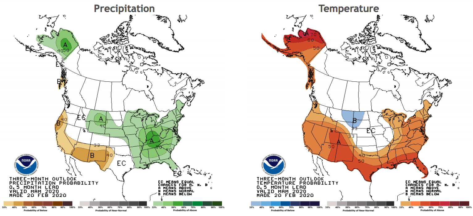
NOAA’s outlook for spring is almost identical to their previous outlooks, suggesting a continuation of the status quo. Source: NOAA
That’s all from me folks. This is the last outlook for the North America this season, but keep checking in with the weekly forecasts every Thursday as they’ll continue till mid March. If you’ve got a different theory on what’s going to happen this spring, or just want to provide feedback, then please hit me up on the discussion below. Or you can follow me on Facebook.