2020-2021 North American Snow Season Outlook – January Update
Abundance In The North As Models Stay The Course
Mountainwatch | The Grasshopper
We’re at the halfway mark in the North American snow season, and so far it’s been all about the north where Canadian resorts are yet again reveling in an abundance of snow. The Sierras and southern Rockies are starting to feel the pinch from unfavorable climate conditions, but the next couple of weeks will bring plenty of respite.
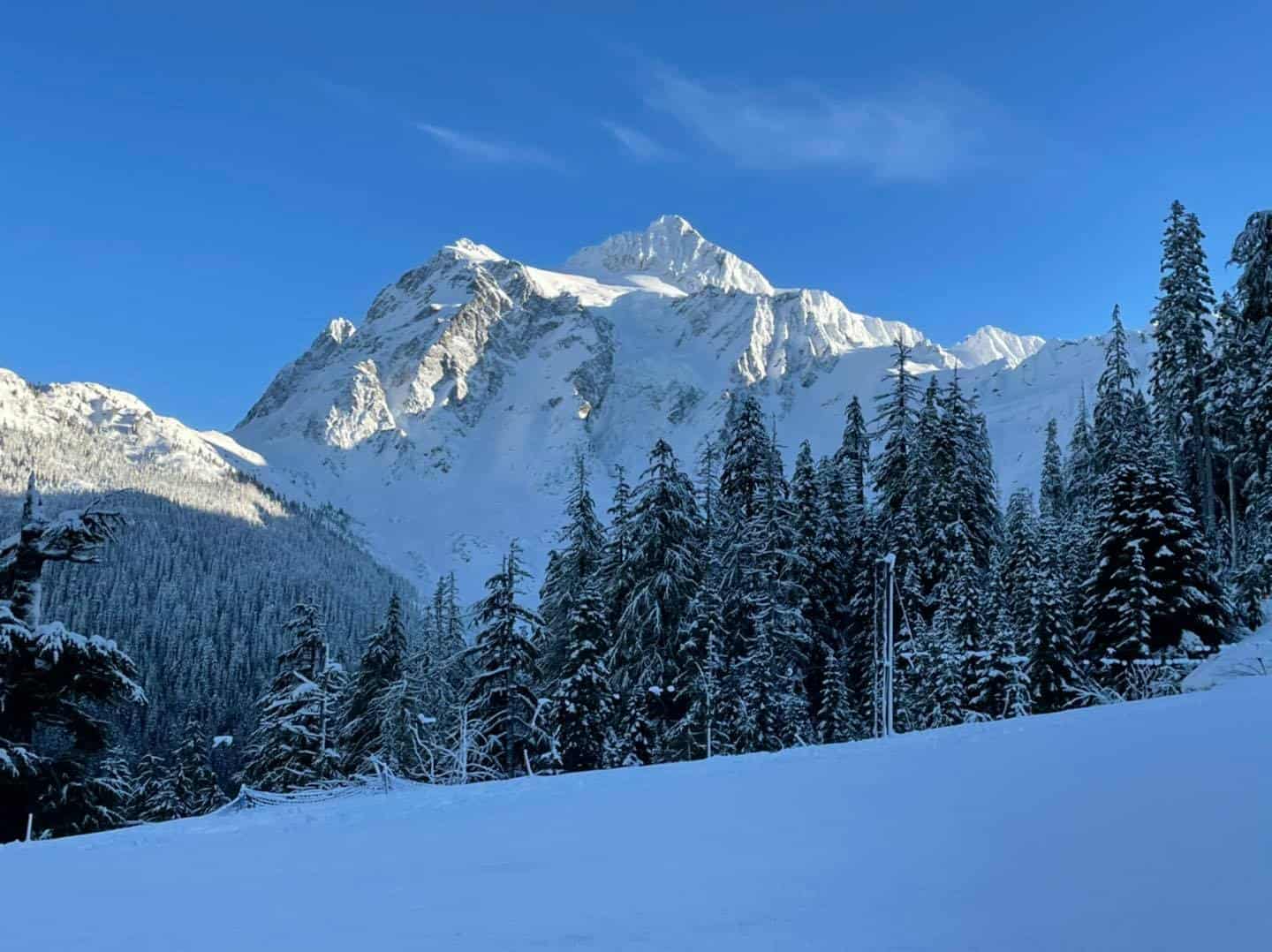
The past month has seen a barrage of intense storms across high latitudes of the North Pacific Ocean and North America, plastering resorts in Canada and the northern Cascades (Washington state) with a huge mass of snow. One particular storm reached a depth of 921hPa as it neared the Bering Sea on New Years Eve, making it the strongest non-tropical cyclone ever observed in the North Pacific and the strongest on record to ever hit Alaska.
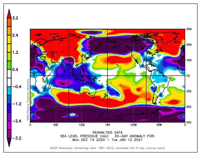
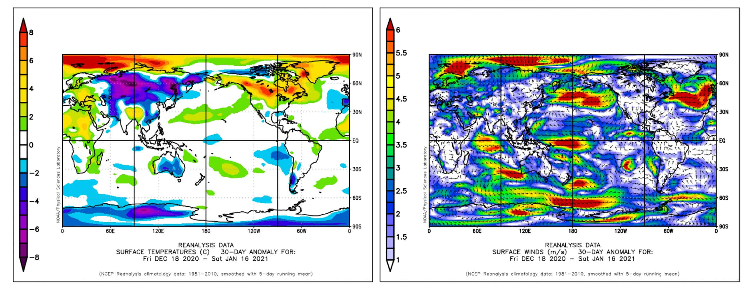
Sea-level pressure anomalies from the last 30 days show the high latitudes of the North Pacific and North America have been stormier than usual, while the lower latitudes have been more settled. Source: NOAA
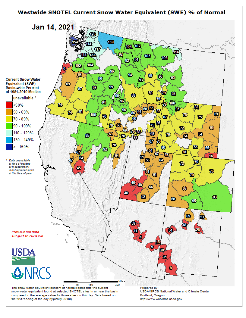
This northern windfall has come at the expense of snowfall farther south, where a lack of storms has brought dry settled conditions. Scrolling through resorts from north to south, snowfall steadily decreases from near average in Idaho and Montana to around 50-75% or less from the Sierras to Colorado and New Mexico.
Respite for the south in the short-term
In what will be a quiet week for the north, it’ll be the South’s turn to be on the receiving end and pick up some much-needed snow. Southern Colorado and northern New Mexico will receive 15-25cm late Monday and Tuesday (18th-19thJan), before a larger weather system passing over the south Friday into Sunday (22nd-24thJan) should see 10-30cm falling in the Sierras and over much of the central and southern Rockies, although some lucky resorts, such as Alta, Snow Bird, Wolf Creek, and Purgatory to name a few, could receive double that.
Next week, the final week of January, could see another one or two big snowstorms passing south of the Canadian border, with potentially heavy snowfalls for the Sierras and central-southern Rockies.
With the Pacific-North American Pattern (PNA) dipping negative this week, ensemble models expect it to remain negative well into February, indicating the first week or two of the month will remain unsettled. These ensemble models suggest that the north (Canada, Cascades, Idaho, Montana) will be in the firing line once again, while the Sierras, Utah Colorado and Wyoming could also do handsomely picking up all the scraps.
Blocking highs may bring better powder
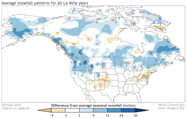
A North-South dipole of snowfall is what we’ve come to expect during La Nina winters due to a northward shift in the average storm track. Blocking highs in the North Pacific Ocean frequently force storms to navigate around their northern periphery, bringing cold northwesterlies and snow to the north. Similar to last month’s outlook, it is precisely this scenario that climate models and NOAA continue to adhere to for the coming months.
However, a lack of blocking highs this past month has allowed storms to simply plough over the north from milder climes of the North Pacific, rather than approach from a colder northerly route. Snow has come to the north amidst warmer winds from the southwest, making for heavier, wetter snow, and leading many resorts to describe snow conditions as hard packed and variable.
Snowfall to stay the course
With models and NOAA sticking to their guns – that being cold, wet, stormy in the north, and warm, dry, settled in the south – it’s likely snowfall will stay the course. The main difference is that we may see an improvement in snow quality as storms are forced over blocking highs in the Pacific, dragging in colder air from the north.
As such, the remaining months of the season should see above average snowfall over Canada, the northern Cascades, Montana and northern Idaho. Despite good snowfall during the next week or two, overall the Sierras, Nevada, Utah, Colorado, Arizona and New Mexico are likely to receive less than average. The southern Cascades (Oregon), southern Idaho and Wyoming lie in the narrow belt of average snowfall, delineating between the abundant north and austere south.
That’s all from me folks, enjoy the rest of the season in any which way you can, even if it’s only through a screen. If you’ve got a different theory on what’s going to happen over the next few months, or just want to provide feedback, then please hit me up on the discussion below. Or you can follow me on Facebook.


