Grasshopper’s 2025 New Zealand Snow Season Outlook – June Update
Mountainwatch | The Grasshopper
Early season snowfalls have already shown their face in New Zealand and with some more snow on the horizon for this week there’s no better time than to revisit the long term seasonal forecast for this winter season.
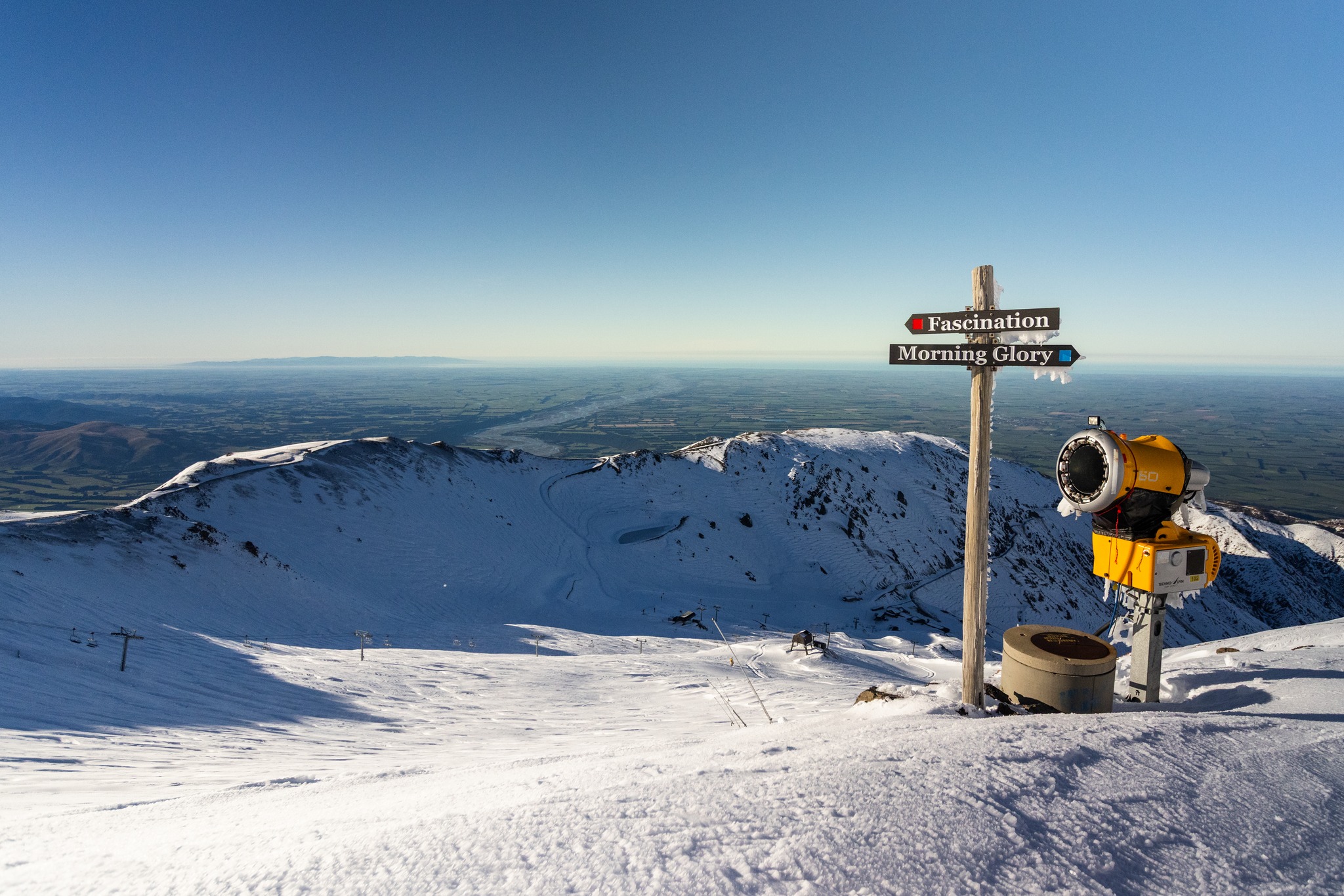
As mentioned, some considerable early season totals in areas around Canterbury such as Mt Hutt were reported last month providing an uncommonly deep base for this time of year, a result of a favourable pressure pattern and plenty of moisture available from the warm waters surrounding the country. Unfortunately, with some recent warm weather not all of that snow that fell earlier in May is still around to facilitate an early opening. However, for those with their antennae dialled in you might have also seen the potential for some more snowfalls this week as a low-pressure system and associated trough transits the centre of the country leaving a desirable cold southwesterly wind regime in its wake.
As you’ll see from our forecast models, there are good chances for snow on Wednesday Thursday and again heading through the weekend. As we are almost in the swing of things keep an eye out for more detailed short term NZ forecasts returning on the 9th of June written by yours truly where we will unpack events like this in more detail.
As for the New Zealand snow season outlook the theme from last month was a neutral ENSO year which as discussed isn’t the greatest precursor to a deep season. However, we have already seen some healthy storm systems so let us investigate more below, with hopes for a wrong-un.
Drivers
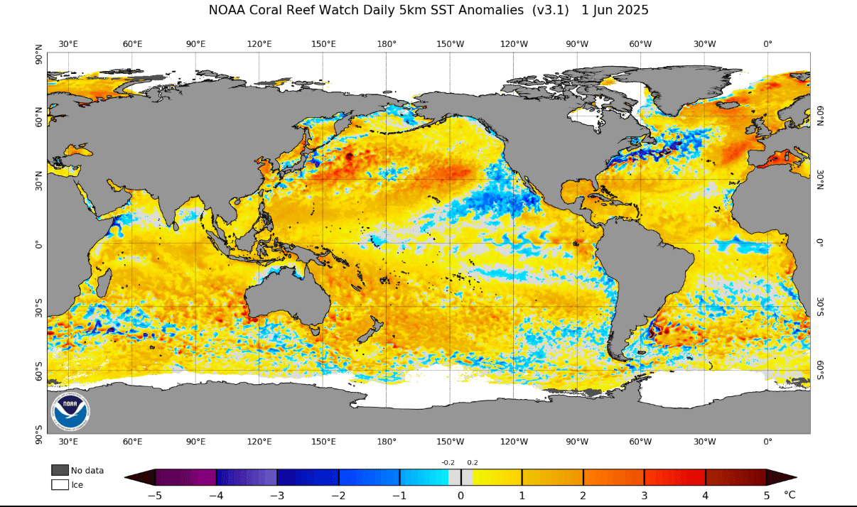
Our running story so far is a neutral ENSO continuing through the southern hemisphere winter which typically promotes a more east/northeasterly wind regime due to higher pressures to the southeast. We saw hints of this high pressure in the long-term models and warm temperatures on average expected over the winter period most likely influenced by both very warm SST and this warmer wind regime. An updated global SST anomaly is shown below with much the same story as expected, return to neutral values in the equatorial Pacific and large swaths of warmth throughout Australasia.
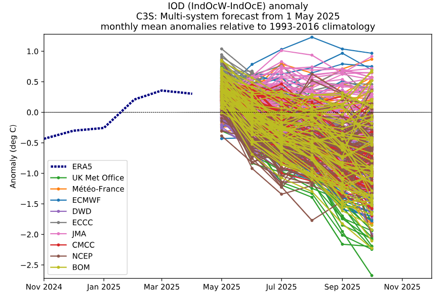
Another driver to consider is the IOD. While it does not have the same level of impact in New Zealand to Australia, a negative IOD can still promote wetter than normal conditions. It does this through more tropical moisture available to the northwest of Australia being brought down into the mid-latitudes commonly through troughs like northwest cloud bands. The increase in available moisture can act to provide more juice to systems and increase precipitation. This year the IOD has been tipped to swing into the negative realm towards the second half of the winter.
The image below shows this swing into the negative range through the end of winter with a spaghetti plot illustrating ensemble members from major agencies worldwide. Looking broadly, we can see a negative trend through the back end of winter and for reference the Bureau of Meteorology threshold for the SST to categorise an IOD event in this index is +/- 0.4°C.
Heading into the more in-depth short-term forecasts starting on the 9th drivers, like the SAM will come into play acting to enhance or detract from short term snowfall patterns with potential to tap into cooler airmasses and storm tracks further south.
Seasonal Products
Revisiting the MSLP forecasts for the winter season and into the spring we can see a similar story to the last update. A most likely situation of anomalously high pressure to the southeast and low pressure to the northwest combining to promote that undesirable east/northeasterly wind regime we’ve already mentioned. It is worth noting the signal for these areas of anomalous pressure is weak-to-moderate, possibly indicating decent periods of wrong-un conditions and more favourable storm cycles.
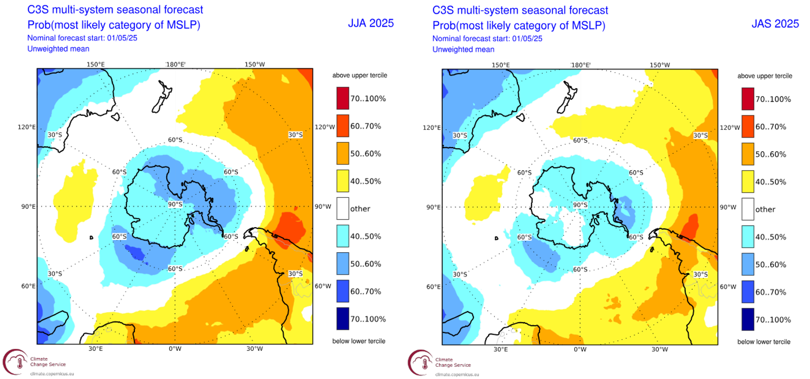
The forecasted most likely MSLP anomaly through the June-August period (left) and the July-September period (right). High pressure is modelled to sit to the southeast and low pressure to the northwest sandwiches New Zealand but heading through into the spring it looks like the region of high pressure does weaken. Source: Copernicus Climate Change Service.
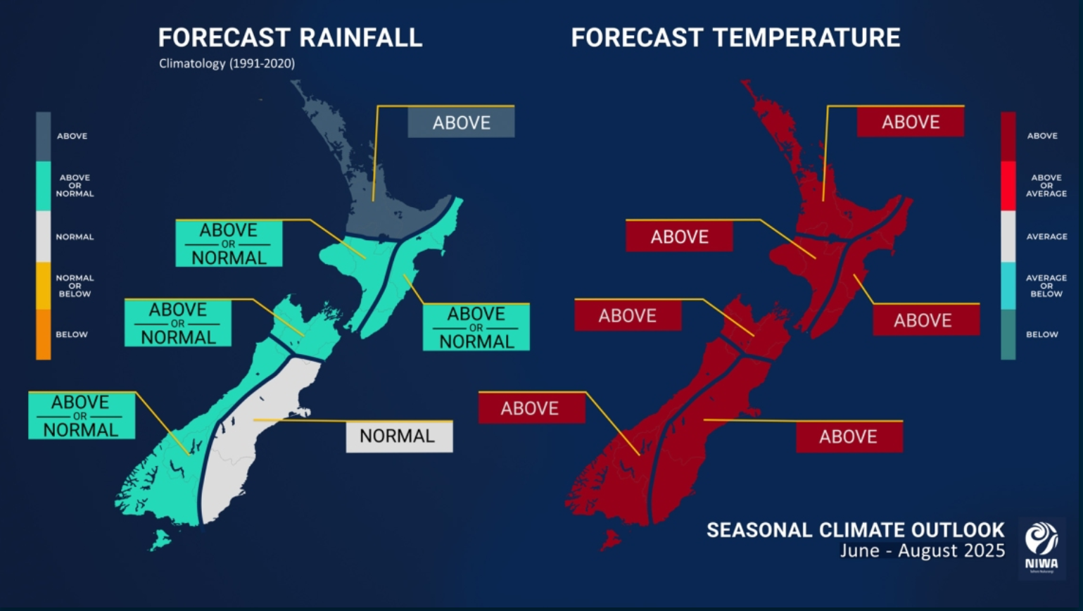
New Zealand’s National Institute of Atmospheric Research (NIWA) winter outlook pictured below suggests warm temperatures which is no surprise, but also the potential for some average to above average precipitation in areas across the country. This can be most likely attributed to the shift into negative IOD territory towards the end of the second half of the winter.
Conclusion
As the lifts begin to spin it will be interest to see how this season evolves with warm temperatures posing a risk to lower elevations but potentially a late season resurgence is on the cards. We will have to wait and see if high pressure to the southeast does become the norm or if wrong-un southwesterly winds can show their face.
Stay tuned as we ramp up the short term forecasts next week, and I’ll be back with a longer term update for New Zealand next month.


