Highs to Lows and Back Again – Japan Snow Wrap

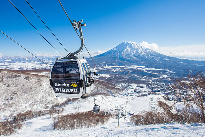
Skiing in Japan doesn’t get much better than that. Last week in Niseko Image:: SkiJapan.com
Mountainwatch | Japan Snow Wrap
It’s been a few weeks since we last checked in on conditions in Japan, and in that time we’ve seen a variety of conditions across both Honshu and Hokkaido. If you remember back to the beginning of winter, the consensus on El Nino was dominated by a lot of uncertainty, and it feels like that has really shone through this year.
Nonetheless, the snow continues to fall across Japan, with interludes of rain that feel like they’ve arrived early this year? Even still, there’s still another solid six or so weeks left in the Japanese winter, so why not read on for more…

After yesterday’s warm weather in Nozawa Onsen today things are looking much cooler. The snow is coming, too. Image:: Nozawa-Onsen.com
READ NOW: Have you checked out our daily written snow reports from Hakuba, Niseko and Furano?.
Today on the hill
Niseko:
As the sun breaks on a new week Niseko would be wise to quickly forget a Valentines day that was dominated by rain and wind. It made for an ugly day’s skiing and a good one to spend in the onsen. Thankfully conditions couldn’t be any more different today. It’s -17º up top and snowing sideways. The storm total sits at 10cm so far, with about another 15cm due to fall by tomorrow morning. Quick base update, Niseko is sporting an 130cm base at the bottom with 320cm up top.
Hakuba:
Let’s just agree to forget what happened yesterday – it was ugly. Today, however, is looking much better. So far, there has been a few centimetres of new snow about the peaks, but you won’t see it thanks to the fog. The models are tipping ten centimetres through the day, so get out there and hit it after lunch. Compared to Niseko, Hakuba is presently sitting on only 90cm down low and 195cm up top.
Furano:
Well, well, Furano’s northern latitude seems to have spared it from most of the damage of yesterday’s warm weather – although that’s not to say it didn’t rain. Unfortunately, it was ugly out there and the rain has wreaked havoc with the snowpack. Thankfully it seems to have cleared today, it’s currently cold and snowing, with plenty more snow on the way over the next few days. Base wise, Furano are sitting on 260cm down low and 300cm up top.
In The Forecast
Hakuba:
The freezing level has hit the valley floor today, and it’s snowing and windy about the peaks. Expect 10-15cm to fall today, followed by a dusting tomorrow. The best day this week looks to be Tuesday/Wednesday before the mild weather returns on Thursday into the weekend. Keep in mind that these variations will create a hazardous snowpack, so why not give Steve Lee’s Backcountry Tours a call before heading beyond the boundary?
Niseko:
There’s a lot of snow on the horizon this week, punctuated only by a brief warm period due to arrive from Thursday and Friday. This means there will be plenty of opportunity to score powder if you’re anywhere around Hokkaido this week. Make the most of it, the season will be done before we know it!
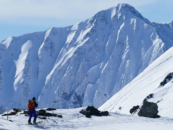
Steve Lee and his crew in Hakuba said that, “After big snowfall, loads of avy activity things settled for one of Hakuba’s best days of the season on Feb 12.” Image:: Skiing with Steve Lee

Sharing the stoke with the little tackers Image:: Glen Claydon Photography

Dig one in. Image:: Glen Claydon Photography
You’re never going to get sick of that view. Image:: SkiJapan.com
Hakuba forecasts,
snow reports and
live snow cams.
Niseko forecasts,
snow reports and
live snow cams.


