SNOW for NEW ZEALAND – Multi Metre Revitalisation
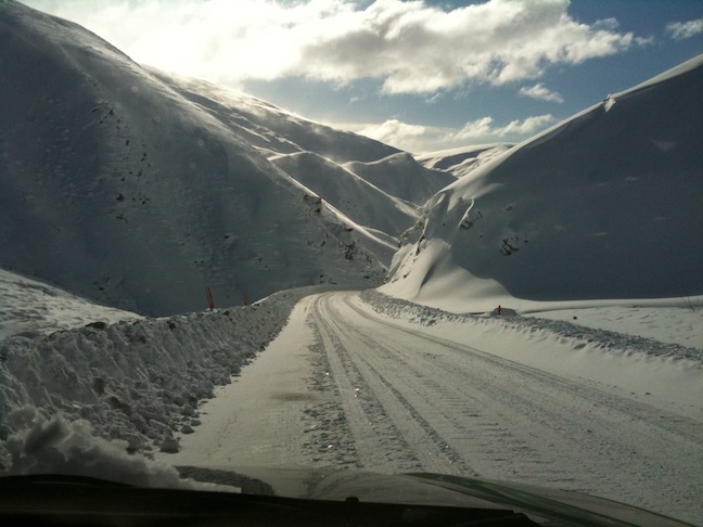
Top of Crown Range on 13 July. Image:: Nick Hyne
Storm Analysis
By all accounts it’s a freak; a week long, nation-wide, epic-sized snow storm spun up from Antarctica by an uncommon-for-this-time-of-year westerly to arrive, heavy-laden, over New Zealand to unburden itself of up to 5m of snow in under five days.
“The key to this storm was a large persistent trough of low pressure extending from Antarctica north to the Tasman Sea and New Zealand,” explained The Grasshopper. “This dragged copious amounts of really cold air up into the Tasman, where it was able to pick up moisture from the relatively warmer seas before slamming into the Southern Alps and Central Plateau in strong westerlies and north-westerlies. The result was ridiculous amounts of snow about the main divide, with plenty left over for everywhere else.
“What a relief given the lack of snow this winter. Sequences of snow events like this don’t come along very often and NZ has definitely got lucky with this one.”
“The storm of the season,” said Mountainwatch’s New Zealand snow forecaster Ben Taylor. “Not a bad way to kick of our late arriving winter with many ski areas receiving over 150cm of storm snow, some over 200cm, and NZ’s big mountains over 5m!
“There’s a few reasons for the sudden turn around in our winter. Most storms race through pretty quickly, dump 20 or 30cm then it’s all over. This guy has hung in there for over a week thanks to a big blocking high pressure sitting out near Easter Island standing guard over the exit door. Secondly this storm is large. The southern edge of it is way down over Antarctica so the air rotating over NZ through the period has flown direct from the coldest place on earth,” said Taylor.
“Thirdly that cold air has travelled over warmer ocean on it’s route here and picked up plenty of moisture that’s then forced straight into our Southern Alps that stick up 2- 3km. All that air has only one place to go essentially, up. This means loads of rapidly condensing air leading on to bucket loads of precipitation. The westerly direction is also good, pretty much at right angles to the lay of the mountains. This forces air up instead of around.
“Finally this westerly storm has had an unusual characteristic in that a load of precipitation has made it over to areas that are normally in rain shadow out of a westerly event, testament to the intensity of the flow. After such an amazing start I’m looking forward to seeing what the rest of the winter now holds for us.”
The North and South Island resorts are all reporting powder days with plenty of wind-blown pockets and dry-packed groomers. Ongoing cold air should maintain the excellent snow quality and more snow is expected through until the weekend, particularly on the North Island which may receive as much as 70cm of fresh snow in the coming three days.
The downside of the sudden snow abundance is an off the scale avalanche danger and, although there is plenty of snow, a solid off piste base is yet to form so backcountry skiing is still hazardous. And in the usual New Zealand way, high winds and blizzard-like conditions have been forcing some of the resorts to go on standby or close temporarily this week.
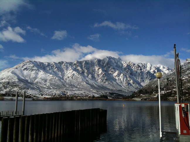
The Remarkables 13 July. Image:: Nick Hyne
Revitalisation
However it was created and not matter on what winds it was borne, this storm was the sustenance Zealand so desperately needed to resurrect its season, which it has done to admirable effect. almost overnight New Zealand has become a powder paradise, the weeks of dry desperation a distant memory in the face of metre upon metre of fresh snow.
“This storm has been relentless!” said Mountainwatch’s NZ video snow forecaster Nick Hyne. “It has been pretty much a full week of snowfall and even town has copped quite a bit. A welcome change from a warm and dry June. All of Queenstown’s surrounding mountains are coated white and there have been some nice clear spells in between blizzards to get some time up the hill! The town now has a winter glow about it.”
Welcome indeed, the long, dry June had taken its toll on the New Zealand snow community, forcing the resorts to delay their opening days. Seasonal staff had been at a loose end as days drifted into weeks without work, reliant on the two meals a day the resorts put on to keep their workers decently fed as they played mixed soccer and waited for the snow.
The collective anxiety preceding the storm – which had progressed from mildly disappointed to seriously alarmed as the situation became more dire – is now more than being matched by collective excitement and social media is alive with the exclamations of a re-energised snow community.
In the midst of the waiting it may have seemed winter had forgotten New Zealand, but not that waiting is forgotten and New Zealand’s season will hopefully continue to look very respectable.
Pablo Azocar has captured the best of the storm in a South Island Photo Powder Journal – see it here
The Remarkables forecasts,
snow reports and
live snow cams.
Treble Cone forecasts,
snow reports and
live snow cams.
Snow Park forecasts,
snow reports and
live snow cams.
Cardrona forecasts,
snow reports and
live snow cams.
Turoa forecasts,
snow reports and
live snow cams.
Coronet Peak forecasts,
snow reports and
live snow cams.
Whakapapa forecasts,
snow reports and
live snow cams.
Mount Hutt forecasts,
snow reports and
live snow cams.


