2022-2023 Japanese Snow Season Outlook – Third Time’s A Charm
Mountainwatch | The Grasshopper
As the Australian snow season draws to a close, our antennae naturally turn northwards in our insatiable search for snow. And what impeccable timing, Japan’s Prime Minister announcing last week that travel restrictions will be eased and the country will be back to business as usual for their fast-approaching snow season.
Not only that, with the “Triple Dip” La Nina now simmering in the Pacific, it’s lining up to be a humdinger of a season, even by their standards.
We don’t have to cast our mind back very far to see how bountiful La Nina’s can be in Japan. The torturous memory is still raw for most of us having to watch from afar these past two seasons, as metres upon metres of Japowder came down while travel restrictions were in place. It was especially tough on own Reggae Elliss, who had the unfortunate timing to be in Japan for the season prior (2019-2020), which turned out to be worst season ever.
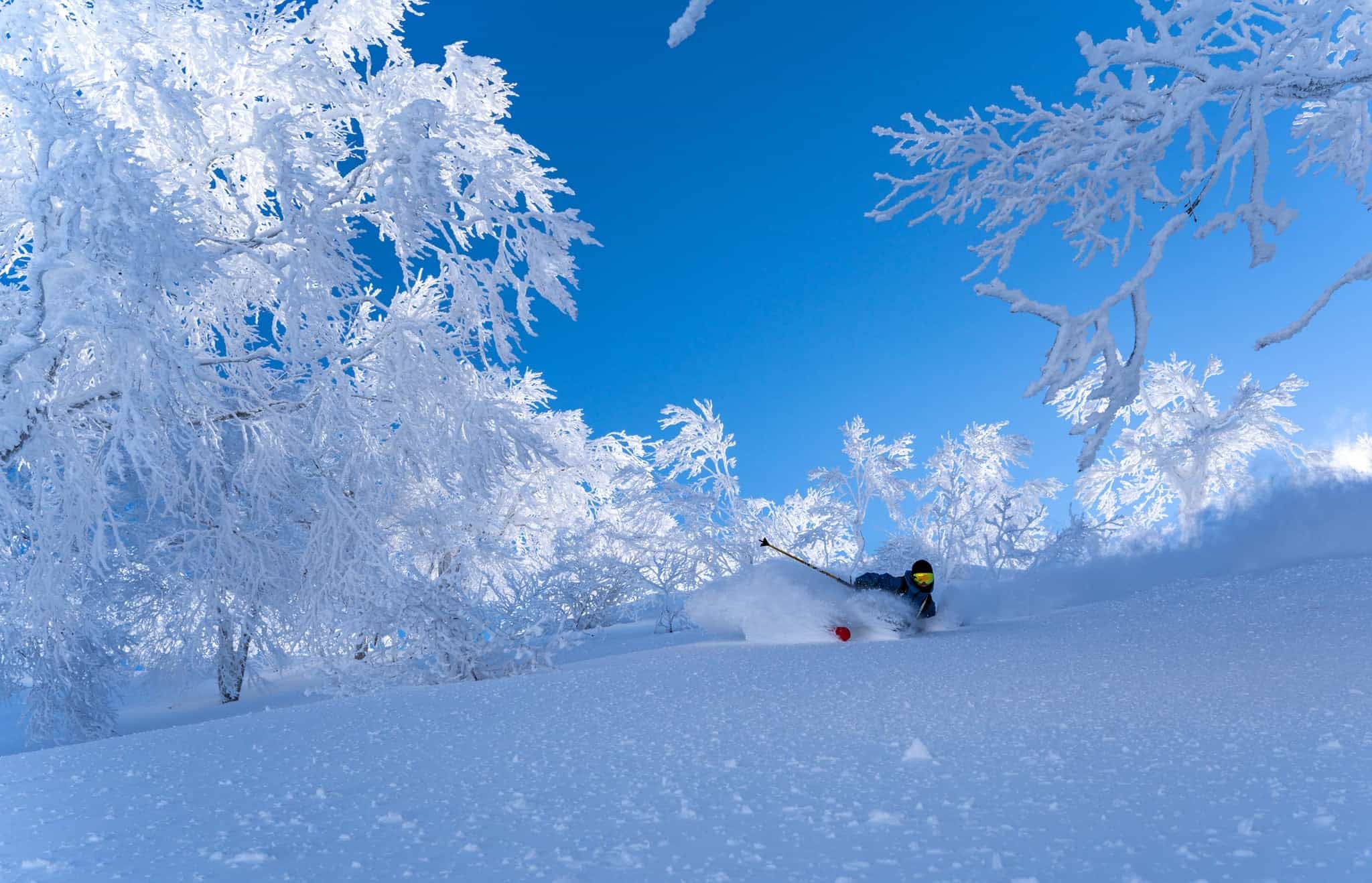
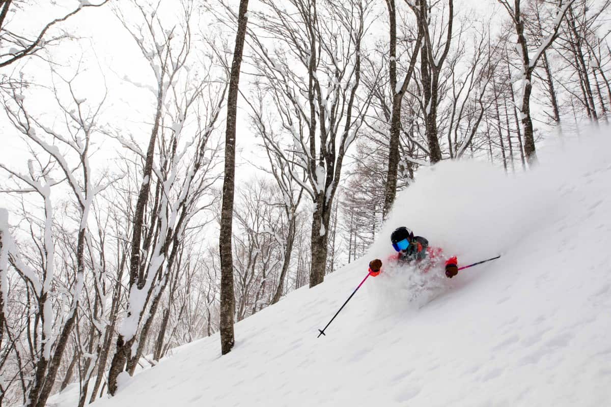
Last season’s La Nina saw the most snowfall in at least a decade at many resorts. On that list was Madarao, Nozawa Onsen and Yukawa all located in central Honshu, where over 10m, 11m and 13m was recorded respectively. That’s about the height of 16 koalas! Forget about cars, buildings and chair lifts were disappearing!
La Nina and its atmospheric responses are all currently hovering just beyond the BOM’s thresholds. Models expect a weak peak over the next couple of months before returning to neutral conditions early 2023, which is relatively early compared to its usual decline during the northern spring.
The increased lifting and sucking of air induced by the pooling of warm water in the western Pacific and around the Maritime Continent, which includes Indonesia, the Philippines and Papua New Guinea, acts to enhance the East Asian Winter Monsoon (EAWM).
Over Japan, this means more air flowing off the Eurasian Continent, which acts like a giant freezer during northern winters, resulting in more of that dreamy, feather-down powder.
In comparing last season to model forecasts for this season, the similarities are striking and both have La Nina stamped all over it. In both cases we have that stronger northwest flow coming out of the continental freezer, as well as enhanced cyclonicity (storminess) over at least the northern half of the country.
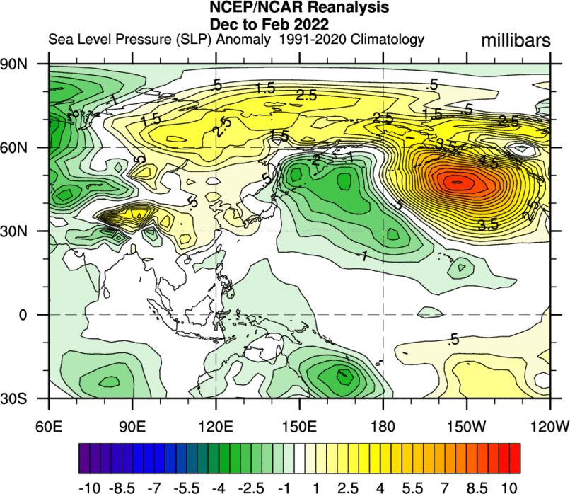
Pictured below is the model forecast for wind anomalies at 850hPa (about 1500m altitude), which perhaps better highlights the enhancement of the EAWM by La Nina. You can clearly see stronger northwest winds over Honshu, and stronger northeast winds along the Chinese coastline down into Southeast Asia.
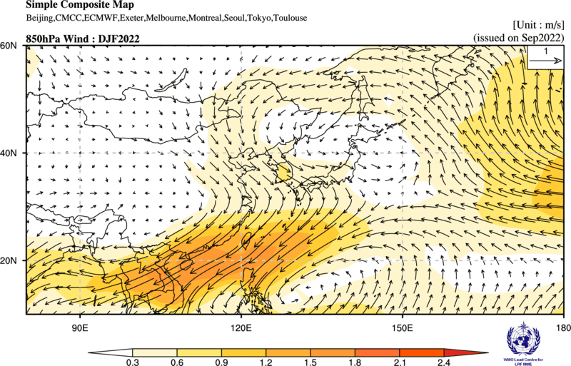
Model forecast wind anomalies at 850hPa for the winter months highlighting the enhanced East Asian Winter Monsoonal flow, starting with stronger northwest winds over Honshu.
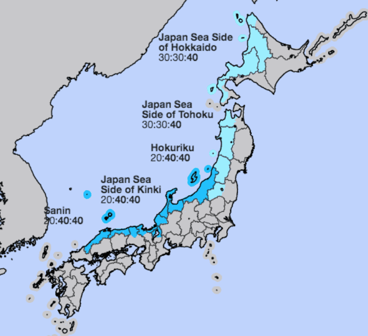
If you weren’t already convinced that things were looking good for the upcoming season, then the snow outlook by Japan’s very own JMA should tip you over the edge. Their forecast is nice and blue indicating that above average snowfall is the most likely outcome, especially over central and western Honshu, which is precisely where models expect those anomalous northwest winds to be strongest. Note that the JMA only provide snow outlooks for those prefectures on the Sea of Japan side.
Let’s get excited
This outlook, I think, should give you even more reason to get excited about the Japanese snow season. In the unlikely event that La Nina fails to provide the goods, even for just a few areas, say on Hokkaido, in an average season, or even the least likely scenario of a little below average, you’re still bound to score big time.
Only the worst Japanese season ever could spoil a trip to this veritable powder paradise, as Reggae can attest to. However, with the “Triple-Dip” La Nina already in motion, this third one will be a charm.
I’ll be updating the Japan snow season outlook next month and my weekly Japan forecasts will start in December.
It sounds like another awesome season on the way. Head to Mountainwatch Travel to check out the Japan packages and our guided Japan Powder Tours


