2023-2024 North American Snow Season Outlook February Update – Hope remains for things to perk up in the North as El Nino Fades
Mountainwatch | The Grasshopper
After a nerve-racking start to the season here in western North America, El Nino has finally pulled through for the south where a massive comeback has seen snow depths surge to median or above levels.
Only the Sierras are still lagging behind when compared to average. However, whopping storms of late have seen conditions improve considerably for resorts there and have provided plenty of powder. The North is still running well below median, but with El Nino on the way out, will things perk up there, and will they slowdown in the south?
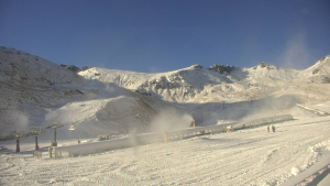
The north, which includes Washington, northern Idaho, Montana, British Columbia and Alberta, is still running well below what we’d expect to see at this point in the season. But here, where a typical season may see up to 10m or more of snowfall, the bar is set rather high.
About 3-5m+ of snow has fallen throughout the north so far this season, so there have been plenty of highs to counter the lows. And by definition, half of all seasons must lie beneath the median, so it isn’t necessarily a representative measure of how shredable conditions actually are.
The problem for the north has been a chronic lack of those proper cold winter storms. Most precipitation has come from warm southerly flows. This was especially the case through the back half of January when the Pineapple Express turned up and dumped a whole lot of rain to high elevations. Things have since dried up and became more settled through February, while low snowfall and mild temps have continued.
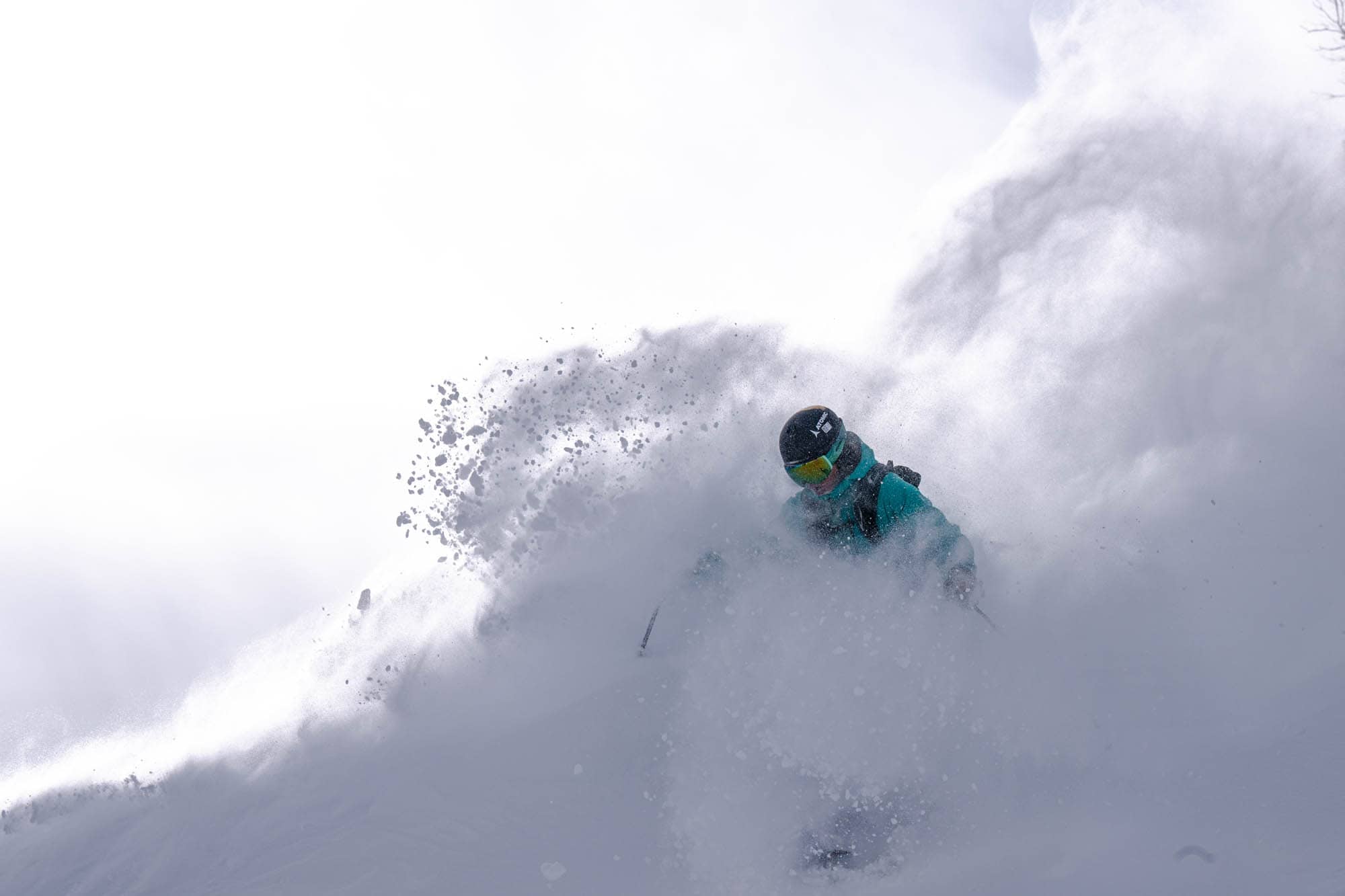
For resorts in the southern half of western North America, it’s been a different story. Storms have favoured a southerly track and have caused the snowpack to surge up to near-median depths in Oregon, southern Idaho, parts of Wyoming, and Colorado, while Utah, Arizona and New Mexico have gone over and above.
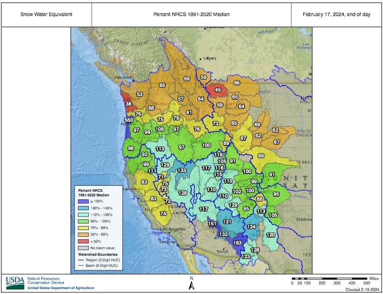
Although the snowpack is still lacking in the Sierras, conditions have improved massively as storms have tended to hit the mountain range head-on. An additional 72cms over the past three days has pushed depths into the near-median category.
At the time of writing (Feb 22nd), 337cms has been recorded at the Main Lodge of Mammoth so far this month, and with the additional snow in the forecast, we should be looking at a monthly tally that will place it within the top-10 of highest February snowfall on record.
It hasn’t all been smooth sailing for the Sierras though. A lot of this snowfall has also come from warm, wet southerlies, in which rain has affected low altitudes, especially at the Tahoe resorts and those along the I-80 who all have terrain below 2,500m.
This north-south split is what we’ve come to expect during El Nino seasons, and so far, at least since I last wrote, things have been going to plan. Low pressure anomalies in the north Pacific have stretched over southern U.S. leaving a swath of higher-than-average precipitation there, while the north has generally been left high and dry. Interior B.C. is the main exception to this due to also picking up a lot of precip out of those wet, warm airmasses.
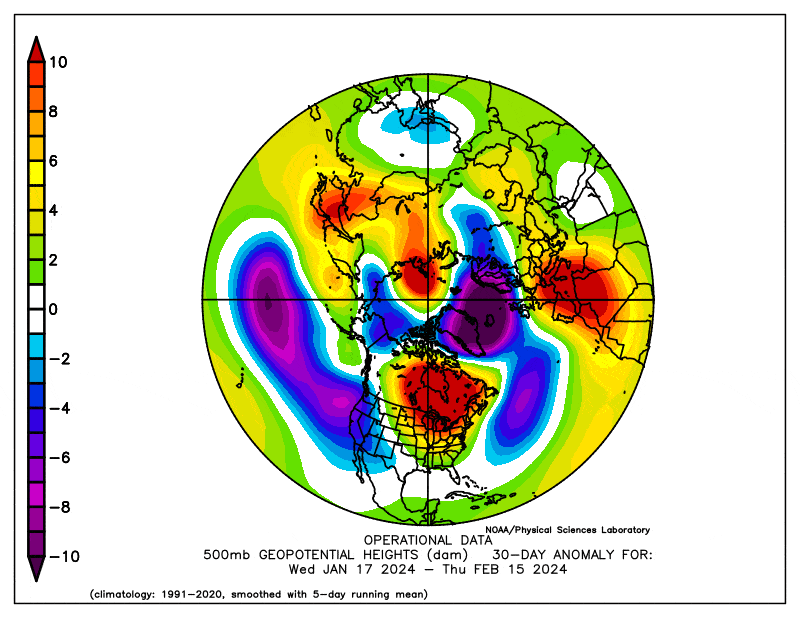
However, these broader patterns can’t all be attributed to El Nino, as many of its atmospheric responses have been propped up recently by the Madden-Julian Oscillation (MJO). The MJO has been hanging out in the middle of the Pacific since late January, providing a boost to convection there and dampening the trade winds, which in turn has led to a temporary rise in sea surface temperatures. It’s all handy stuff for an El Nino past its prime.
The MJO has now weakened and forecasts suggest it may re-emerge and start to strengthen over the Maritime Continent in early March, turning from friend to foe and possibly hastening El Nino’s demise.
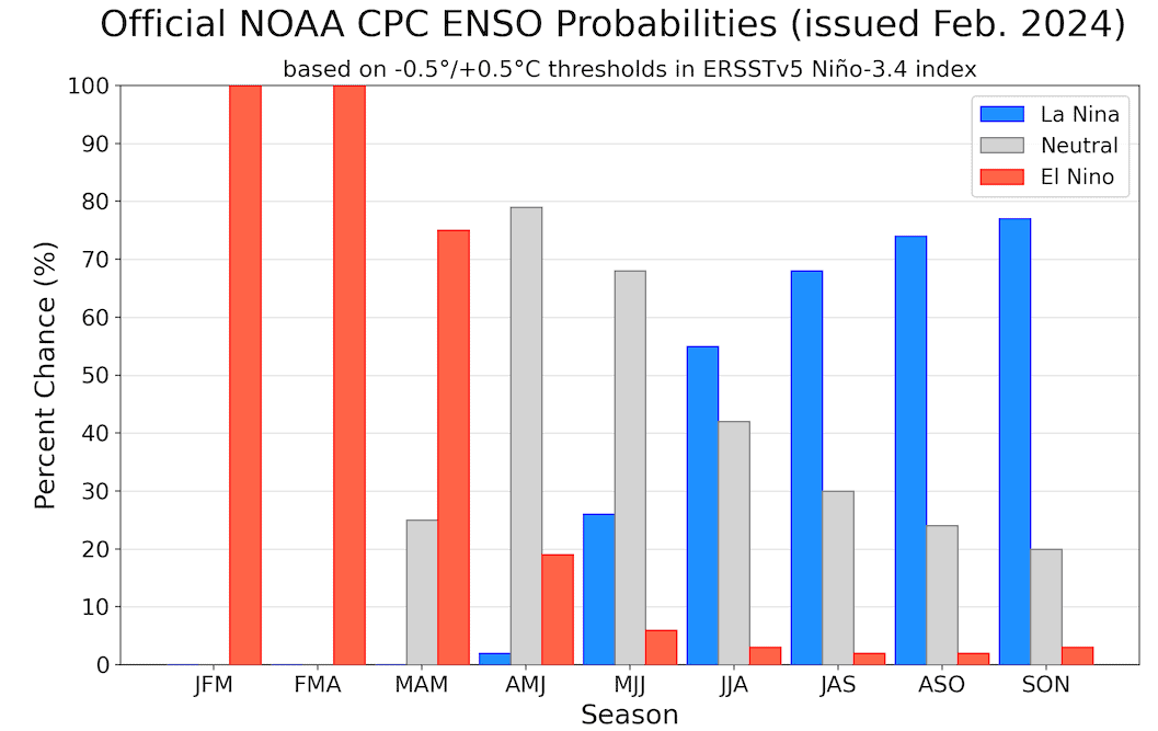
Apart from this recent boost from the MJO, El Nino and its atmospheric responses have generally been on the decline since late last year. Models still expect we’ll reach neutral thresholds of the El Nino-Southern Oscillation (ENSO) sometime in April or May.
It’s not uncommon for El Nino to decay rapidly after a strong event. Nor is it uncommon for La Nina to follow hot on its’ heels. Current forecasts suggest this will most likely be the case, giving La Nina a 55% chance of developing during the southern hemisphere winter.
Given our main driver of climate variation is doing a vanishing act, it’s no surprise that El Nino trends in seasonal models follow suit. The north-south split, in terms of favourable snowfall conditions (e.g. pressure anomalies, precipitation, temperatures etc), is still faintly there during March, barely there in April, and gone in May.
For the spring months, it makes sense that the majority of snow will fall during March before steadily dropping off through April and May as the cold season winds down. In fact, more snow tends to fall during March than in February at many resorts, especially at those in the North, as well as along Rockies where March can also be the snowiest month of the year. This snowfall pattern follows in the path of the jet streams as they migrate northwards during this time of year.
So, with favourable conditions fading in the south, and thus improving in the north, combined with the usual seasonal drift northwards of the main storm track, we can remain somewhat hopeful for things to at least perk up in the north. If the short-term forecast is anything to go by, we won’t have to wait long for that to happen, with big snowfalls on the cards through the remainder of February and possibly into early March. Ditto for the south. I’ll save all the details on that for Thursday’s forecast, so be sure to check in then!
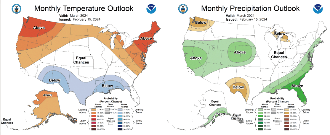
NOAA’s outlook for March shows the climate still remains favourable for good snowfall in the south, and less favourable in the north. Their three-month outlook, as well as seasonal model forecasts, suggest conditions will gradually even out during spring as El Nino fades away in the Pacific. Source: NOAA/National Weather Service
So, all in all, climate drivers and models still look favourable for the South at least through March, and show steady improvement for the North throughout the spring months. Remember, an El Niño pattern is dealing with averages and may account for up to 10-20% of snowfall variation in a season. The real on-the-ground weather is only reasonably forecastable up to 7-10 days out. To score the goods it’s often more about timing, and to do that you can keep your finger on the pulse here with my weekly forecasts, issued every Thursday. Until then…
Grasshopper