2023-2024 North American Snow Season Outlook – Grasshopper’s December Update
Mountainwatch | The Grasshopper
It’s been a relatively sluggish month up in North America where early-season snowfall has been mostly below average. The few storms that managed to sneak in have primarily benefited British Columbia, the Cascades and the Rockies.
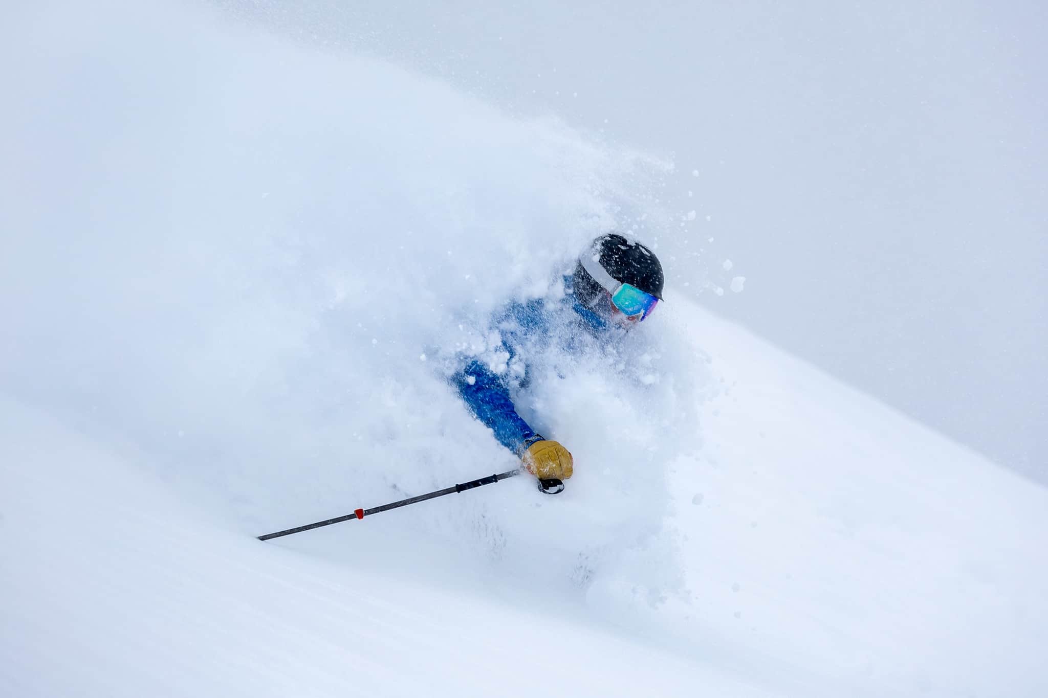
The latest storm on the weekend followed that trend, particularly for the Cascades and the Rockies where snow totals over the past 4-5 days have been some of the deepest of the season – Alta receiving 127cms, Stevens pass 94cm Stevens Pass, 80cms in Steam boat and 78cms for Jackson Hole. There were also some healthy totals in Canada with Revelstoke picking up 38cms, Whistler 35cms and 29cms for Kicking Horse.
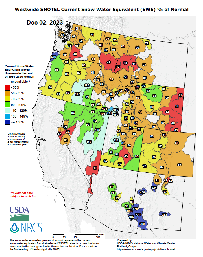
A glance at a dozen or so resorts here tells me bases after the last storm generally range between 0.75-1.5m, with snowfall tallies already up near 1.5-2.5m – not bad for sub-par early-season conditions! The Sierras, however, pale in comparison to last season’s quick start, but bases there are approaching half a metre on upper slopes.
Despite a strong El Niño simmering away in the tropical Pacific, it’s been a very un-El Niño-like month. As I mentioned in the previous outlook, El Niño would typically benefit the lower tier of North America. Even in our own back yard, this past month has seen above-average rainfall across the north and east of both Australia and New Zealand, while westerlies have largely been absent – resembling more of a La Niña pattern than an El Niño.
Nonetheless, it’s still early days, and it makes sense that winter comes to the north of North America first before gradually migrating southwards, following in the paths of the polar and subtropical jet streams as they intensify. In fact, it’s typical that a large number of locations in the North and throughout the Rockies receive more snowfall during the fringes of the season. During the deep, dark winter months, the storm track often lies further south, and the cold Arctic air masses up there are often too dry for substantial snowfall.
In the long-run, seasonal models, NOAA and Canada’s MSC still anticipate El Niño to play out this season. However, high-resolution deterministic models show that until mid-December, the southern tier will remain at low tide, with storms continuing to favour the North and the Rockies, where an additional 40-75cm+ could fall.
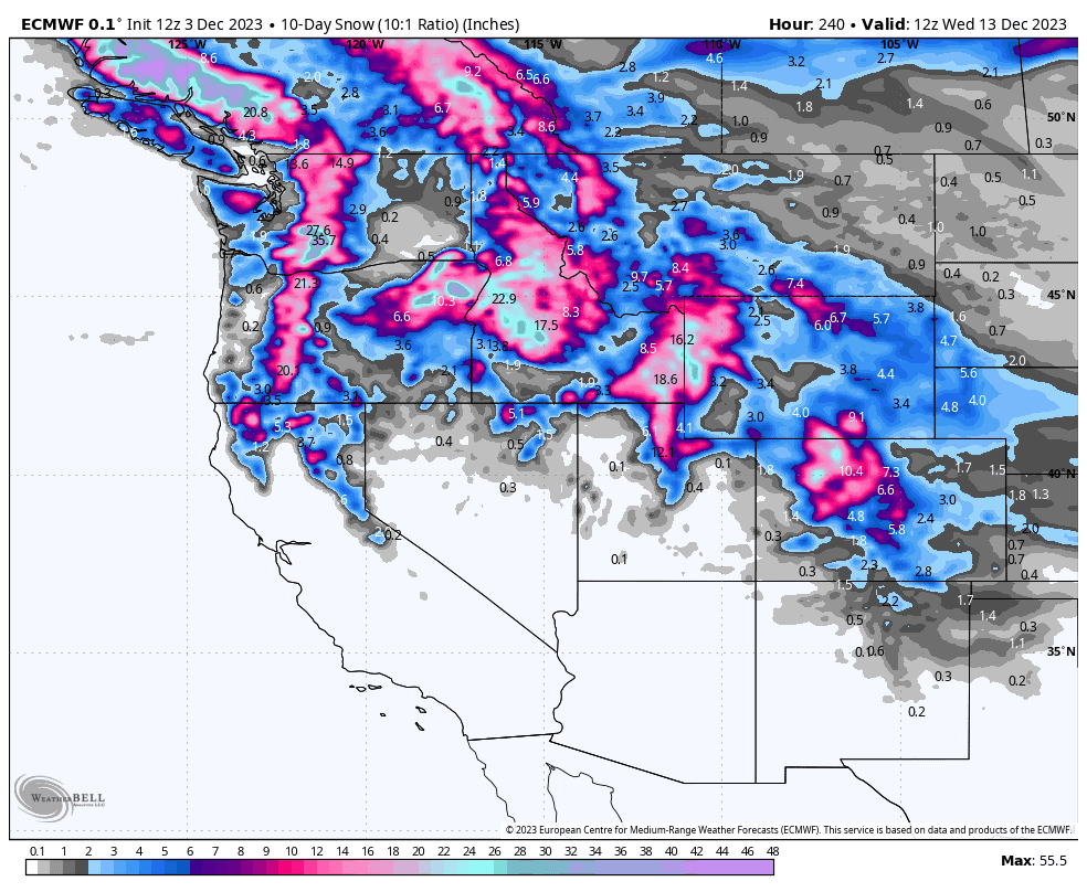
During this period, the Madden-Julian Oscillation (MJO) will migrate over the Maritime continent and western Pacific, likely counteracting some of El Niño’s atmospheric influence. However, around mid-December, the MJO is expected to drift eastwards across the dateline, potentially enhancing El Niño’s impact during the second half of the month. This is when we could see the tallies start to rack up in the Sierras and southern Rockies. But like I mentioned a month ago, warm temperatures could be a real issue, particularly for low-elevation snow along the Pacific Crest.
Well, that’s all for now, folks. Remember, an El Niño pattern is dealing with averages over the length of a season, but sometimes the weather has different ideas and can completely throw out the rule book. Climate drivers may account for up to 10-20% of snowfall variation, leaving the rest up to the chaotic nature of weather, reasonably forecastable only up to 7-10 days out. So, be sure to keep on top of things with my weekly forecasts starting mid-December.
Grasshopper


