Grasshopper’s 2023 New Zealand Snow Season Outlook – May Update
Mountainwatch | The Grasshopper
La Nina-style weather has continued to plague New Zealand over the last several weeks, bringing warm northerlies that have kept the mountains here pretty much snow-free. This week, however, Middle Earth will get a makeover.
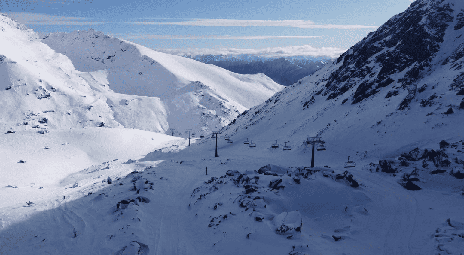
A cold southerly buster is forecasted to drop 10-30cm of snow across Kiwi ski fields on Wednesday and Thursday, from the Southern Lakes to Mt Ruapehu. And now that we’re into May, the season due to kick off in only 5-6 weeks, we’re hoping the snow will start to stick.
While La Nina shrinks into the horizon behind us, officially we’re floating over neutral territory of the El Nino Southern Oscillation (ENSO) as we sail towards El Nino-land. We’ve been there before, most recently in 2015, which reached into the “very strong” category of El Nino events.
This year, El Nino thresholds are expected to be met sometime during June or July, and then continue to build to moderate-strong levels by the end of the season. Only Australia’s Bureau of Meteorology (BOM) model expects El Nino will reach the lofty heights of “very strong” like it did in 2015. It’s an outlier compared to all other models, and unfortunately NZ doesn’t have a flash seasonal model of their own – this Antipodean bread basket is great for producing brilliant rugby players and fast sailing boats, but not weather models, apparently!
As it did in 2015, El Nino can chuck a lot of fronts over NZ, with cold S-SW winds often dominating. Patience pays dividends as the snowpack builds gradually, little by little, with each passing front, in contrast to the whizz-bang, big flashy snow dumps of La Nina – although a number of such dumps can be expected in any season.
A basic and crucial point for NZ during El Nino is that pressures tend to be higher than normal to the west and lower to the east. Lying within this high-low pressure spectrum, a dial can be turned right making NZ a frontal graveyard where once-strong and vivacious fronts go to wither and die. Turn the dial left, and NZ lies within a busy frontal highway delivering regular bouts of small to medium sized stuff.
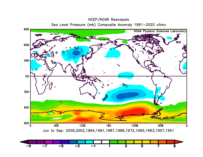
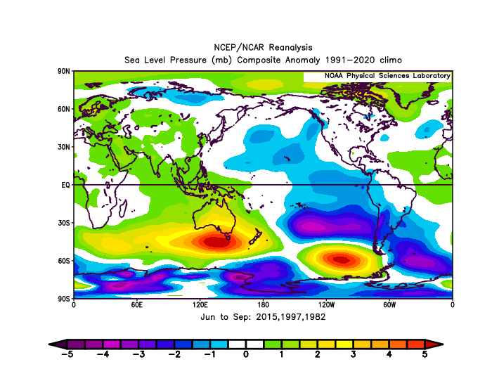
The fear is that a strong El Nino event could see the dialled turned right, causing the ominous high pressure to the west – usually centred near Tasmania – ballooning out and swallowing NZ like it did during 1982 and 1997, two other years that El Nino reached “very strong” thresholds.
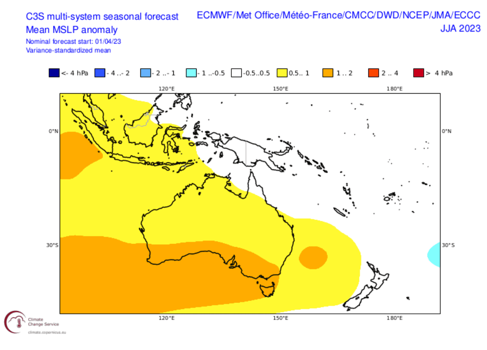
Thankfully, the consensus of model forecasts paints a much brighter picture, placing NZ instead smack bang in the middle of the high-low pressure spectrum – neither a frontal graveyard or busy highway, nor calmer or stormier than usual. It’s the Toyota Prius of outlooks, nothing flashy, but quiet, dependable, and will get us there in the end.
S-SW winds are still likely to blow, not all the time, mind you, just more often than normal. So, we should make the most of what ever does turn up. However, average temperatures may end up warmer than average simply due to the fact that NZ is currently surrounded by warm waters, which may contribute to additional snow melt.
All in all, an average season is still most likely for all areas. This weeks’ snowfall is a great example of what’s to come: fairly regular small-medium sized stuff. Mid next week, around the 17-18thMay, a weaker front is likely to drop an additional few-several centimetres over the Southern Lakes, with a lighter dusting elsewhere. And it’s this pattern I suspect we could also see more of, giving the Southern Lakes have a good chance to go one up, whereas, I wouldn’t be surprised to see Canterbury and Ruapehu fields lagging behind.
That’s it from me folks. Remember, these climate drivers only account for perhaps a quarter of snowfall variation – the rest is left up to the snow gods. As in any season, it’s often about timing, and the best way to time it right is to keep a handle on weather forecasts, which you can do right here on Mountain Watch with top-of-the-line model data, and forecasts by yours truly.
If you’ve got a different theory on what’s going to happen this winter, or just want to provide feedback, then please hit me up on Facebook and hit the follow button while you’re at it.
The Grasshopper


