Grasshopper’s Weekly North America Forecast, March 1st, 2024 – Major Storm Hitting the West with Massive Snowfall Instore

Mountainwatch | The Grasshopper
Written Thursday morning 29th February (Pacific Time)
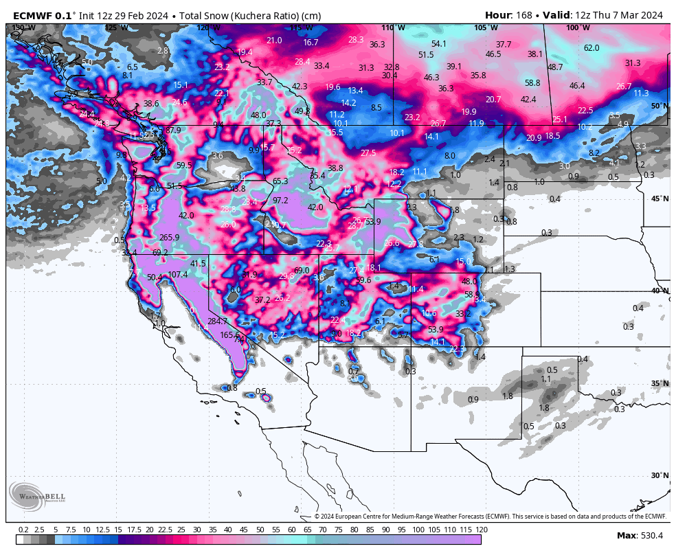
It’s been a deep week for the northern half of Western North America, where significant snowfall was well overdue. The Central Rockies also did well, and a top-up was provided for the Sierras and Southern Rockies so as not to feel too left out.
The pattern will remain active over at least the next seven days, with a major storm impacting north and central areas today into Sunday. Oregon and California will bear the brunt of this storm with totals up in the 1-3m+ range, perhaps making this the biggest one of the season. It’ll be dangerous and cause all sorts of havoc, so one must have their wits about them. Totals will also reach up around the 1m mark in Idaho and Wyoming, with 25-75cm expected elsewhere in the Northern and Central Rockies.
Another storm, this one a little weaker, will likely show up late Monday, and once again hit Oregon and California with more heavy snowfall through Wednesday, with decent falls also in the Central Rockies.
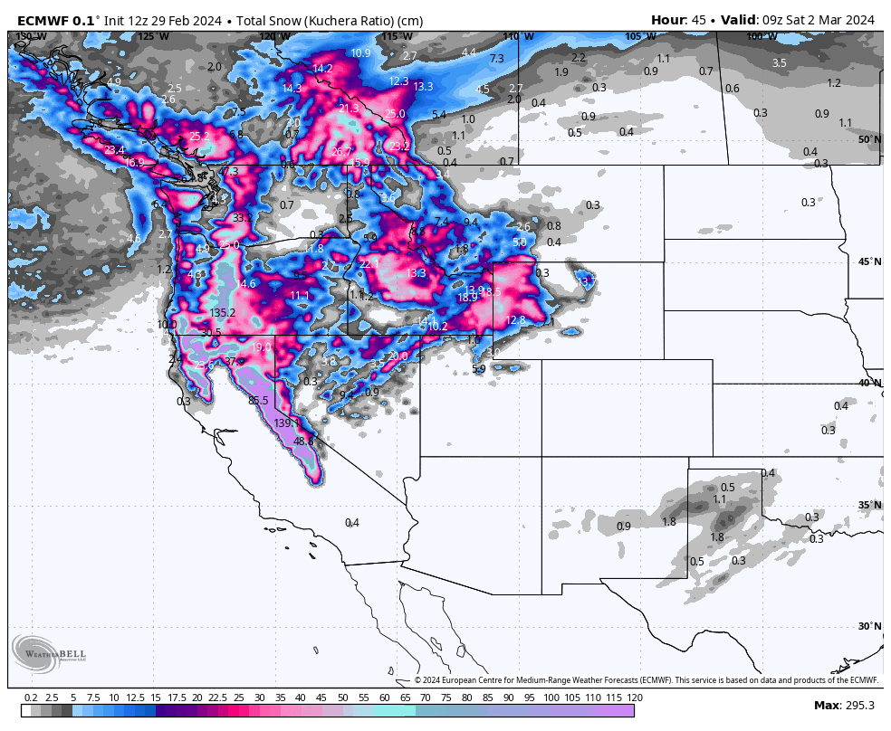
Thursday Feb 29th & Friday March 1st
A powerful cold front, which arrived in the Northwest yesterday, will continue to push southwards and eastwards during this period. Heavy to very heavy snowfall and strong SW winds lie along this frontal band, which is currently working its way down the Cascades and southern Canadian Rockies this morning.
Although temps won’t be super low within the frontal band itself, they’ll be low enough to provide snow to or below base levels. Behind the front, or rather to its north, the airmass will be much colder and somewhat calmer, with mostly light-moderate falls of high-quality fluff.
During the second half of today, this frontal band will push down over northern California, Idaho and Wyoming. And during Friday, another push of cold air will see it spread and stall over the entirety of the Sierras where it’ll be coming down in lorry loads, with moderate-heavy falls further inland reaching southern Idaho, northern Utah and Wyoming.
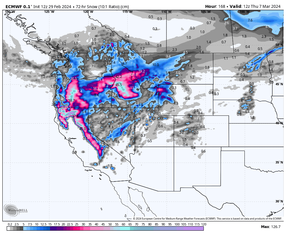
Saturday March 2nd & Sunday March 3rd
The onslaught will continue in the Sierras during Saturday, while the frontal band of heavy snowfall slowly drifts south into southern Utah, northern Arizona and Colorado, and eventually reaching northern New Mexico early Sunday.
Here, in the south, the front will gradually weaken during Sunday with snowfall following suit. North of the front, light-moderate snowfall and cold temperatures will continue throughout the weekend, providing excellent conditions to score some fluff.
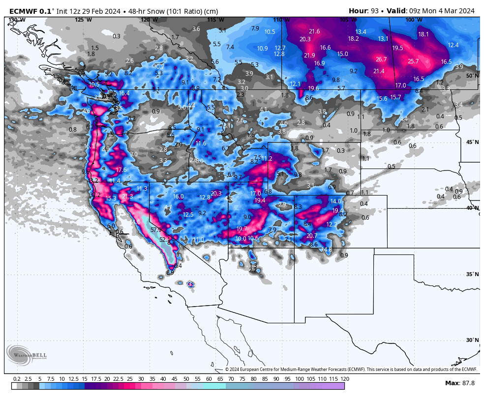
Monday March 4th to Wednesday March 6th
Monday, remaining snowfalls will clear the South while a weak low-pressure system continues to impact the north, with mostly light snowfall persisting there as well as northern California.
Later on Monday, however, another low-pressure system may enter the scene, making snowfall a bit heavier across Oregon, northern California and southern Idaho. This belt of moderate-heavy snowfall will persist through Tuesday, while extending into Montana, and to a lesser extent Wyoming, before spreading down the Sierras during Wednesday. North of this, a cold, dry airmass will likely see snowfalls dry up with clearing skies.
Extended Outlook
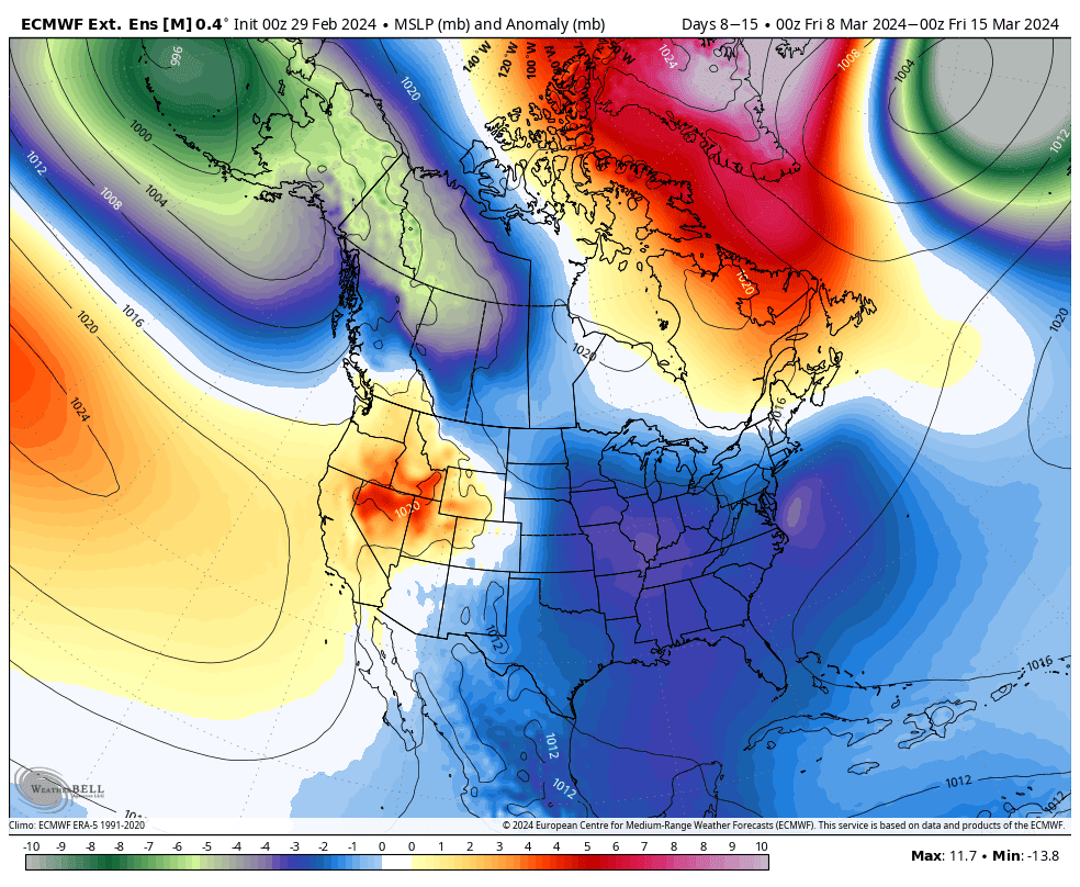
The storm cycle is likely to gradually wind down over the back half of next week, before becoming active again over the Northwest and through the Rockies through the first half the week starting Sunday March 10th.
That’s all from me today. Have a great week, see you next Thursday.
Grasshopper


