Grasshopper’s Weekly North American Forecast, January 18th– One and Done for the Sierras, Light Top-Ups and Sunshine Elsewhere
Mountainwatch | The Grasshopper
Written Wednesday January 18th (Pacific Standard Time)
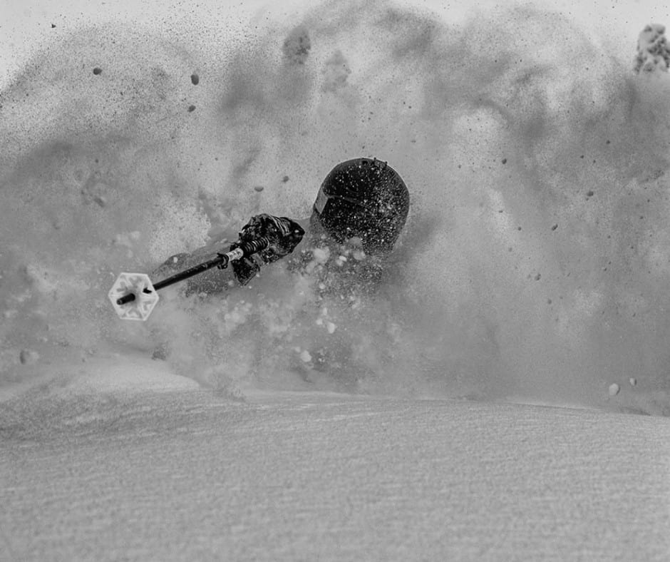
It’s been another deep week for the Sierras, as well as the central-southern Rockies. However, after another quick top-up during the wee hours of Thursday, it’ll be the last snowfall we see in the Sierras for at least the next 7-10 days. Resorts there will enjoy a well-deserved break and plenty sunshine after the first half of winter has brought relentless snowstorms and well above average snowfall.
Elsewhere, weak fronts will bring mostly a few light top-ups as they sweep southeastwards over the Pacific NW down through the Rockies. These will be interspersed with settled and sunny weather, which should make for some great on-mountain conditions.
Thursday Jan 19th & Friday 20th
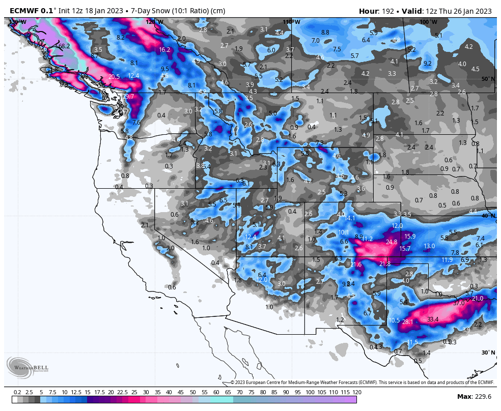
The wee hours of Thursday will see the Sierras copping another decent dump of around 10-30cm as a front drifts over the area. Tahoe and the northern Sierras will be in the high end of that range, while those resorts to the south will be at the low end.
At the same time, with the front extending northwards, the northern Rockies will also receive a wee top up of about 5-15cm for those resorts on the western periphery, while those on the eastern side, such as Alberta and Wyoming will receive just a skiff or less.
Throughout the rest of Thursday and Friday, the front will drift southeastwards over the central and southern Rockies with that same 5-15cm top-up in store for most resorts down there.
Saturday Jan 21st& Sunday 22nd
Saturday will see a front coming out of the northwest – something we haven’t seen much this season – and rolling over the Pacific NW and northern Rockies, with a period of moderate-heavy falls near the coast, and light-moderate falls inland.
On Sunday, the front will continue to push southeastwards over the central Rockies and finally reach down into New Mexico by the end of the day, skipping out Arizona, however. Just a light top-up of a few-to-several centimetres is likely, but we could see some heavier falls starting to crop up in Colorado and New Mexico.
Monday Jan 23rd to Wednesday 24th
Monday will see the front mentioned above gradually exiting Colorado and New Mexico, leaving behind mostly a light top-up, but some resorts could possibly sneak in a good 20cm or so.
While that’s going on down south, a weak front will brush over the Pacific NW and northern Rockies with just a light dusting, followed by a similar system on Tuesday. This second weak system will similarly brush over Colorado and New Mexico during Wednesday, while high pressure and sunshine dominates much of the West.
Next Thursday Jan 25th & Beyond
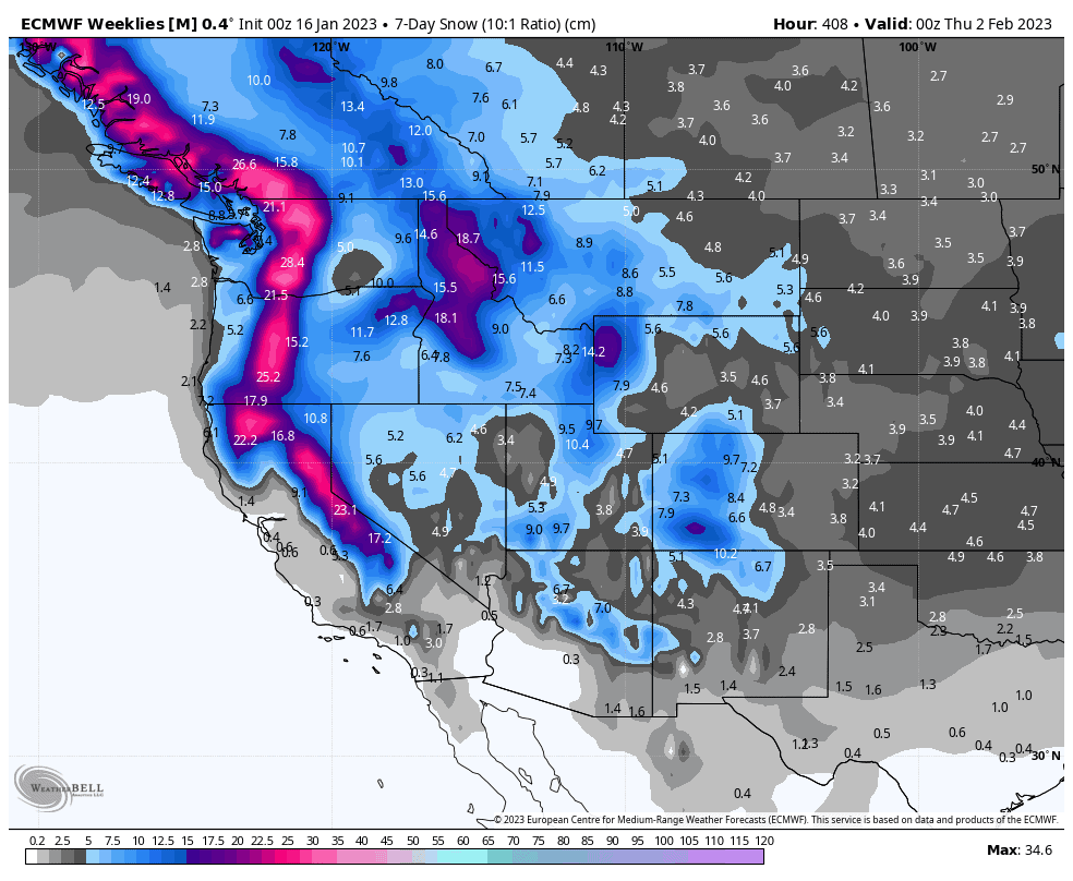
The settled conditions look to continue through into next weekend as high pressure dominates. Ensemble models suggest a more active pattern will return in the following days, with the Sierras in line to see a lot of the action yet again, alongside the Pacific NW and central-northern Rockies.
Well, that’s all from me this week guys, see you next week.


