The Grasshopper’s Weekly North American Forecast – Neck deep in Canada, while Sierras put on hold
Mountainwatch | The Grasshopper
Wednesday, December 26 (Pacific Time)
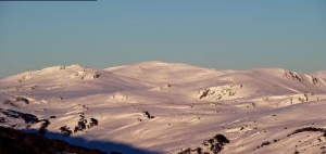
Looking at the overall picture for the next ten days, you’ll notice that the Sierra Nevada lacks colour of any sort and it hardly gets a mention in the highlight reel. Maybe folks there over did things over Christmas and are now dealing with the aftermath.
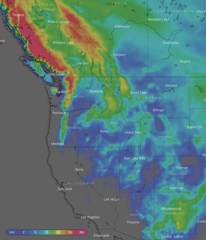
Ten-day snow accumulations. Neck deep in Canada while Sierras are put on hold. Source: windy.com
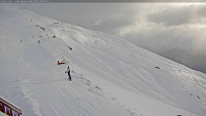
On the other end of the spectrum, the Coast Mountains of Canada are expected to receive anywhere upwards of 1.4m, so there’s no guessing where all the storms are heading for. The northern Cascades and Canadian Rockies will also be benefactors of the northern storm track, with snow accumulations up around 1.3m at the extreme end and 60cm at the lower end. The mountains of Montana and Idaho will also be sitting pretty with 40cm-60cm, while only 15cm should fall over the Rockies further south as the area is dominated by high pressure. However, New Mexico will sneak in a cheeky 30cm-50cm as they will be sitting south of all that high pressure.
Thursday 27 Dec:
A low over the High Plains, which has been dumping snow over the American portion of the Rockies over the last couple of days, will rumble away to raze the northeast. Meanwhile, a weak trough will leave a dusting of snow over Canadian resorts as well as the Cascades and northern portion of the American Rockies early in the day as it meanders southeast, eventually spreading snowfalls to the southern half of the American Rockies.
Friday 28 Dec:
Snowfalls will continue until late in the day over the southern portion of the American Rockies as the trough lingers, with New Mexico getting the most out of it. A storm moving off the Pacific will dump snow over Canadian resorts and the northern Cascades, and snowfalls will eventually spread to the north of the American Rockies later in the day.
Saturday 29 Dec:
Snow will continue to bucket down over Canadian resorts and there’ll be heavy snowfalls over the Cascades in the latter half of the day as a front spreads south. Snowfalls over the northern half of the American Rockies will peter out, but then ramp up again late in the day as the front affects the area.
Sunday 30 Dec:
Snowfalls over Canada, the Cascades and northern half of the American Rockies will gradually ease to flurries, while also spreading to Utah and Colorado, as the storm system moves away to the east.
Monday 31 Dec:
Snow flurries over the Cascades and American Rockies will eventually clear as pressures rise, but they will linger over Canada as the next front approaches from the Pacific.
Tuesday 1 Jan:
Early snowfalls will ease over Canadian resorts as the frontal system passes over to the east, while also giving the northern half of the American Rockies a dusting later in the day.
Wednesday 2 Jan:
Snow flurries over Canadian resorts will get heavier late in the day as a front drifts south over the area. Early snow flurries over the northern half of the American Rockies will give way to high pressure.
Extended Outlook:
High pressure sits firmly over the American Rockies, keeping America mostly snowless, while the front blows over Canada next Thursday and Friday, leaving behind a fair wad of snow. High pressure will then briefly pass over Canada before the next storm cycle hits next Sunday or Monday.