The Grasshopper’s Weekly North America Forecast – Still Up To Their Necks in Canada and Sierras Making Up For Lost Time
Mountainwatch | The Grasshopper
Wednesday 2nd January (Pacific time)
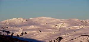
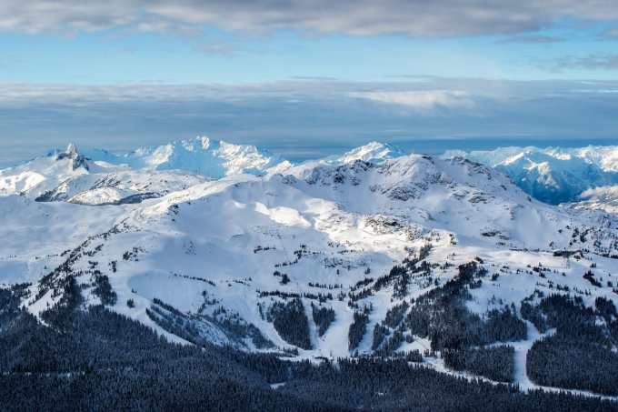
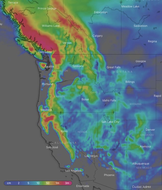
It’s looking like a good old stormy week ahead with several systems coming off the Pacific likely to reach the Californian Sierras where between 50-90cm of snow should fall along its main spine. It’s welcome news after the lack of snowfall in the past week or so. The Cascades will also receive a similar amount, while the Coast Mountains will again be off the charts with metres – that’s plural – piling up at higher altitudes. The Canadian Rockies will also reach the metre mark at a lot of resorts, while 40-75cm should fall on some lucky mountains of Montana, Wyoming and Idaho. Further south on the American Rockies, 15cm-30cm of fresh powder should keep resorts there ticking along nicely.
Thursday 3 Jan:
A low approaching Canada’s Coast Mountains will drive a strong S-SW flow over the area while dumping a massive amount of snow there. Big amounts will also fall over the Canadian Rockies and northern Cascades, while less will fall over the Rockies in the north of Montana and Idaho during the first half of the day. Everywhere else will remain settled under high pressure.
Friday 4 Jan:
The low will creep onto the Coast Mountains and weaken, while heavy snowfalls gradually ease to flurries over Canadian resorts. There’ll also be snow showers/flurries over the Cascades and Rockies of northern Montana and Idaho. Meanwhile, a second low will spin-up as it approaches the Californian coastline.
Saturday 5 Jan:
The second low will make a sharp turn to the north and then traverse the Cascades and Coast Mountains, but not before heavy snowfalls get under way on the Sierras. The heaviest snowfalls over the Cascades and Coast Mountains will be in the wake of the low later in the day. Moisture will also work its way inland, allowing snowfalls to flare up over the Canadian Rockies and Rockies of the southern half of America.
Sunday 6 Jan:
The low will chug eastwards over Canada, while a fairly cold and moist westerly flow ensures pretty much every resort in western North America gets a good coating.
Monday 7 Jan:
Heavy snowfalls will shift north from the Sierras to the Cascades, then to the Coast Mountains later in the day as a front combs the area. Adjacent areas inland will likewise receive similar treatment with the northern half of the American Rockies, followed by the Canadian Rockies, getting a bucket load or two of fresh powder.
Tuesday 8 Jan:
Yet another low will trundle over Canada with heavy snowfalls on resorts there abating late in the day. A font extending further south will also dump snow onto the Cascades then the northern Sierras, while resorts in Montana and Idaho should see snow too.
Wednesday 9 Jan:
It’s likely a low will cross the Sierras with another hefty dump there, while remaining snowfalls should clear Canada and the Cascades. Idaho and Montana should keep their snowfalls going for much of the day.
Extended Outlook:
The southern portion of the American Rockies should get a good dusting next Thursday and possibly next Friday, as the low leaves the Sierras to wander further inland. After that, a moment of calm before then next storm cycle hits.