Australian Forecast – Winter Keeps Chipping Away with More Snow & Snowmaking on the Way
Published early Sunday, 26th July 2026
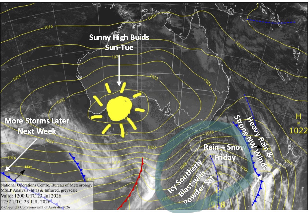
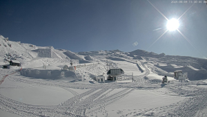
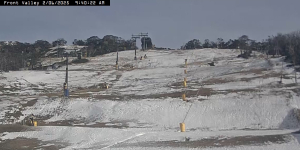
Wintry conditions saw resorts pick up a dusting of around 2-5cm during Thursday and Friday, while the snow guns had a go at it. However, niggly winds from the west-southwest blowing across the line of chair lifts caused some to go on wind hold.
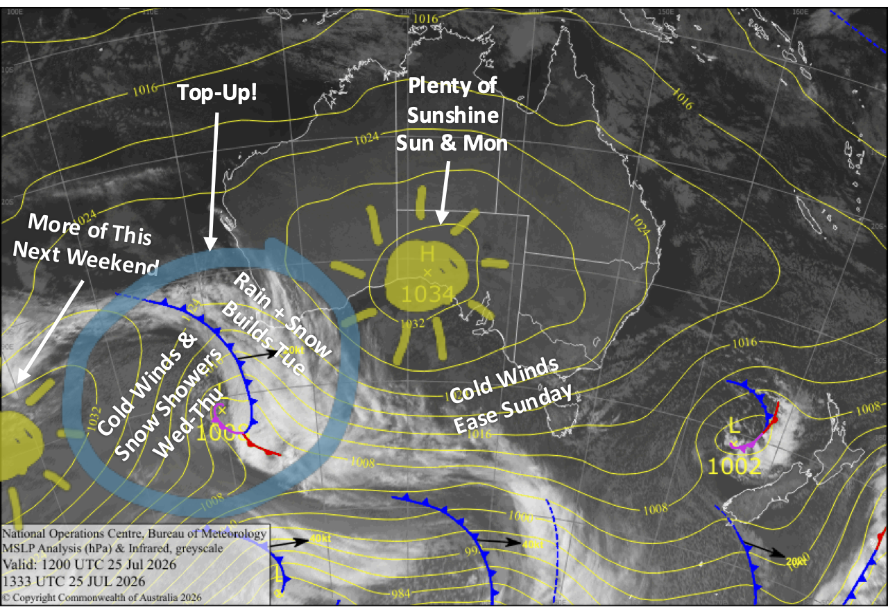
Sunday and Monday will be mostly fine as a ridge of high pressure swings past, and with improved snow conditions and continued snowmaking overnight, it’ll be a great time to head up.
The next storm system crosses during Tuesday and Wednesday, giving us a top-up of around 5-15cm. Snowfall and northwest winds build during Tuesday, although it turns wet on the lower slopes before a cold southwest change overnight whips through, bringing a burst of snow to low levels.
Cold winds persist into Wednesday and Thursday, with lingering snow showers, especially for Mt Baw Baw, so the snow guns will get another good long run in and conditions will continue to improve.
Sunday 26th July
Clouds gradually break up during the morning for a mostly sun-filled day, but they’ll linger a bit longer in Victoria. Brisk west-to-southwest winds gradually die away.
Monday 27th July
A mostly sunny day, apart from some cloud in Victoria affecting Mt Buller and Baw Baw. Northwest breezes develop.
Tuesday 28th July
Light snowfall to around 1500-1600m develops during the morning as northwest winds become strong, then builds into heavier falls during the latter half of the day as snow levels lift to 1600-1800m.
It’ll be a wet day down on the lower slopes, but a cold west-to-southwest change whips through overnight, bringing a quick burst of snow to low levels. Throughout the day and night, we should pick up around 5-15cm of fresh snow dispersed from low to high altitudes, although we’ll likely see less at 1500m and below.
Wednesday 29th July
Resorts will receive another dusting from light snow showers lingering until around evening, interspersed with a little sunshine, as strong, cold southwesterlies gradually ease. The snow showers will be more persistent at Mt Baw Baw where 5-10cm could accumulate.
Thursday 30th July
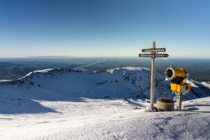
A mostly fine day, with chilly southerly breezes, although Mt Baw Baw will be more in the firing line and will remain cloudy and could see a few more snow showers.
Extended Forecast
After the top-up of snow this week, we’ll score a run of fine weather during Friday and the weekend as high pressure drifts overhead. Overnight temperatures will get nice and cold for the snow guns to add more of their crystal dust, so conditions will be great.
The next storm is expected to cross sometime between Monday the 3rd and Friday the 7th of August. The system is expected to bring a bout of cold air with light snow showers at the least, but there’s the potential for something more, if we’re lucky.
That’s all from me today, folks. I’m firing out these forecasts every Monday, Wednesday and Friday throughout the season, and an extra update on Sundays during peak season. Have a great day, and I’ll see you back here on Monday.
Grasshopper