New Zealand Weekend Forecast, Friday July 10th – Last Dregs of the Storm Clear for a Magical Matariki Weekend
Mountainwatch | The Grasshopper
Published early Friday, 10th July 2026
The last dregs of this week’s storm clear up today, Friday, as ski fields tally up final storm totals and dig out their front doors and equipment. Most of this work has already been completed in the Southern Lakes, where the tally sits at 30-45cm after an extra 10-15cm fell on Wednesday.
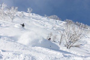
However, it’s still an ongoing process in Canterbury, which bore the brunt of the storm, with storm tallies between 70 and 120 cm being reported by Thursday morning, with another 24 hours of snowfall yet to be added. Mt Hutt reported a whopping 97cm, and the whole of Canterbury has been completely transformed, with the smaller club fields scrambling to open as soon as possible to make the most of the best early-season conditions in a long while.
Mt Ruapehu is also yet to give final storm tallies after snow arrived there Wednesday night. We were expecting 10-30+ cm by the time the storm clears out on Friday.
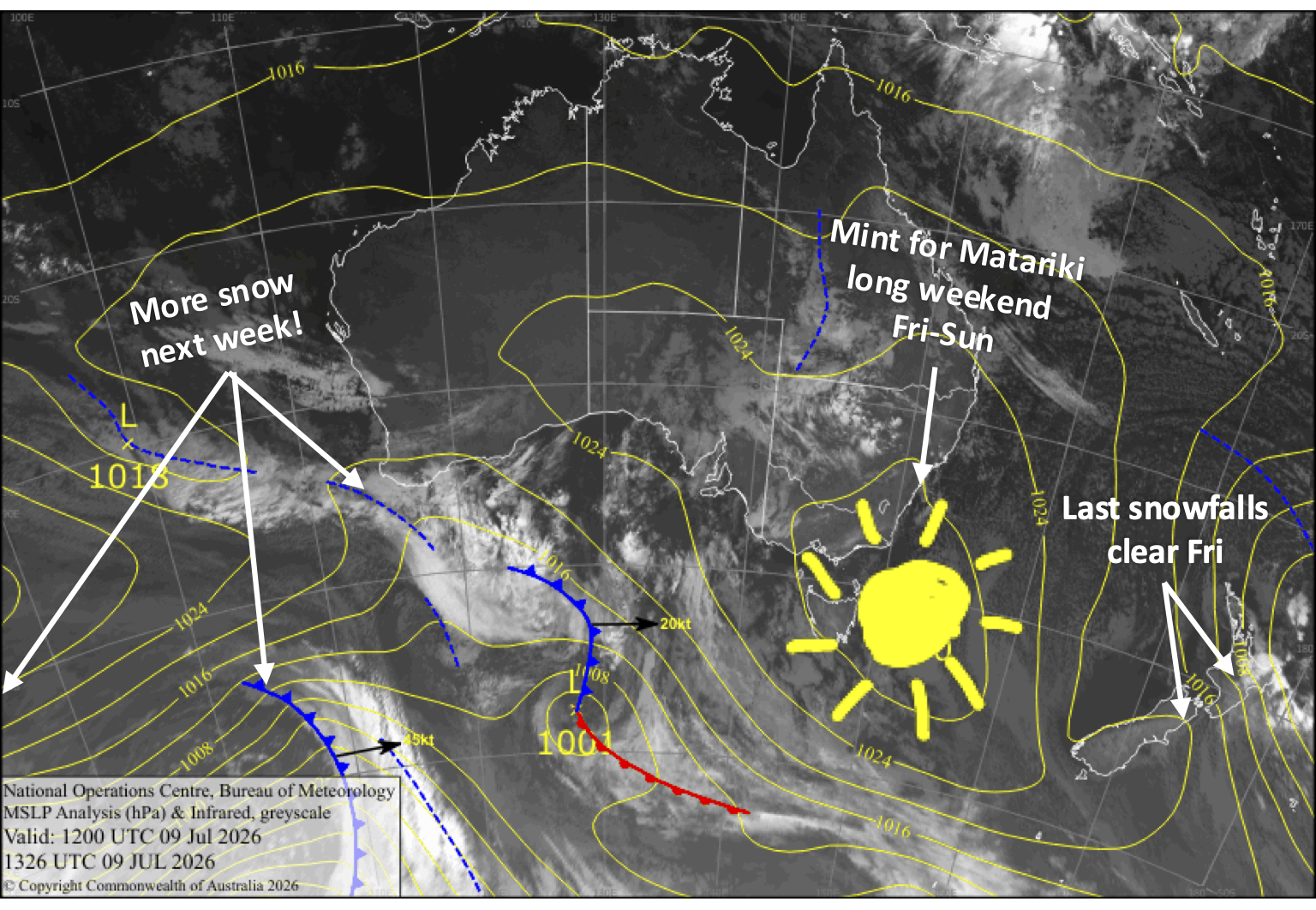
This weekend is a long one, with Friday being a public holiday for Matariki, the Māori New Year. With a tonne of fresh powder and fine, sunny weather settling over the country, it’ll be one you won’t want to miss out on. Storms return next week with a couple of fronts crossing the country late Monday and Tuesday, bringing shots of snow mainly to mid and upper slopes.
Friday 10th July
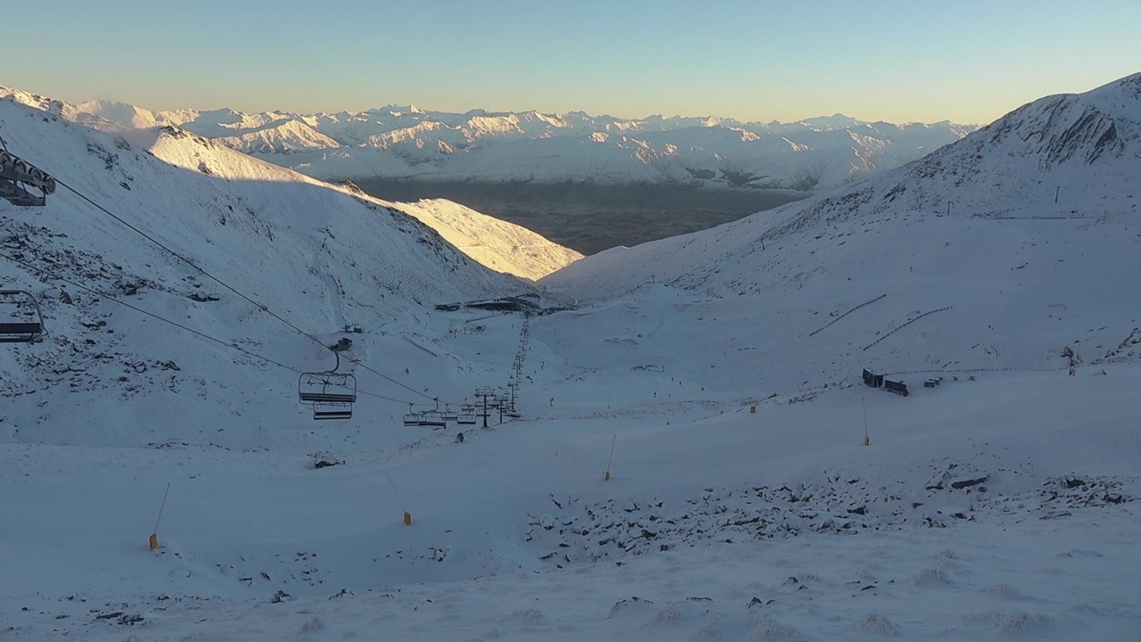
Friday is a public holiday for Matariki, the Māori New Year, and it will be a beauty for the Southern Lakes with clear, sunny skies and a light, chilly southerly breeze.
A massive powder day for Canterbury that you won’t want to miss. Cloud over Mt Hutt and the Craigieburn Range ski fields gradually clears for a sunny afternoon, but it’ll remain cloudy in the north with light flurries lingering into the afternoon. Cold southerly breeze.
Light snowfall on Mt Ruapehu gradually clears as a stiff, cold southeast wind eases, and skies will brighten in the afternoon as the cloud cover thins.
Saturday 11th July
A day you won’t want to miss with clear, sunny skies across South Island ski fields, apart from some morning cloud in north Canterbury. Light southerly breezes die out.
Mt Ruapehu will remain partly cloudy with a chilly southeast breeze.
Sunday 12th July
Another nice, sunny day for South Island ski fields with a northwest breeze developing.
The best day of the season so far for Mt Ruapehu, with a fresh layer of snow, clear skies and little to no wind.
Monday 13th July
Cloud increases over the South Island as a front approaches from the west, and northwest winds strengthen, especially in Canterbury, where winds will rise to a strong gale. The front will bring a shot of around 2-5cm of snow as it crosses after dark, but it could be wet and sleety about the lower slopes, especially in Canterbury. However, Treble Cone should pick up 10-15cm being closer to the Main Divide, and will likely see snow showers start up earlier in the afternoon.
Mt Ruapehu starts out fine, but cloud will increase in the afternoon as northerly winds pick up.
Tuesday 14th July
South Island ski fields will start the day fine, but northwest wind will become strong once again as another front approaches from the west, especially in Canterbury. The front crosses the Southern Lakes in the afternoon and evening, bringing another shot of snow to mid and upper slopes but rain to lower slopes. It’ll be a similar story in Canterbury when the front crosses the region at night, but the snow/rain will be much lighter, with Mt Hutt likely staying dry.
A front passes over Mt Ruapehu during the morning hours, bringing a shot of around 5-15cm of snow, but it’ll likely fall as rain at base level. Behind the front, strong northerlies change to a moderate westerly with lighter, occasional showers of mid-upper level snow and low-level rain.
Extended Forecast
The storm window remains open until late next week. However, models aren’t well aligned on the strength of passing storm systems, with ski fields receiving anywhere from a light dusting to a sizable powder dump. High pressure will then likely build sometime from next weekend, the 18th and 19th, for a settled spell before the next storm window opens up later in the month.
That’s all from me today, folks. I’m sending out NZ forecasts every Monday, Wednesday and Friday throughout the season. Have a great weekend, and I’ll see you back here on Monday.
Grasshopper