Australian Weekend Forecast, Friday July 10th – Bluebird Days Make Way for a Timely Boost to the Snowpack

Mountainwatch | The Grasshopper
Published early Friday, 10th July 2026
Friday will be the last of this run of stunning weather we’ve had since last week’s storm transformed the Australian Alps with 20-45cm of snow. The snow guns have been firing on all cylinders most nights and early mornings, so more lifts have opened this week but with school holidays at their peak, the open terrain is bursting at the seams.
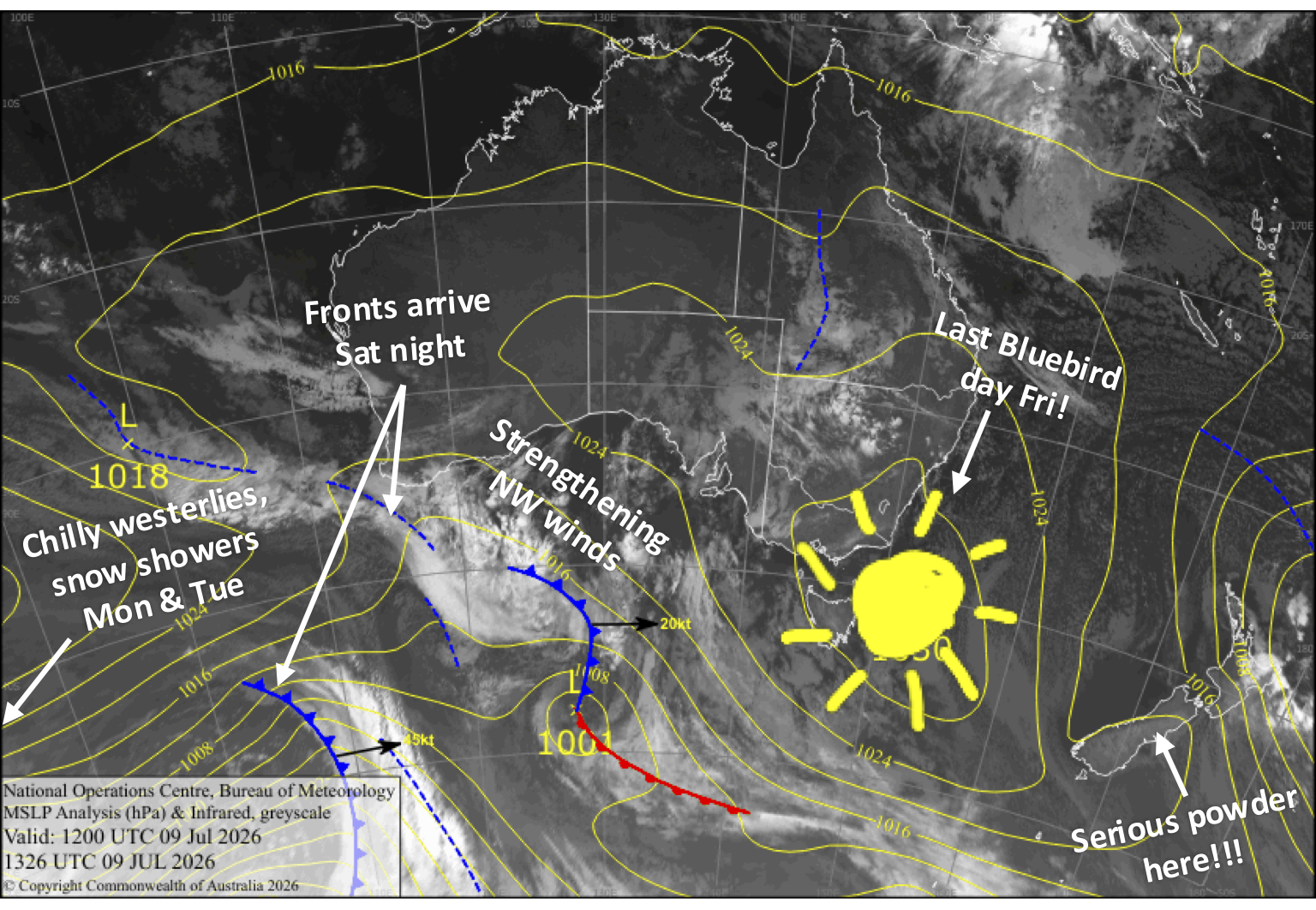
The high-pressure system, which brought a record-breaking pressure reading of 1044.5 hPa to Aussie shores earlier this week, drifts into the Tasman Sea, allowing the weather to turn more active this weekend, with a series of cold fronts moving in starting Saturday night.
We’ll cop some low- to mid-level rain with that initial front, but a cold westerly flow afterwards will bring snow showers from Sunday through Tuesday, although it’ll likely turn wet about the lower slopes at times on Monday and Tuesday.
Storm totals are likely to range from 15cm to a healthy 40cm, with the upper slopes above 1700 metres receiving significantly more than the lower slopes due to fluctuating snow levels. This will provide the timely boost we need to take the season up another gear.
Friday 10th July
Another fine day, with some scraps of high cloud and a developing light northerly breeze. Cold snow-making temps early morning and overnight for New South Wales, but they’ll be marginal in Victoria.
Saturday 11th July
Northwest winds strengthen as a cold front approaches from the west, with showers building over Victoria from the morning and New South Wales from the afternoon, falling as snow to around 1700m.
The cold front crosses overnight, bringing a period of heavier snowfall to mid and upper slopes before snow levels quickly drop below base levels and start to ease before dawn Sunday.
Sunday 12th July
A day for the storm riders with snow showers throughout the day, reaching as low as 900-1000m, becoming more persistent in the evening as snow levels start to lift. Strong, cold westerly winds with blizzard conditions.
Monday 13th July
Showers continue, falling as snow on mid and upper slopes with snow levels hovering around the 1600-1700m mark. Strong, chilly northwest winds, with blizzard conditions.
Tuesday 14th July
Snow showers again throughout the day as snow levels bounce between 1500-1700m or less, with strong, gusty west-to-northwest winds. The snow showers clear at night as a colder, drier southwesterly wind change arrives.
Extended Forecast
After another settled spell, the next storm window opens up from Sunday or Monday, the 19th or 20th of July. It’s likely we’ll cop the usual load of prefrontal rain before a cold change brings snow showers over the following few days, giving the slopes another top-up.
That’s all from me today, folks. I’m sending out these forecasts every Monday, Wednesday and Friday throughout the season, and I’ll fire out an extra update on Sundays during peak season. Have a great couple of days, and I’ll see you back here on Sunday.
Grasshopper