Australian Forecast, August 7th – Clear, Calm Skies, And Some Snowmaking, Before A More Hopeful Outlook
Mountainwatch | The Grasshopper
Written early Monday 7thAugust, valid to Wednesday 9thAugust
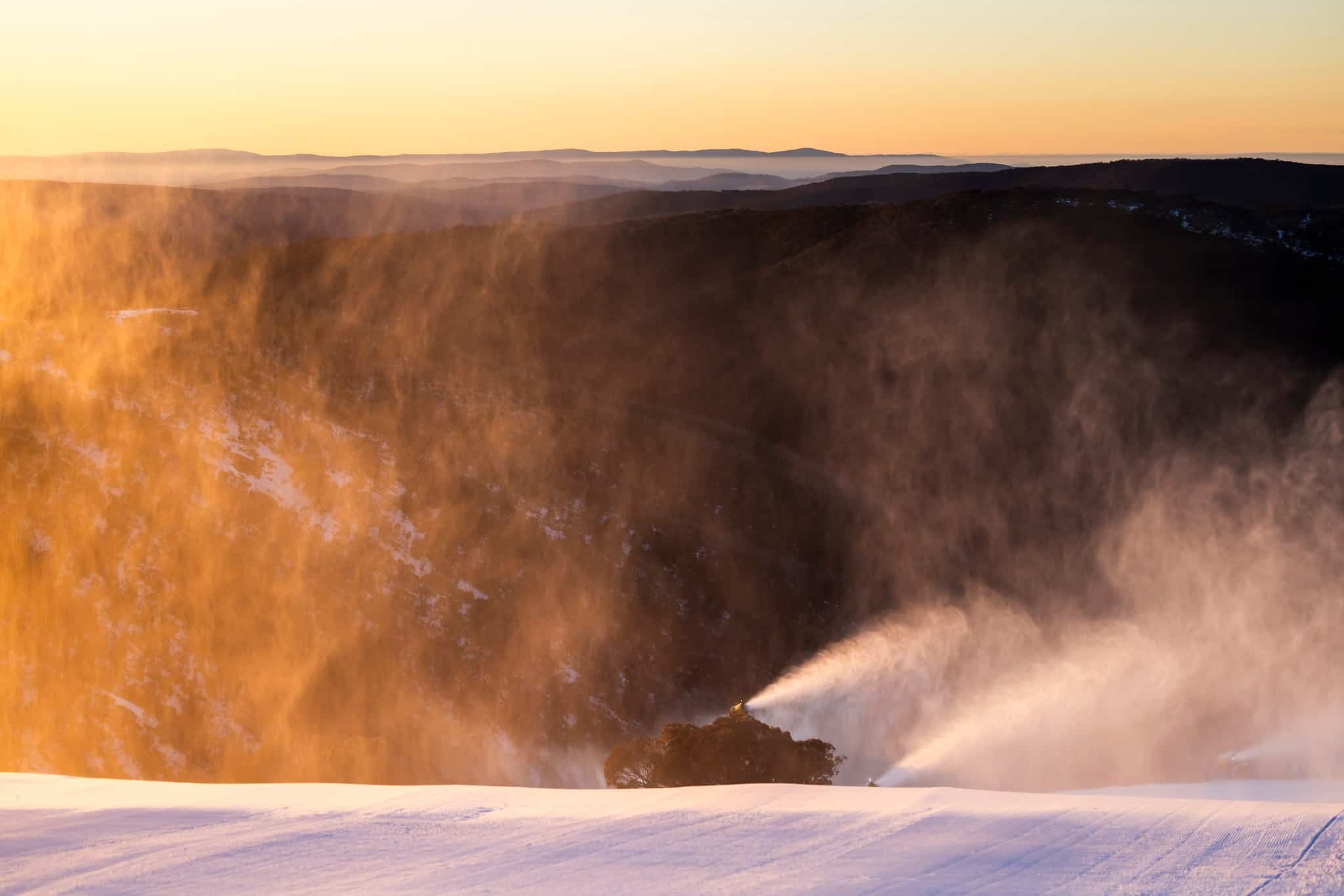
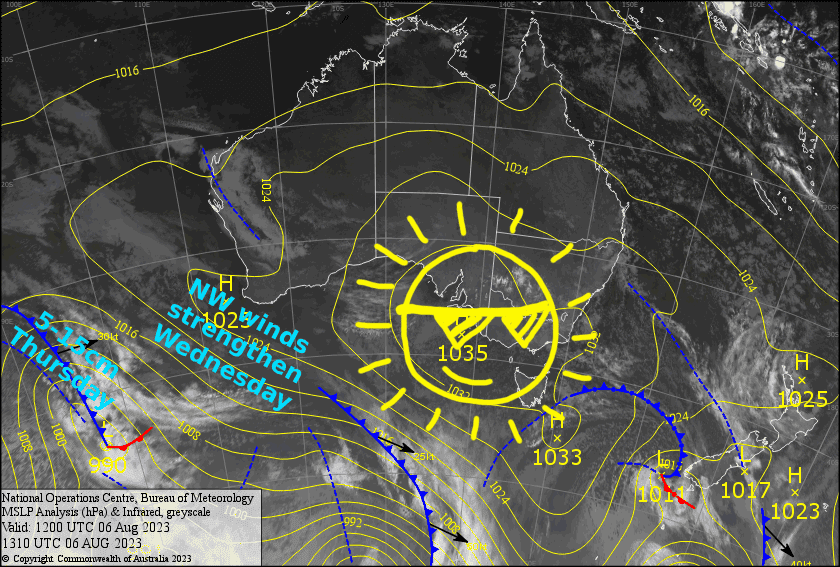
The weather will be nothing short of stunning the next few days as a big high drifts eastwards over us. Northwest winds picking up later on Wednesday may be the only thing that could possibly ruffle a few feathers, but apart from that, the sun will be bright and the air fresh and calm. Sub-zero overnight temperatures should see the snow machines patch up any holes and bolster the main runs, which are running at low tide after a tough month.
As far as the weather goes, there’ll be no better place to be than on the Aussie slopes.
Monday 7th
A beautiful sunny, calm day, with just a bit cloud popping up in the afternoon.
Tuesday 8th
Another gorgeous sunny day, with a light westerly zephyr.
Wednesday 9th
Fine with a bit of high cloud. NW winds will pick up, becoming strong in exposed areas.
Extended Forecast
A cold front will pass over the Aussie Alps on Thursday. Current forecasts are looking more promising than previous ones, with a colder airmass set to deliver a nice top-up of about 5-15cm down to around 1300-1400m. Fingers crossed it’s not a fizzer!
Cold W-SW winds should see additional light snow showers falling across Friday and Saturday, before a high clears things up Sunday.
Next week, more active weather looks to take hold, with some good early signs of snowfall from mid-week onwards.
That’s all from me today, folks. See you again Wednesday.


