Australian Forecast, June 8th – Mostly Fine for Opening Weekend After 5-10cm Up High on Friday
Mountainwatch | The Grasshopper
Valid Thursday 8thJune to Sunday 11th June
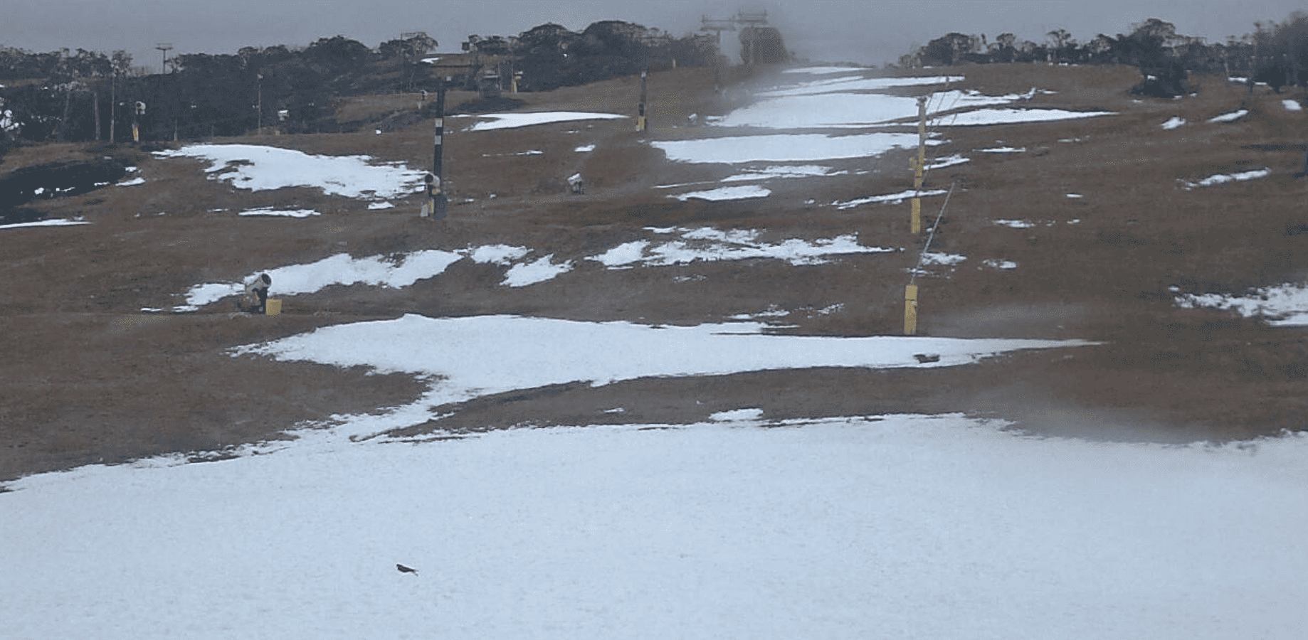
I’m baaaack! And you know what that means… it’s the start of another season down under. It’s opening weekend this weekend, and it’s a long one thanks to the King of England. Unfortunately, there’s no snow!
The previous snowfall has all but completely melted away. But that’s not unusual at this time of year here in the Aussie Alps. Most of you all know this, and that’s why you’re still looking forward to the weekend, which will be more social than snowy, more about the chin wagging than the shredding – the avant-ski as opposed to the après-ski.
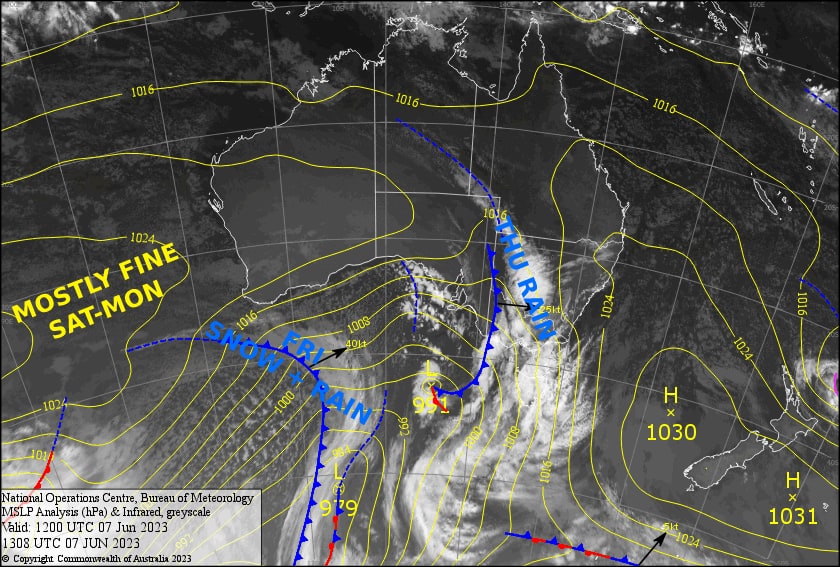
Now, the weather… It’ll be a rough start to Friday as a front passes overhead, but we should see 5-10cm falling on the upper slopes, above about 1700m, and just a dusting below to 1400-1500m whiles conditions abate and temperatures drop. High pressure will then bring mostly fine weather over the 3-day long weekend, albeit a little cloud here and there at times. Keep your eyes peeled on the forecast next weekend, because signs are looking good for a couple of nice dumps.
Friday 9th
It’ll be a rough start to the day, with mix of rain + snow coming down and W-NW winds blowing a gale. However, things will brighten as the precip pins back to snow showers later in the morning with snow levels dropping to about 1400-1500m. The snow showers and winds will continue to abate throughout the afternoon and the sun should even make an appearance.
Saturday 10th
Not a bad day to be had. A westerly breeze will push in just a little morning cloud for NSW, but a bit more on the Victorian side, which will linger throughout the day, and some light drizzle is likely to show up on Mt Buller.
Sunday 11th
A mostly fine, calm day, with just a little cloud on the Victorian side.
Monday 12th
A bit of cloud, plenty of sun, and a N-NW breeze. Get amongst and make the most of the day off!
Extended Forecast
Next week is looking pretty good for snowfall. A low dipping under Tasmania will see the weather starting to pack in during Tuesday, then clearing up Wednesday night/early Thursday. At this stage we could have 10-20cm above 1400-1500m on the line.
We could also see another low follow close behind, this one potentially colder and more vigorous than the one preceding it, with good signs for something decent next Friday into the weekend – just what we need!
That’s all from me today, folks.


