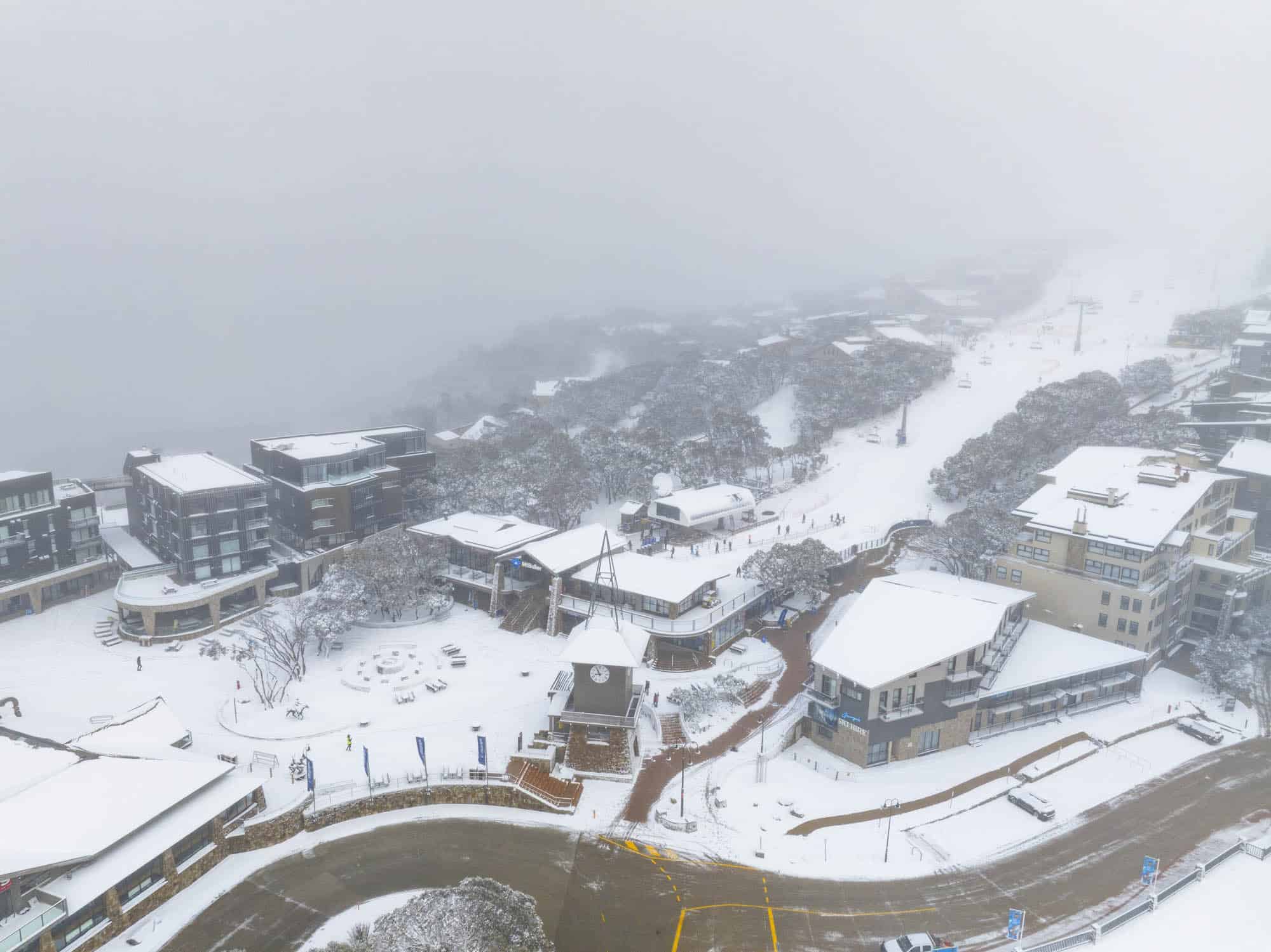
Australian Forecast, June 19th – Round Three to Drop 15-25+cms Today
Mountainwatch | The Grasshopper
Valid Monday 19thJune to Wednesday 21stJune
We’ve got the third round of these snowstorms lined up today, if you include that one mid last week. Yesterday went according to plan with about 5-15cm sprinkled over Aussie resorts, with some flakes making it down to 1000m, although it unfortunately didn’t stick at these lower altitudes.
Today’s cold front has a bit more juice in it with a solid 15-25cm expected, although we could see up to 30cm in some spots, most likely in Victoria which may squeeze a little more out of this front than NSW.
The following couple of days should be all go, as high pressure improves weather conditions during Tuesday, followed by a beaut day Wednesday. There’ll also be plenty of snowmaking to bolster the main runs while freezing temps hang around.
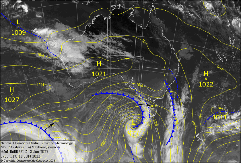
Latest pressure analysis and satellite image. Source: The BOM (vandalised by the Grasshopper)
Monday 19th
Snowstorm alert! Snowfall will become heavy for a time as the cold front passes over, first over Victoria this morning into early afternoon, then NSW during the afternoon. The snow will ease behind the front with the cloud eventually breaking up too. Snow levels lowering to about 800-900m, but some snow may make it a little lower. Gale NW winds and low visibility in blizzard conditions, turning a fairly strong and frigid SW behind the front.
Tuesday 20th
A mostly fine powder day. However cloud will linger over Baw Baw, with a snow flurry or two possible there, as well as Buller where it’ll break up during the arvo. Freezing S-SW winds will gradually ease, so wrap up warm!
Wednesday 21st
A beautiful, winters day with a cold start. It’ll warm up as a northerly breeze picks up.
Extended Forecast
This strong of unsettled weather looks to continue through the second half of next week. First a quick top-up of perhaps 5-15cm as a front passes over Thursday night, then a prolonged period of light-moderate snowfalls Saturday through Mondayas a low dips underneath us. For the latter snow event, we could be looking at up to 10-20cm, but as the freezing levels will mostly be hovering between 1400-1600m, some of that will be the wet stuff on the lowest slopes and thus lower accumulations are expected there.
That’s all from me today, folks. See you again on Wednesday!


