Australian Weekend Forecast,June 16th – Cloud, Drizzle, Wind & Sunshine today & Saturday, then 5-15cm Sunday
Mountainwatch | The Grasshopper
Valid Friday 16thJune to Sunday 18thJune
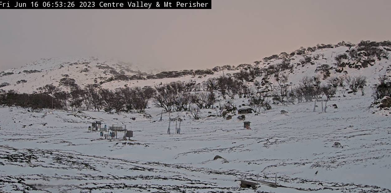
The upper slopes are looking much whiter after that mid-week snowstorm dropped up to 20-25cm above 1700m, with 5-15cm below that.
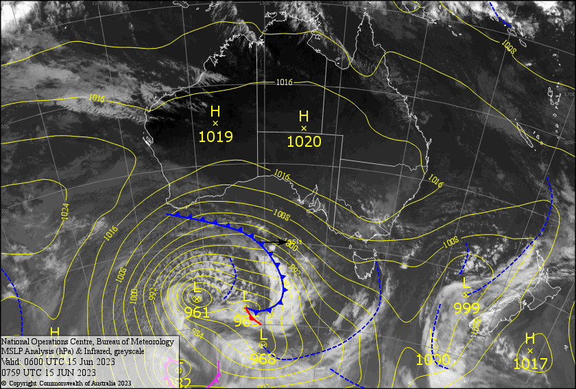
The next couple of days will bring a mix of cloud, sunshine and a little drizzle, while NW winds gradually strengthen ahead of an approaching cold front. Freezing levels will be hovering around 1800-1900m today, before eventually lowering to 1500-1600m during Saturday.
This means that when the cold front passes over early Sunday, we’ll skip the usual prefrontal rain and cop a straight 5-15cm, with snowflakes possibly reaching a low 1000-1100m altitude.
Friday 16th
A fair bit of cloud about during the morning with light, patchy drizzle here and there. It’ll brighten up during the afternoon as the cloud thins and breaks up. NW winds strengthening, possibly reaching gale in the west.
Saturday 17th
Gale NW winds will make it much rougher than it ought to be on what should be a mostly sunny day. There will, however, be a little bit of cloud lurking around, as well as a spot or two of drizzle.
Sunday 18th
A fairly intense, but brief period of snow will fall on the Vic side during pre-dawn hours, then on the NSW side during the morning hours that follow. Snow levels may get as low as 1000-1100m during this time! Lingering snow showers and flurries will abate during the afternoon as fine breaks increase, and freezing, gale NW winds turn to a strong westerly.
Extended Forecast
The horizon is looking snowy white folks. First, Monday’s cold front is looking a little beefier than previous forecasts. We’re looking at snowfall figures of 15-25cm for the day, with snow levels getting all the way down to 800-1000m! It’ll be a cold one, that’s for sure.
Fortunately, that cold air will linger for much of the week, so that when the next system comes through late Wednesday/Thursdayit should be snow that falls, which may continue into next Friday. And that’s not all, because another snowstorm is on the cards next weekend too! With the additional snow making that will get done during this period, the resorts will be humming and off to a relatively good start to the season.
That’s all from me today, folks. See you again on Monday!
Grasshopper


