Countdown to Winter – Season-Starter Snowfall Expected Saturday
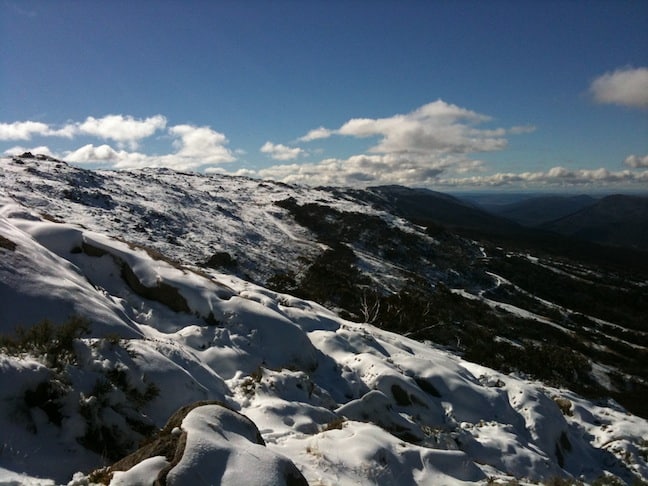
The NSW Snowies had a good pre-season snowfall at the end of May. Image:: Thredbo
Countdown to Winter | Alex Horvath
It’s 11 days until the kick-off of season 2011 and things are certainly starting to look interesting. If you’ve been paying attention to our 3-hourly forecast model you’ll have noticed we have some moderate snowfalls inbound this weekend and into early next week. Now, the reason to get excited about this one is the possibility for it to shape into a season starter…
Synoptic Outlook:
Currently, with the development of the series of cold fronts due to hit the SE of Australia from Saturday morning, freezing levels are tipped to lower during Saturday, resulting in a nice dusting of snow on the upper slopes of the resorts and a little less lower down.
Moving into Sunday we see a drop in freezing levels drop down to about the bottom lift line of most of the resorts, where it should remain stable until Tuesday/Wednesday. Alongside these colder temperatures we see a series of fronts moving through the region, that will deliver moderate snowfalls each day.
“The coming system is looking more and more like the real deal” Mountainwatch’s alpine meteorologist, The Grasshopper, said. “I’m calling it the great white hope. The front on Saturday will have those empty brown hills on the ropes, and the second surge of cold air and moisture on Monday will deliver a knockout punch, setting us up for a fantastic opening weekend.”
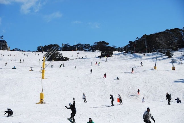
Perisher opened Front Vally on 21 May thanks to May snowfalls. Image:: Perisher
What it means for ’11 Season Kick Off:
So while we are counting down the days and checking the charts every hour in preparation for opening weekend, let’s take a step back and investigate the likelihood of this season starting with a bang!
As we have mentioned in the past, forecasts outside of approximately 72hrs are filled with guesswork, and looking at what the different forecast models are saying for this weekend it is easy get confused. The possibility of the front due on Saturday penetrating north to hit the alps – which is what we need for this snow to eventuate – is dependent on the exact position of the high pressure ridge to the north and west and we don’t know what it’s going to do as yet.
This complex set up is adding to the uncertainty across the models with some suggesting the delivery of considerable falls early next week and some looking more conservative.
The good news is that the models agree that it’s going to be cold, so any precipitation we do get is a great chance of falling as snow.
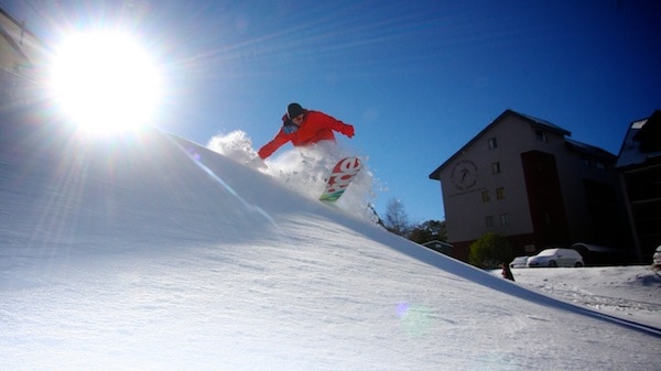
Falls Creek opening weekend 2010 was the best in years, here Ride Team Snowboarder Kieran McLaughlin enjoys favorable early season conditions. Image: Chris Hocking
Pre-frontal Rain:
Being early season, the current situation with higher freezing levels is nothing to worry about. There is nothing on the ground to be washed away so in this instance any rain that falls is going to enhance the fridge effect that we introduced to you guys last week.
“Systems like this always hold a little bit of a surprise. You never know quite how much snow they’re going to squeeze out as moist air rises rapidly over the Alps. But the good thing about this system is that the bulk of the moisture is due once the cold air has arrived, and so rain shouldn’t be the problem it often is.” The Grasshopper says.
Either way, the next few days will provide a better picture so keep checking our forecasts in order to get the latest information. As this system progresses we will provide further analysis and will be sure to keep the gurus providing you with the latest information!
Long Range Outlook:
Moving further into the week we are likely to see cool nights with mostly dry stable conditions across the alps that provides an excellent opportunity for the resorts to send their snowmakers into high gear, enabling a strong base to be ready for opening weekend skiing and boarding. The next frontal activity we are seeing is likely to occur around June 11 – 14. Its still early days for this one but the potential is definitely there.
Taking a look at our more long-range signals the SOI index is currently sitting at +2.3 (30 day mean SOI as at 23/5). This value is showing a return to more neutral conditions providing a positive outlook for a solid season as predicted by the Grasshopper in his seasonal outlook.
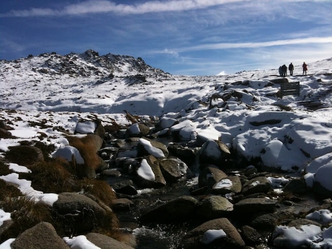
Snow at the back of Thredbo on 28 May. Image: Thredbo
What the resorts are saying:
“We are excited to see what Mother Nature delivers across the weekend, our snowmakers are ready to go, our summer grooming means that we only need a couple days to have a base ready to go. Next week will be all about making as much snow as possible ahead of opening weekend and anything natural that falls will be an added bonus! There is plenty happening in Thredbo across the long weekend, both on the hill and across the resort so come down and get involved!” Susie Diver, Thredbo Media.
“Here at Perisher we are holding our breath in anticipation of the cold fronts that are due early next week. We will be enhancing any natural snowfalls with plenty of snowmaking in order to have a solid base ready to go for skiing and riding over opening weekend. There will be plenty going on including the annual Snowy Mountains of Music see www.perisher.com.au for more details.” Kellie Schlecht, Perisher Media.
“The colder temperatures we are expecting over the coming week, combined with natural snowfalls will enable us to open a number of runs for skiers and boarders across the long weekend. Our snowmakers are on standby 24/7 this week and will be making the most of every opportunity they can to get snow on the ground.” Paul Chandler, Selwyn Snowfields.
The stoke is high, spread the word! Snow is on the way and opening weekend may still turn into more then just a party!
Falls Creek forecasts,
snow reports and
live snow cams.
Mount Buller forecasts,
snow reports and
live snow cams.
Charlotte Pass forecasts,
snow reports and
live snow cams.
Hotham forecasts,
snow reports and
live snow cams.
Thredbo forecasts,
snow reports and
live snow cams.
Mount Baw Baw forecasts,
snow reports and
live snow cams.


