Grasshopper’s 2023 Australian Snow Season Outlook
Mountainwatch | The Grasshopper
In a little over two months’ time the Australian ski season is expected to get underway, but in terms of snow storms, it’s now open season with the first snowfall of the year possible any day now. After three consecutive seasons riding in La Nina’s often bumpy trail, the atmosphere is back flipping 180 and turning climate drivers on their heads, with an El Nino and positive IOD expected to bring drier, clearer skies, and possibly less of the hallowed fluffy stuff.
It’s official, the triple-dip La Nina has finally been put to bed. Overall, La Nina’s look good for Aussie snow, but on closer inspection we see greater variation as they walk a tight rope between rain and snow due to marginal temperatures. In recent times, our Aussie snow has often fallen on the wrong side of that line with high precipitation not always translating to more snow in Alpine areas.
While the 2020 and 2021 seasons could simply be summed as poor and slightly subpar respectively, last season was pretty decent, with consistent snowfall and several big dumps allowing the snowpack to survive a few big rain events.
Over the last few months, sea surface temperatures across the tropical Pacific have been steadily warming, pushing past La Nina thresholds into neutral territory. This warming trend is expected to continue where there is a good chance it’ll reach El Nino thresholds during the winter months – most likely July at this stage.
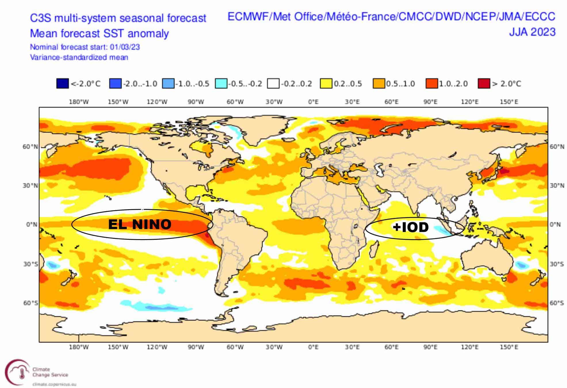
C3S seasonal forecast for sea surface temperature anomaly for the winter months showing El Nino in the Pacific Ocean and a positive phase of the IOD in the Indian Ocean. Source: Copernicus Climate Change Service.
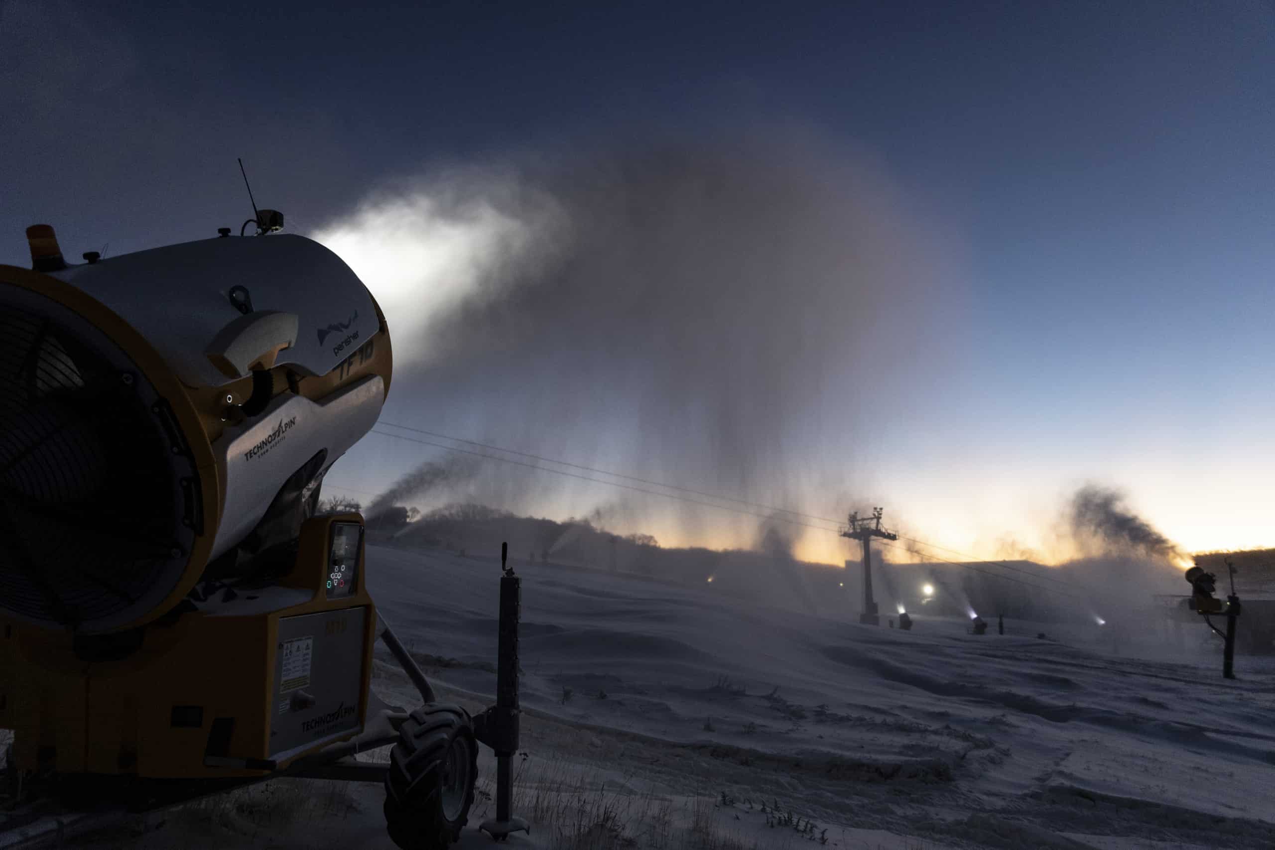
Being the polar opposite to hot, steamy La Nina, El Nino typically brings a different set of challenges for Aussie ski fields, namely, lower-than-average snowfall. It’s not ideal, but less rainfall and clearer, colder nights go some way to mitigate this as the snow that does fall isn’t washed away and we see an increase in artificial snow making.
Additionally, with more warm, sunny days, and clear, frosty nights, we might expect a more rampant melt-freeze cycle leading to crusty, icy conditions during the mornings, before softening during the afternoons. For those show prefer the latter it will give you time to sleep in, cook up a big breaky, and have several coffees before heading up the hill. If you are lazy, it’s a dream scenario, plus, who can complain about an increase in vitamin-D?
Looking further west, the Indian Ocean Dipole (IOD) is sitting within neutral bounds, but the majority of models expect we’ll see a positive phase throughout the winter months. It’s another blow to our snow outlook, as a positive IOD can exacerbate El Nino’s drying effect, leading to less natural snow.
However, despite these climate drivers not lining up in our favour, current forecasts are expecting these El Nino and IOD events may only reach moderate strength, with the hope that they will lack the harsh bite of stronger events. This is supported by seasonal models, which show only slightly warmer and drier conditions over the Aussie Alps, as well as slightly higher-pressure anomalies, predominantly towards the end of the season, suggesting we may only feel the bite at the tail end.
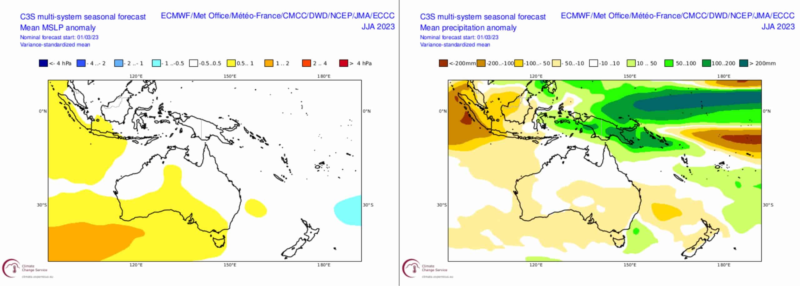
C3S seasonal forecasts for mean sea level pressure anomalies (left) and precipitation anomalies (right) for the winter months. Source: Copernicus Climate Change Service.
Wrap up
All-in-all, with climate drivers likely to grow in influence later in the season, we’re no less likely to cop some early season storms. We can remain hopeful that these storms will build a solid base for a season that may overall see less snowfall, but one where it’ll stick around and is maintained by increased artificial snow making.
I for one am looking forward to another season down under, and remember, these climate drivers only account for perhaps a quarter of snowfall variation – the rest is left up to the snow gods. As in any season, it’s often about timing, and the best way to time it right is to keep a handle on weather forecasts, which you can do right here on Mountain Watch with top-of-the-line model data, and forecasts by yours truly.
That’s it from me folks. If you’ve got a different theory on what’s going to happen this winter, or just want to provide feedback, then please hit me up on Facebook and hit the follow button while you’re at it.
The Grasshopper


