Grasshopper’s Weekly Japan Forecast, February 16th – Settled Weather Turns Ugly on Sunday Before the Powder Piles Up Again
Mountainwatch | The Grasshopper
Written Thursday February 16th(Japan Standard Time)
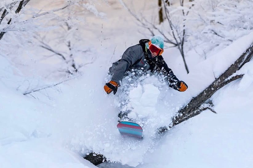
As expected, a snowstorm hit during Tuesday with many resorts around central Honshu reporting their largest, or next largest, daily totals for the season so far. Myoko was one of those resorts, with 80cm reported yesterday morning and another 40cm this morning.
In comparison however, Hakuba resorts received a paltry 10-40cm over the last couple of days, which, let’s be honest, I’d be more than happy with!
The next few days will be perfect for getting amongst all that powder with mostly settled weather. The weather then gets a bit ugly on Sunday as a low approaches from the west with heavy rain likely falling on low-mid slopes of Honshu.
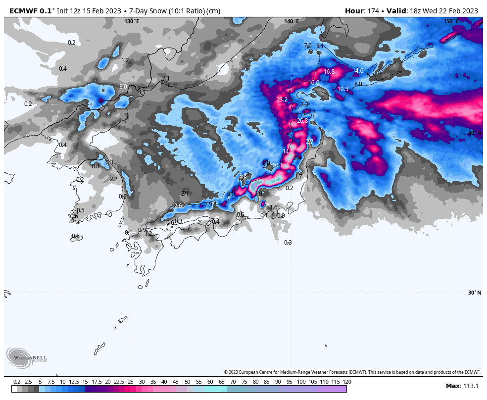
What goes up must come down, and that will fortunately be the case when the cold airmass arrives early Monday, kicking off a couple of days of heavy snowfall for Honshu, with light falls also instore for Hokkaido.
Thursday Feb 16th& Friday Feb 17th
Today, high pressure nudging in from the west will see snow showers eventually clearing most ski areas, excepting a handful in northern Honshu and Hokkaido who will continue to see just light flurries.
Friday will bring mostly sunny, settled skies to central Honshu, while cloud and lingering flurries farther north will become slightly more vigorous from late in the day as a weak trough makes landfall.
Saturday Feb 18th& Sunday Feb 19th
Saturday, central Honshu will continue to spend most of the day under sunny, calm skies, while the southern half of northern Honshu as well as Hokkaido will remain partially cloudy with the odd flurry.
Then, late afternoon and evening on Saturday, Hokkaido will have another period of slightly heavier snowfall with stronger SW winds as another front passes over. This front is attached to a low brewing in the south of the Sea of Japan, which will start spreading moderate to heavy rain+snow mix over Honshu from Saturday night where freezing levels will be up around 1800m over central Honshu.
Sunday, heavy rain+snow will continue to fall over Honshu, easing in the north from afternoon as the low passes to the east, with snow levels creeping down as cooler westerlies start to arrive. Hokkaido, meanwhile, will remain partly cloudy, with just the odd flurry for those who are exposed to a northerly breeze.
Monday Feb 20thto Wednesday Feb 22nd
Early Monday will see freezing N-NW winds finally sweeping over Japan with snow levels reaching rock bottom. Heavy snow will ensue over central Honshu and won’t start on an easing trend until Tuesday, before eventually clearing during Wednesday as winds ease, with the sun also breaking out to unveil absolute powdermonium!
It’ll be a similar story over northern Honshu, but after an initial heavy burst, snowfall rates will be more in the light-moderate category and may not entirely clear by the end of Wednesday.
Hokkaido will likely see periods of light snowfall during this time, with the heaviest falls coming during Monday with the arrival of the cold airmass from the north.
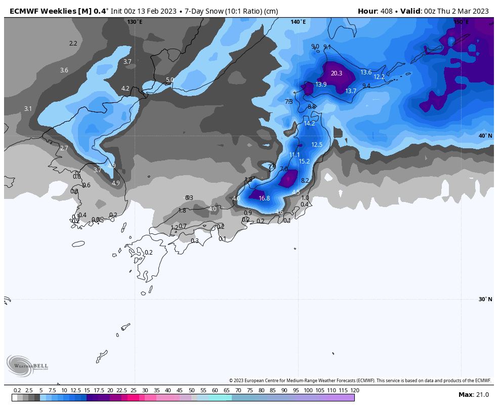
ECMWF ensemble model 7-day snowfall forecast starting next week Thursday, the 23rdof February, to the following Thursday, the 2ndof March. Source: WeatherBell
Thursday Feb 23rd& beyond
Models expect another cold front will bring good snowfall across Japan next Thursday before clearing the following day. From then onwards, the next several days appear to be dominated by more settled conditions in what is looking like a relatively quiet week weatherwise.
That’s all from me this week guys, see you next week!
Grasshopper


