Grasshopper’s Weekly Japan Forecast, February 9th – Freshies Today, then a Duo of lows, and Powder from Tuesday
Mountainwatch | The Grasshopper
Written Thursday 9thFebruary (Japan Standard Time)
Over the past few days we’ve seen relatively low snowfall on Honshu after some big numbers came in from a big dump last Wednesday into Thursday. Including that big dump and a couple of top-ups over the following few days, snowfall accumulations over the last seven days are still reported to be in 20-65cm range at base levels.
Not bad, and you could at least double that for higher altitudes too. To top it off, there have been a couple of warm, fine days thrown in for good measure, making for some great conditions.
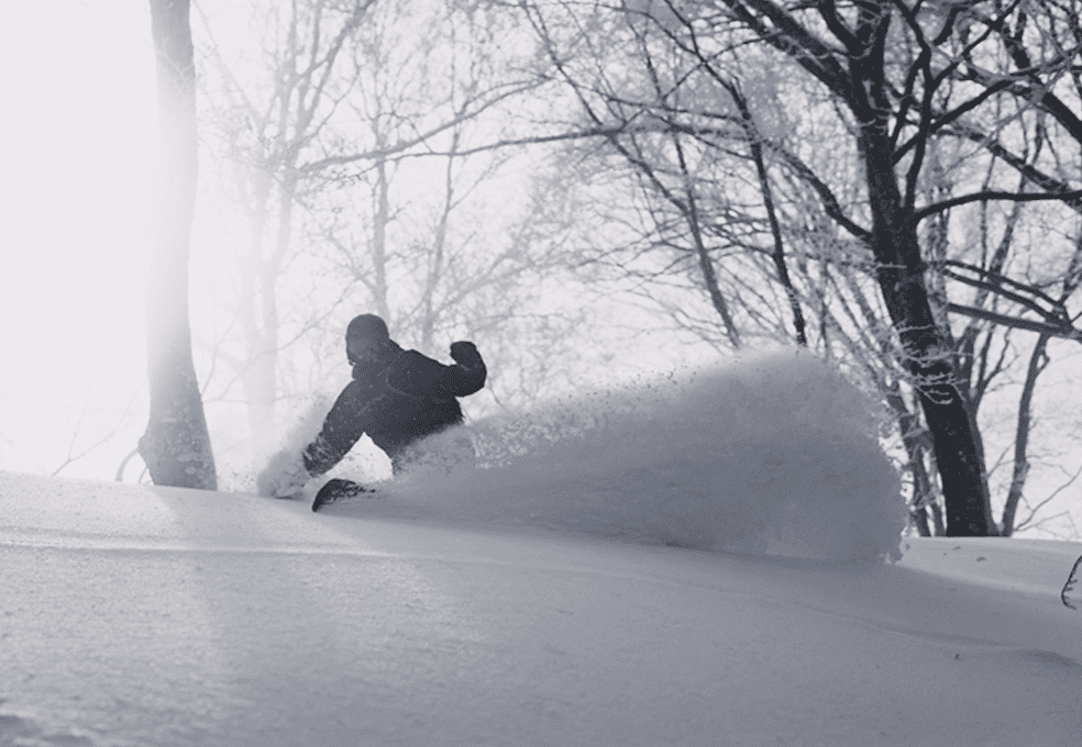
Further north on Hokkaido, consistent snowfall and cold temps have seen big weekly totals adding up, where close to a metre is reported at the base of Niseko resorts and just over 60cm at the base of Furano. Skiing conditions up there have been excellent with fresh deep, dry powder every day, along with sunny spells.
This week, we have great conditions today after a fresh load last night with a little more still to come. We’ll then see a duo of lows pop out of the west during Friday and Monday, bringing a heap of snow up high to Honshu, but wet soggy stuff down low. Fortunately, the latter of the two will usher in a healthy dose of cold NW winds, with several days of good snowfall for both Honshu and Hokkaido from Tuesday onwards.
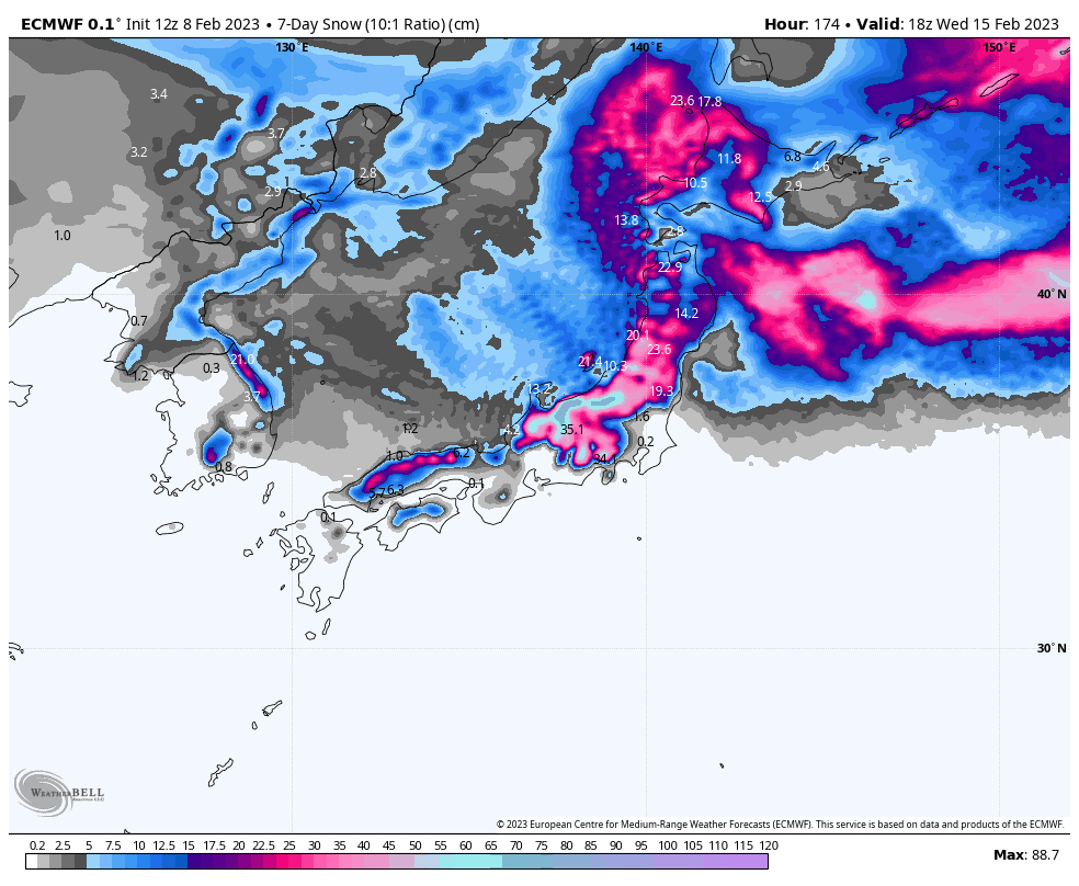
Thursday Feb 9th & Friday Feb 10th
After the cold front came through last night, we’ll see snowfalls gradually ease over Honshu today, Thursday, with the cold NW winds following suit. Light consistent snowfall over Hokkaido won’t peter out until tonight.
Friday will start out partly cloudy/sunny, with a few lingering snow showers about western Hokkaido. But from late morning, a low out of the west will spread mild southerly winds and heavy precip up Honshu. Fortunately, freezing levels don’t get crazy high, peaking just over 1000m at one point over central Honshu, so there’ll be some wet stuff down low but plenty of snow higher up.
Saturday Feb 11th & Sunday Feb 12th
As the low mentioned above buzzes off into the east, the snow/wet stuff will clear Honshu during the morning as slightly chillier northerlies come on, leaving a fine afternoon. Hokkaido, meanwhile should see some good sunny spells, but there is a chance of snow showers during the second half of the day as models are a little inconsistent here.
On Sunday, a ridge passing over Honshu will bring mostly sunny, calm skies with warm spring-like temps. Snow showers on Hokkaido will ramp up for a time as a low off the continent passes over, with mild SW winds eventually clocking to a colder NW.
Monday Feb 13th to Wednesday Feb 15th
Another low migrating out of the west will bring more mixed precip to at least the southern three-quarters of Honshu during Monday. Freezing levels will start out around 1500m over central Honshu, but will gradually lower later in the day as colder northerlies file in on the backside of the low.
Cold NW winds will see snow falling all the way to the bottom during Tuesday and Wednesday on Honshu. Snowfall will build through Tuesday, likely peaking early Wednesday, before abating later Wednesday.
Up on Hokkaido, there’ll be fine spells with a few snow showers during Monday. Snow showers will then build on Tuesday, peaking late in the day or early Wednesday, before they subside again later on Wednesday. Chilly temps and mostly light winds during this period will keep the good times rolling.
Thursday Feb 16th & beyond
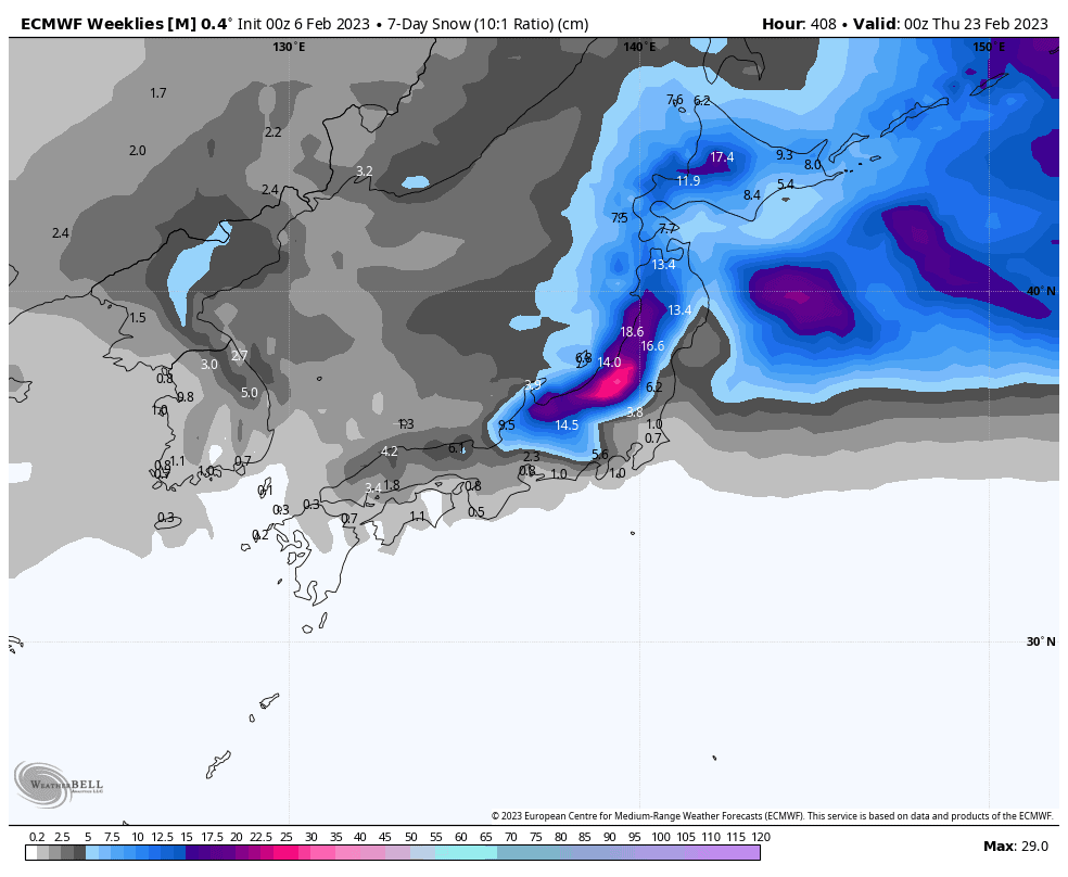
Models are rather inconsistent at this point onwards. We’ll continue to see good snowfalls throughout the country until a high-pressure system clears things up.
This could happen anytime between next Friday and the following Monday – let’s hope for the latter! After that, ensemble models expect average-to-low snowfalls out to Thursday 23rdFeb.
That’s all from me this week guys, see you next week!
Grasshopper


