Grasshopper’s Weekly North America Forecast, Wed Jan 10th – Another Deep Week Ahead Broken up by an Arctic Interlude
Mountainwatch | The Grasshopper
Written late Wednesday 10th January (Pacific Time)
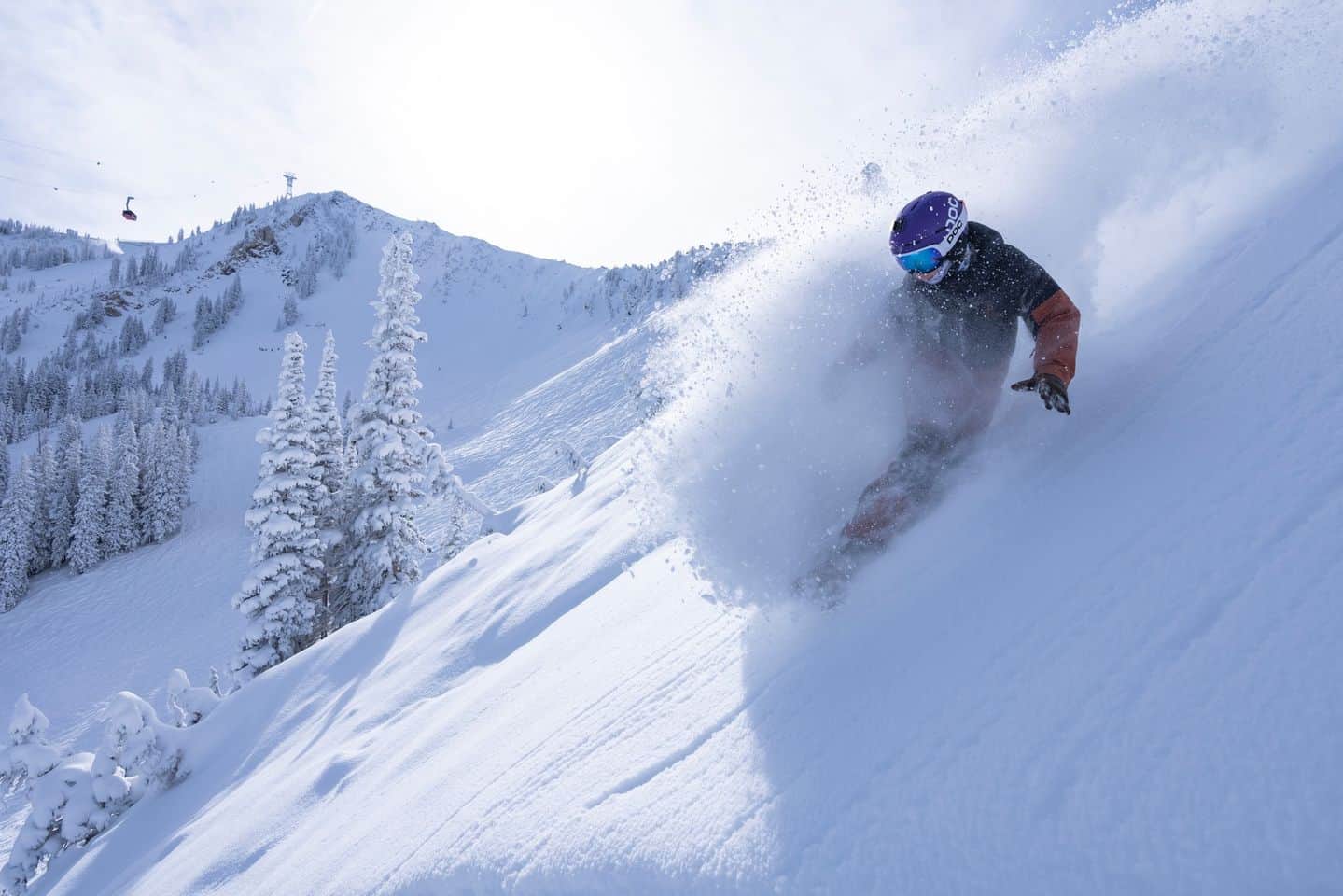
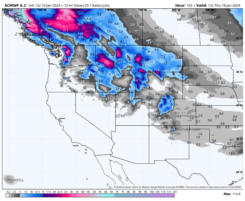
The never-ending storm cycle that has been piling up the powder here in North America will continue into the weekend. Even now, as I put my wee grasshopper limbs to keyboard, the Sierras are currently getting pounded with powder, with solid snowfall also reaching the Rockies further inland.
It’ll be a similar scene this weekend as low number three rolls over the south, by which time the previous two lows would have already powdered up areas to the north.
Things will gradually quieten down as an Arctic-high pushes down from the north, bringing freezing temperatures and clear skies. But yet another storm rolls down over Canada Monday, before expanding southwards into Colorado during Wednesday. Overall, it’ll be a deep week for all and sundry.
Thursday Jan 11th & Friday Jan 12th
Widespread light-moderate snowfall throughout the west during this period, although the southern Cascades in Oregon will see heavy falls and massive totals as it bears the brunt of this storm cycle, which features two centres of action around a duo of low-pressure systems – one in the north and one in the south, both of which drift eastwards and southwards.
The southern low exits the scene late Thursday, while the northern low loiters as it drifts into the south during Friday. Temperatures will be cold and snow quality will be high, especially in the north where the arrival of a ridiculously freezing arctic airmass will see the atmosphere dry out there.
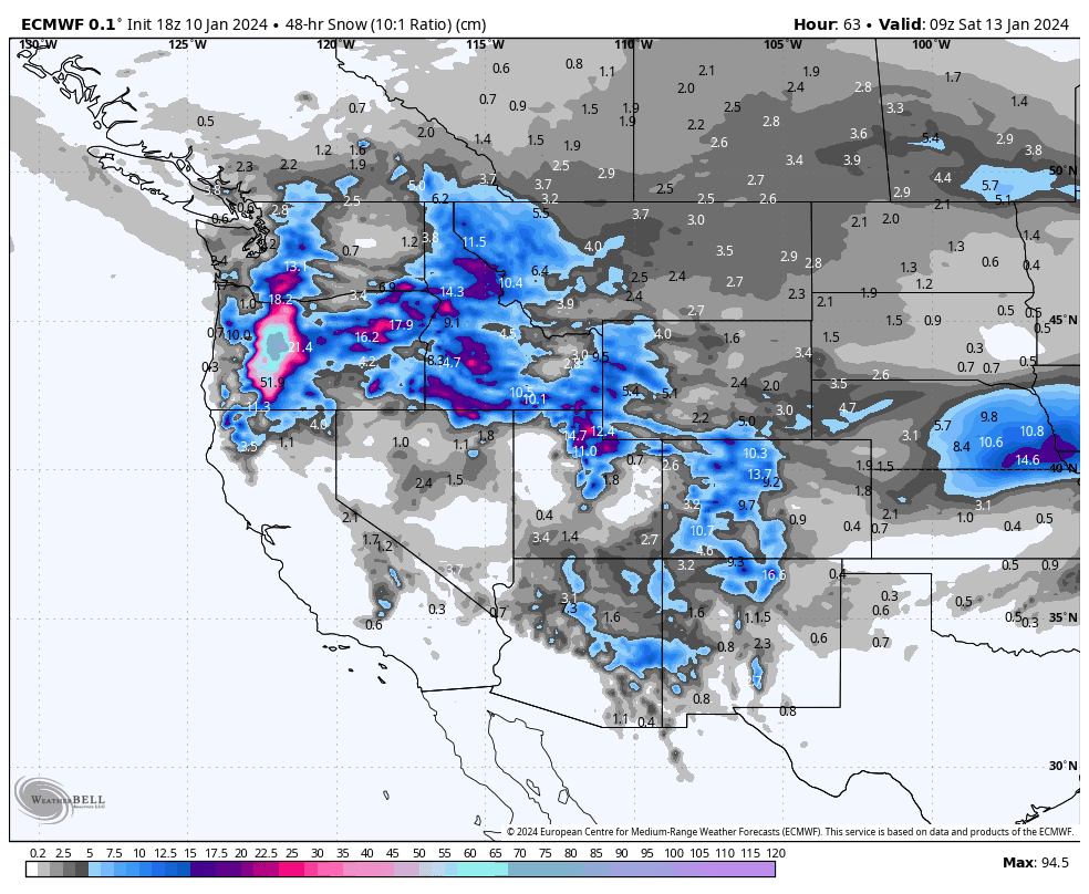
Saturday Jan 13th & Sunday Jan 14th
This weekend, a third low will move eastwards across the south, bringing heavy snowfall to resorts in Oregon and the Sierras, as well as moderate totals to central-southern Rockies (mainly Utah, Colorado, New Mexico).
North of this belt of snowfall, skies will remain clear and calm as the cold, dry arctic airmass persists.
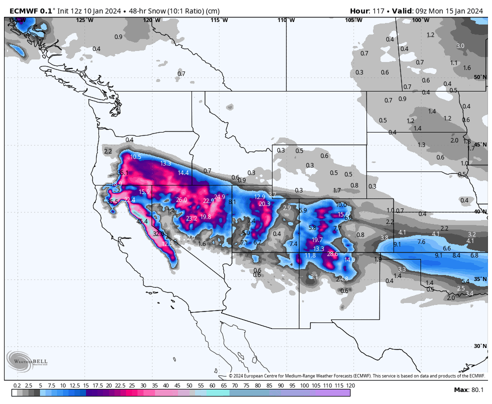
Monday Jan 15th to Wednesday Jan 17th
Snowfall will gradually clear the southern Rockies as the third low (mentioned above) exits the west, and the cold high-pressure system to the north also takes hold down in the south.
Meanwhile, in the north, a storm rolls down over Canada during Monday, with good widespread snowfall persisting up there while the storm expands southwards during Wednesday as far south as the Cascades and northern Colorado.
Extended Outlook
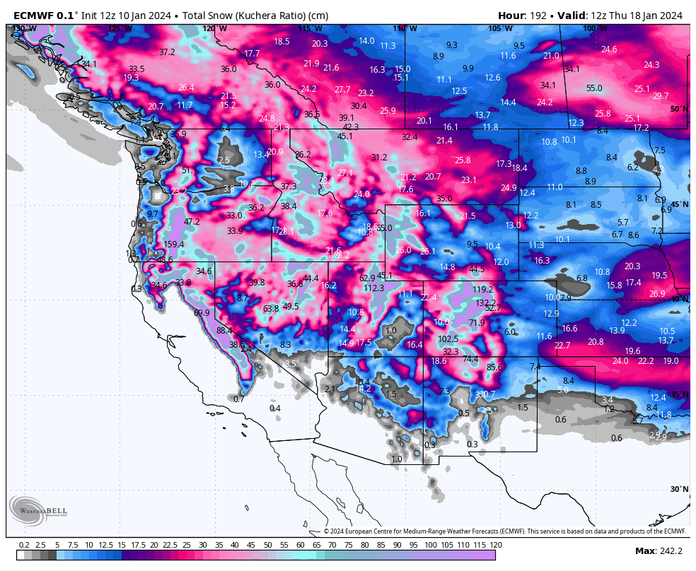
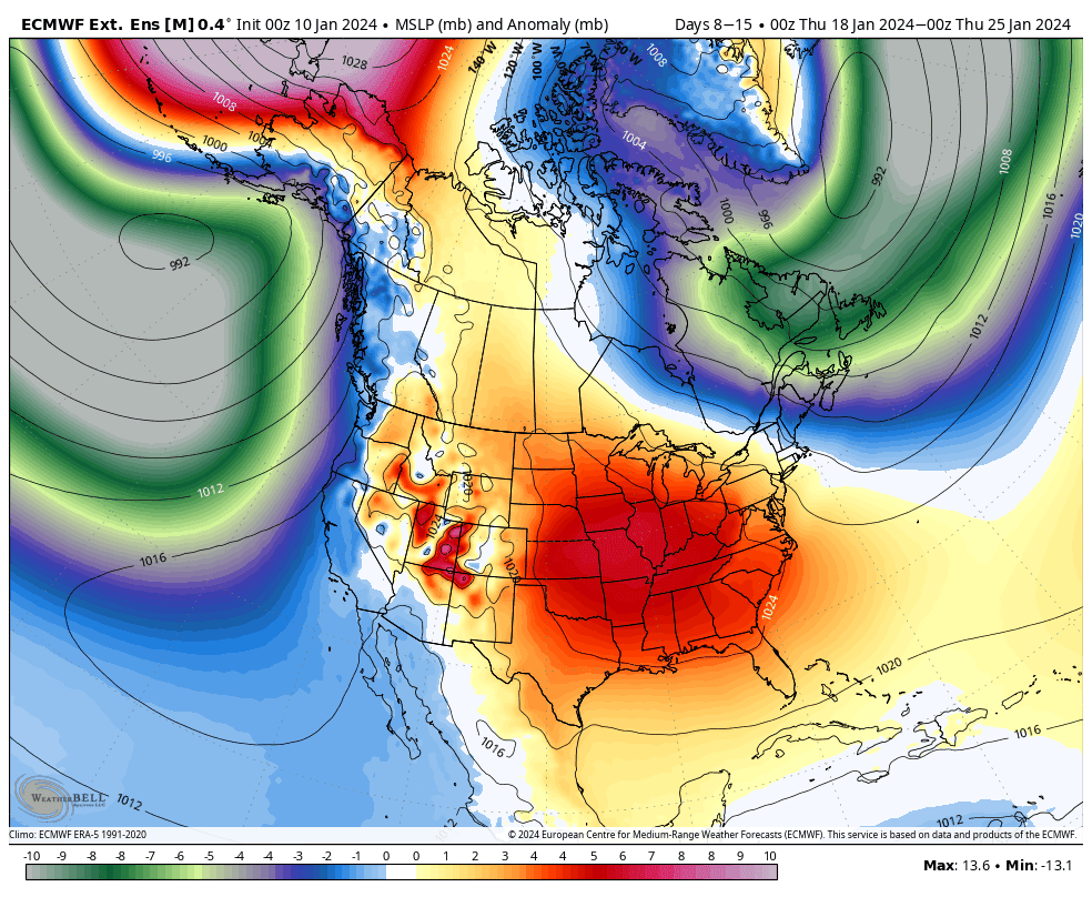
The next 7-day period, starting Thursday 18th Jan, looks to start out with Pacific low-pressure dominating, bringing moist southwesterly flows and a tonne of precip to the Pacific Crest, while high-pressure keeps things calm over the central and southern Rockies. This pattern may ease towards the end of the period as high-pressure expands, likely bringing a quiet mid-winter spell to western North America.
That’s all from me today. Have a great week, see you next Thursday.
Grasshopper


