Grasshopper’s Weekly North American Forecast, February 16th – Northern Storm Pattern Marches South Again Next Week
Mountainwatch | The Grasshopper
Written Wednesday 15thFebruary (Pacific Standard Time)
Over the last week, the storm pattern started in the north, with nice tops ups across Canadian resorts, before it marched into the south where it grew in vigor.
Resorts in Arizona, New Mexico and Colorado took home the lion’s share with totals up into the 0.5-1m bracket being recorded over the last couple of days.
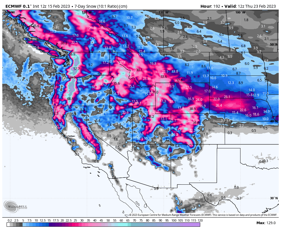
It’ll be a similar story this week. Storm systems will target the north over the next four days, reaching as far south as Wyoming this weekend. Things will then get wild from Monday onwards as the storm pattern strengthens and expands southwards into the Sierras and central southern Rockies, where we should again see some big numbers coming in.
Thursday Feb 16th & Friday Feb 17th
High pressure will keep much of the western U.S. fine and settled and cold during this period, which will make for some epic conditions, especially down south after all that fresh powder from the last couple of days.
Up north, a front will see a band of moderate to heavy falls passing over the Canadian Coastal Mountains into the northern Cascades and over the northern Canadian Rockies, with lighter falls reaching further south into northern Idaho and Montana.
Saturday Feb 18th & Sunday Feb 19th
This weekend will see a duo of storm systems weeping south over Canada and the PNW and through the U.S. Rockies as far south as Wyoming. The first on Saturday will provide mostly light snowfall, while the second more active system will bring moderate to heavy falls on Sunday.
Monday Feb 20th to Wednesday Feb 22nd
The latter of the two storm systems mentioned above will continue across the north during Monday, eventually reaching Utah and Colorado during the second half of the day.
The storm will then get reinforcements in the form of a fresh low out of the NW, significantly strengthening and expanding the storm into a west-wide event, which will include the Sierras and southern Rockies, where heavy falls and cold temps are expected, and will continue to rage through Wednesday.
Next Thursday Feb 23rd& Beyond
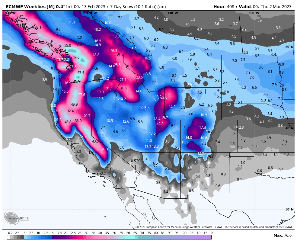
The active pattern looks set to continue for much of the west, with models indicating a particularly deep week for the Pacific Crest and Northern U.S. Rockies.
Well, that’s all from me guys and gals, see you next week.


