New Zealand Forecast – A Boot Full Of Powder Down South Before Southwesterlies Die Down
Mountainwatch | The Grasshopper
Written early Monday 3rdJuly, valid to Thursday 6thJuly
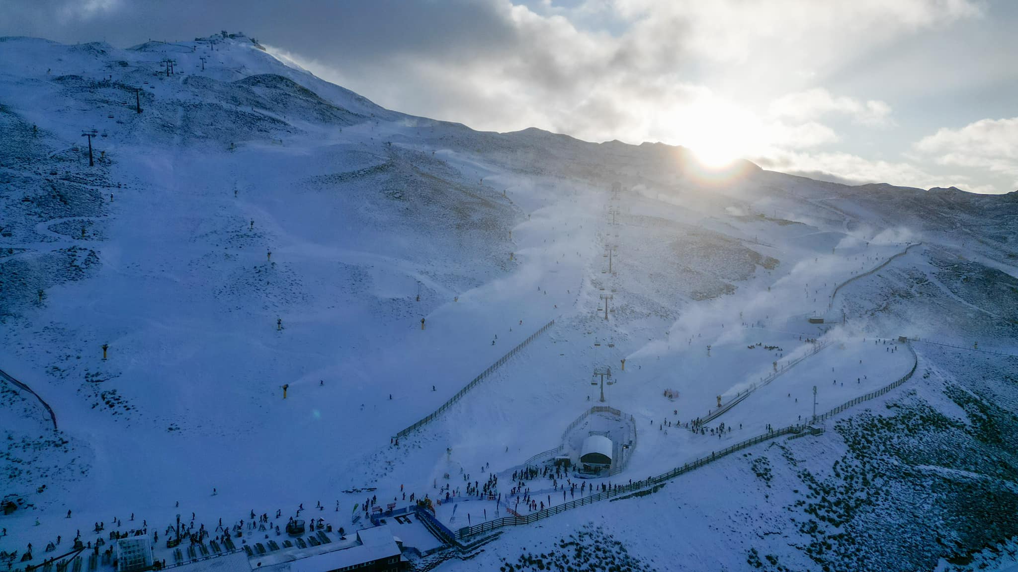
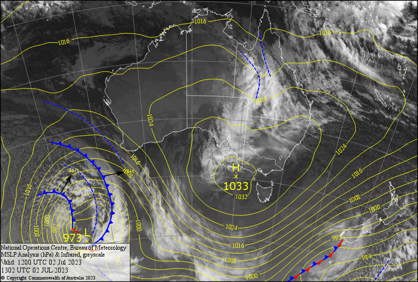
NZ has jumped back into winter mode after a strong, freezing SW flow descended upon the country over the weekend. Snowmaking and grooming teams have been going hard trying to make the most of cold temps, and along with about 5-15cm of natural snow, resorts have bounced back to life. Both Coronet Peak and Mt Hutt reopened yesterday, and Treble Cone plans to open Tuesday.
Strong-gale W-SW winds will persist today, with the Queenstown resorts and Cardrona picking up a boot full of snow, while lesser amounts will make it to the more sheltered Treble Cone and Canterbury will be lucky to see any.
A few snow showers will linger in the south Tuesday, before the winds start to abate Wednesday, and finally dying away Thursday with sunshine to boot as a narrow ridge of high pressure shuffles across the country.
Monday July 3rd
It’ll be snowing in the Southern Lakes by the time you read this! There’ll be some decent falls this morning before it starts to peter out from later this afternoon. With cold SW winds blowing a gale, the Remarkables look best placed with 15-25cm on the cards, while Treble Cone is likely to receive just 5-10cm.
Canterbury will have a partly cloudy/sunny day, with a light snow shower or two possible this afternoon as W-NW winds turn to a strong-gale SW.
Tuesday July 4th
A few more light snow showers and flurries for the Queenstown resorts, but they’ll struggle to reach the Wanaka resorts where just a partly cloudy day is in store. W-SW winds will be strong-gale in exposed areas.
A mostly fine day for Canterbury, but winds will swing between the SW and NW and blow a gale at times, so put a lid on that flat white!
Wednesday July 5th
It’ll be a mostly fine day, but there’ll be a little bit of cloud lingering about the Queenstown resorts and inland club fields in Canterbury. Strong-gale W-SW winds gradually abating and tending southwards.
Thursday July 6th
A fine day for all above any low cloud down in the valleys, basins and plains. Super light southerlies turning to the north.
Extended Forecast
The extended outlook looks more favourable than it previously did, as a Tasman low now looks to develop farther south and take the southerly route, likely leading to only a smattering of rainfall for the South Island over the weekend. A disturbed westerly pattern that follows looks favourable for numerous shots of powder next week, and may see NZ resorts finally getting into second gear.
That’s all from me today, folks. See you again Friday.


