New Zealand Forecast, August 18th – Make the Most of Today, Because it Turns Ugly this Weekend
Mountainwatch | The Grasshopper
Written early Friday 18th August, valid to Sunday 20th August
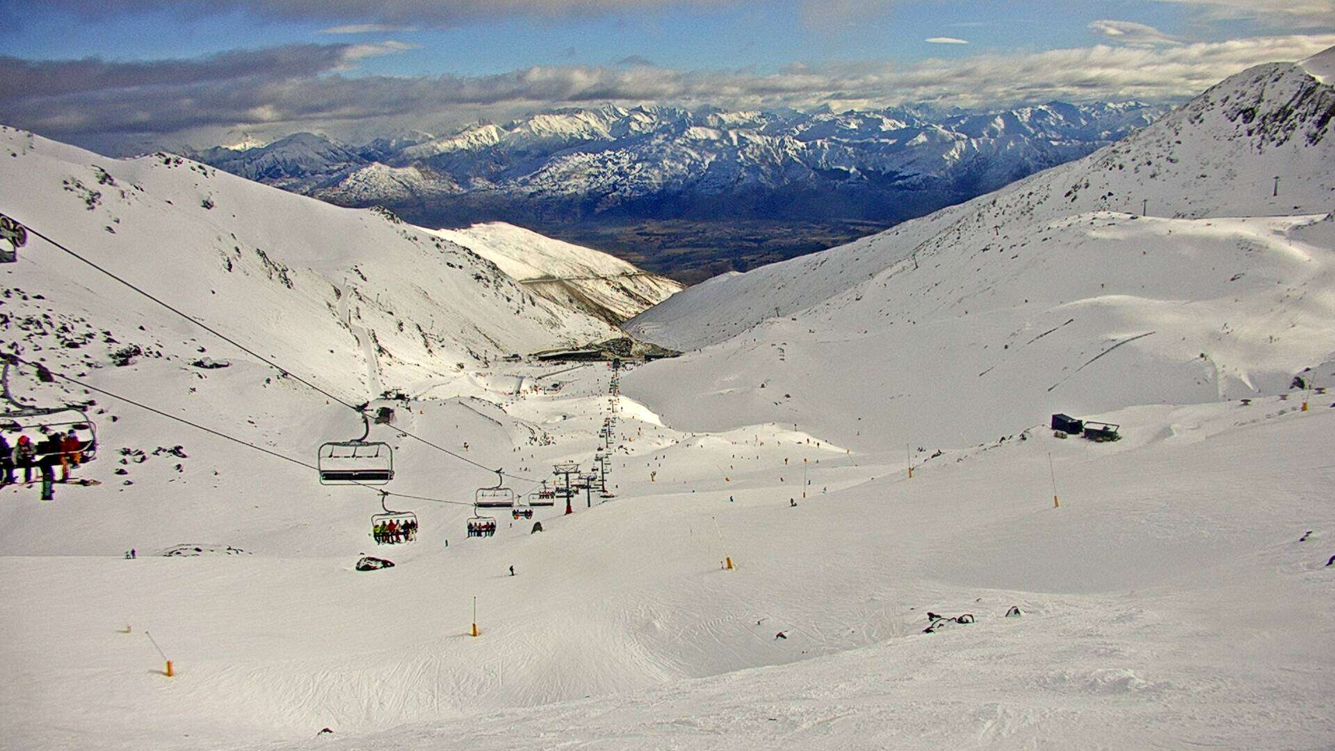
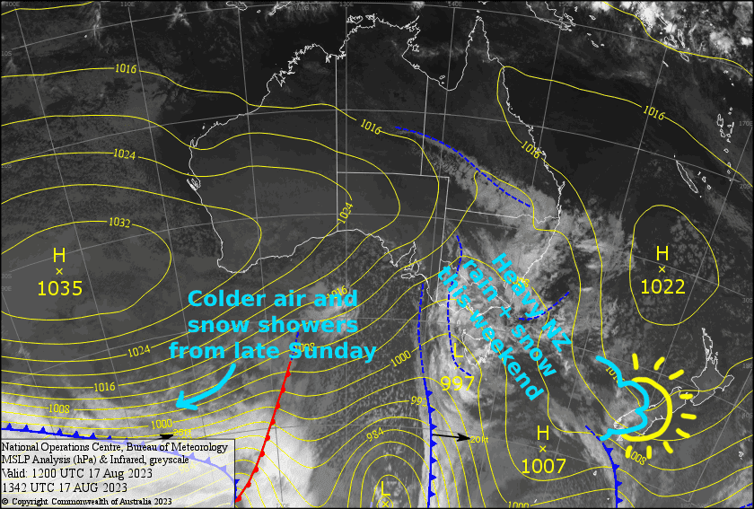
New Zealand’s long, deep freeze will have a significant interlude this weekend as a strong front crossed the country from the Tasman. Friday will be the nicest of the next few days as a weak ridge passes over.
However, it turns ugly on Saturday as not-so-cold N-NW winds rise to gale-severe gale, and heavy snow & rain spreads over the country – the upper slopes benefiting massively to the detriment of the lower slopes. No doubt ski resort operations will be limited throughout the country.
Conditions will remain horrendous on Ruapehu during Sunday, but things will improve on the South Island, the bulk of the precipitation clearing by the time lifts start turning (if they manage to get going with winds still being an issue). However, a cold SW change will bring a dusting to the Southern Lakes late Sunday, which will go some way to repair any damage to the lower slopes.
Friday 18th
A bit of cloud over the South Island will clear this morning for a mint afternoon. Chilly W-NW winds, brisker about the Southern Lakes this morning, but light over Canterbury, gradually tending to a light N-NW breeze everywhere.
Ruapehu will start nice and clear, but then cloud will gradually build later in the morning before a few afternoon snow flurries. A chilly breeze from the west gradually tilts NW.
Saturday 19th
Snow spreads over the South Island during the morning with heavy falls on the cards, especially on Treble Cone and the Canterbury club fields. However, snow levels lift through the afternoon so it’ll turn wet on low-mid slopes, as well as the upper slopes of Mt Hutt. Strong N-NW winds will be blowing a gale in exposed areas for the Southern Lakes, but will rise to severe-gale in Canterbury.
Ruapehu will start off just cloudy, but NW winds will rise to gale during the morning. Then, rain/snow will get going during the afternoon, becoming heavy in the evening. Snow will fall on mid-upper slopes, but it may also turn wet on mid slopes as snow levels gradually lift.
Sunday 20th
The Southern Lakes will start the day with snow falling on mid-upper slopes, but wet sleety stuff down lower. That’ll all clear up around the time lifts start turning, or shortly after, leaving a partly cloudy day with a stiff NW wind. However, there’ll be another period of snowfall to low levels during the evening as a cold southwesterly change goes through.
Snow/rain in Canterbury clears before dawn leaving mostly just various amounts of mid-high cloud as well as periods of sunshine, while gale-severe gale NW winds gradually abate. However, a few snow showers may spill over onto the club fields late morning into the early afternoon, and again at night.
Heavy rain/snow and gale NW winds continue on Ruapehu, with snow levels sitting around mid-slopes. The precip will ease during the evening and snow levels will drop a bit, as a colder, weaker SW change goes through.
Extended Forecast
Cold S-SW winds continue to sweep up the country during Monday, with Ruapehu picking up a nice dusting, while skies clear early over the South Island as a ridge of high pressure builds there.
The ridge slowly drifts northwards from Tuesday, clearing things up nicely on Ruapehu, while cloud and NW winds pick over the Southern Lakes. A weak-ish front then brings a smattering of rain + snow to the Southern Lakes Wednesday before a hearty looking cold front dumps snow over the South Island Thursday into next Friday, Canterbury likely receiving the lions share, then Ruapehu on Saturday. Not bad at all!
That’s all from me today, folks. See you again Monday.


