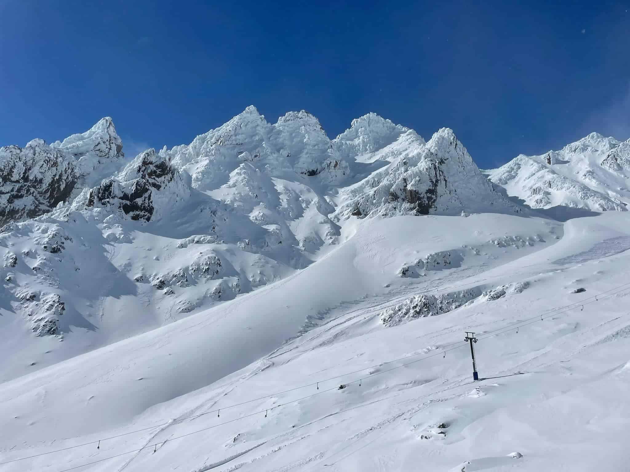
New Zealand Forecast – Full-On Winter Snowstorm To Dump 25-50cm On The Southern Lakes & Ruapehu, And 10-30cm On Canterbury
Mountainwatch | The Grasshopper
Written early Monday 31stJuly, valid to Thursday 3rdJuly
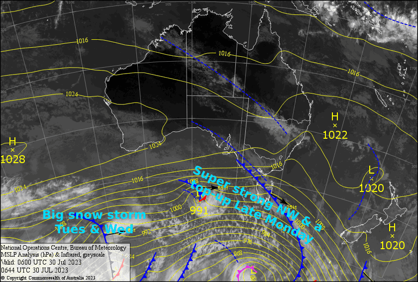
It’s going to be another massive week in NZ as a full-on winter storm set to bring deep powder and gnarly blizzard conditions to kiwi ski resorts. A powerful, cold front will bring heavy snowfall to the South Island during Tuesday and to Ruapehu on Wednesday.
Strong, freezing S-SW winds following the front will see snow falling in the Queenstown and possibly Wanaka townships during Wednesday, as well as the “desert” surrounding Ruapehu. Resort operations will most definitely be hampered, and so too will the roads.
The big clean-up will likely start Thursday as pressures increase and conditions abate. When all is said and done, it’ll likely be the biggest snowstorm to date for the Southern Lakes and possibly Ruapehu too, with about 25-50cm expected. Canterbury should also take home somewhere between 10-30cm – Mt Hutt at the lower end of that range, but the cub fields at the high end.
Monday 31st
The Southern Lakes will start out mostly fine, but cloud will build during the afternoon before snow starts to spill over the Main Divide from late afternoon. The snow may start out wet and sleety on the lower slopes, but snow levels will quickly lower with widespread heavier falls during the evening/at night. Strong NW winds rising to gale in exposed areas.
In Canterbury, Mt Hutt will see some mid-high level cloud as NW winds rise to severe gale. The club fields will be cloudier and light snowfalls will be chucked over the Main Divide from afternoon before heavier, widespread snowfall at night, some of which will also reach Mt Hutt.
Cloud will eventually build over Ruapehu as NW winds pick up. Light rain/drizzle from afternoon, falling as snow on mid-upper slopes.
Tuesday 1st
There’ll be little skiing done on the South Island on this day! Gale-severe gale NW winds will likely put a halt to lift operations, and heavy snowfall will spread north over the Southern Lakes during the morning, then Canterbury in the afternoon. It’ll be a blizzard to say the least. Conditions will abate at night as winds turn to the SW but remain strong.
Light rain/drizzle on Ruapehu will fall as snow on mid-upper slopes and become slightly heavier during the evening. Strong westerlies rising to gale while turning NW.
Wednesday 2nd
Snow showers persist over the Southern Lakes down to lake level, although they’ll struggle to reach Treble Cone where they’ll be few and far between. Strong and freezing SW winds will be blowing a gale in exposed areas.
Canterbury will have plenty of sunshine and a little bit of cloud, although a few snow showers will linger about the club fields. Freezing SW winds will rise to gale in exposed areas.
An ugly day for Ruapehu, but there’ll be beautiful snow, with some heavy falls too, especially early morning, as gale NW winds turn SW. Snow levels will gradually lower throughout the day, likely reaching the Desert Road during the evening as winds turn again to the south.
Thursday 3rd
The Southern Lakes will start off cloudy with a few left over flurries during the morning, but cloud will start to break up during the afternoon as cold, strong-gale SW winds gradually abate.
Canterbury will see a few early snow flurries, then cloud will start to break up later in the day. Strong, cold S-SW winds.
Freezing, gale force southerly winds will continue to blow in cloud and light snow showers over Ruapehu.
Extended Forecast
A ridge of high pressure will at last bring settled conditions to the South Island Friday and Saturday, allowing resorts to revel in all that deep powder in peace and quiet, while southerlies also abate over Ruapehu. Sunday will be nice too, while a slow-moving low approaches from the Tasman.
Cold air circulating around the low will likely flow over the country in a not-too-strong N-NW flow during next Monday and Tuesday, with just some light snow showers expected for most resorts.
That’s all from me today, folks. See you again Friday.


